1
Deep-dive into industry trends, technology comparisons, and expert guides from our team of 3D scanning specialists.


Swipe to browse
Stay ahead with insights from industry-leading 3D scanning professionals
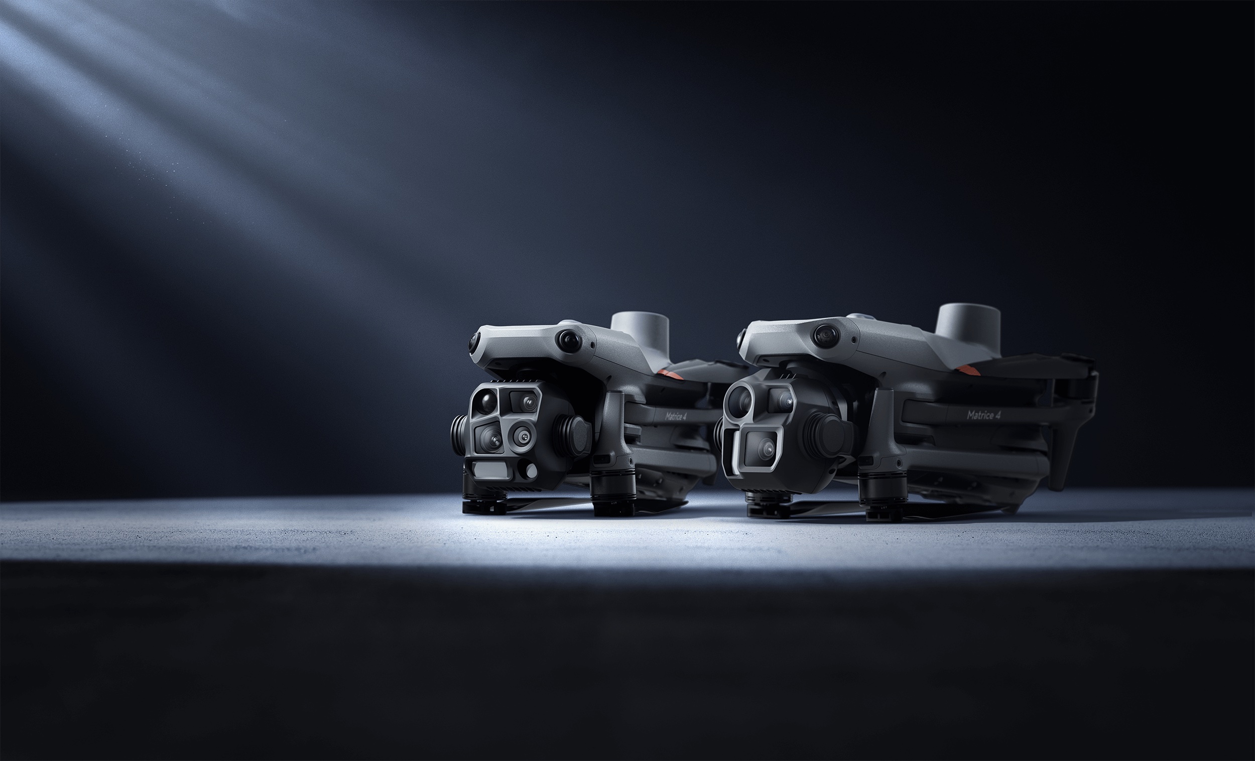
Rent vs. buy math for the DJI Matrice 4T, Matrice 400 and Zenmuse L3 — real rental day-rates, break-even points, and when owning wins.
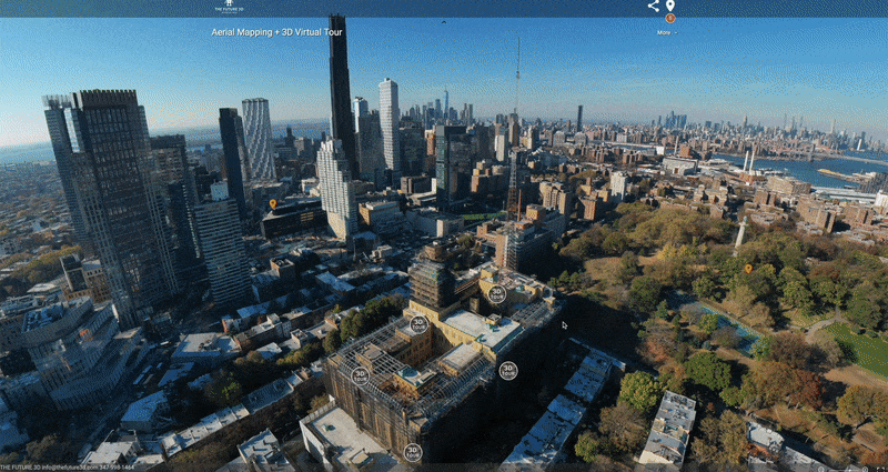
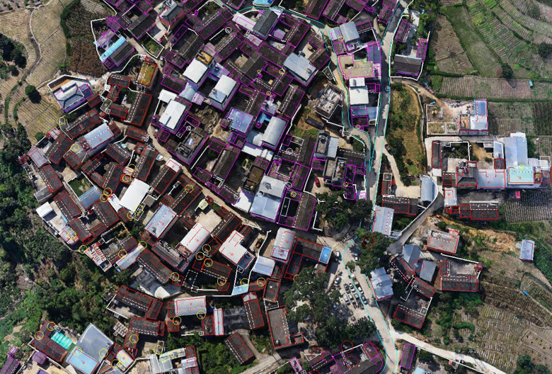
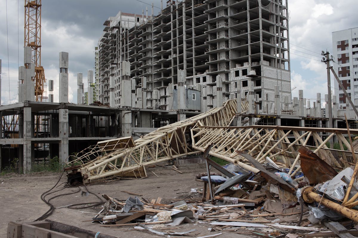
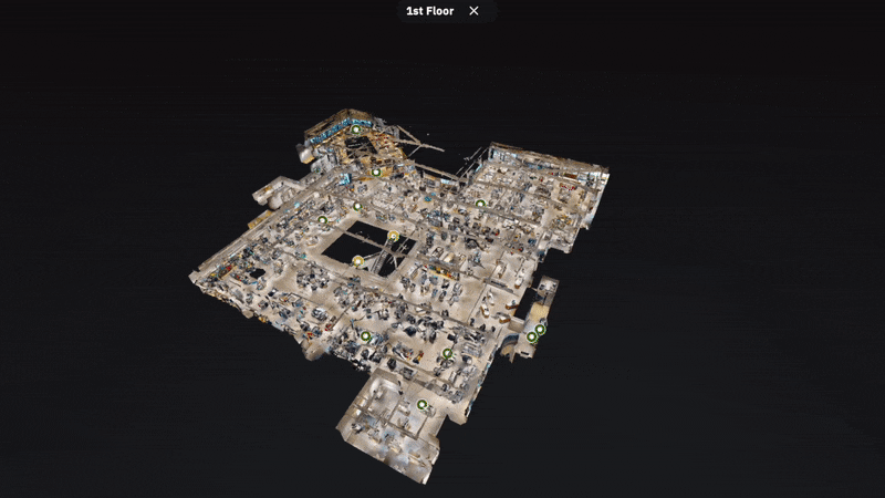
How Midtown Manhattan building managers use 3D laser scanning for tenant improvements, MEP coordination, and base building documentation.
How drone inspections replace swing stages and scaffolding for facade compliance in DUMBO, Brooklyn Heights, and Williamsburg waterfront buildings.
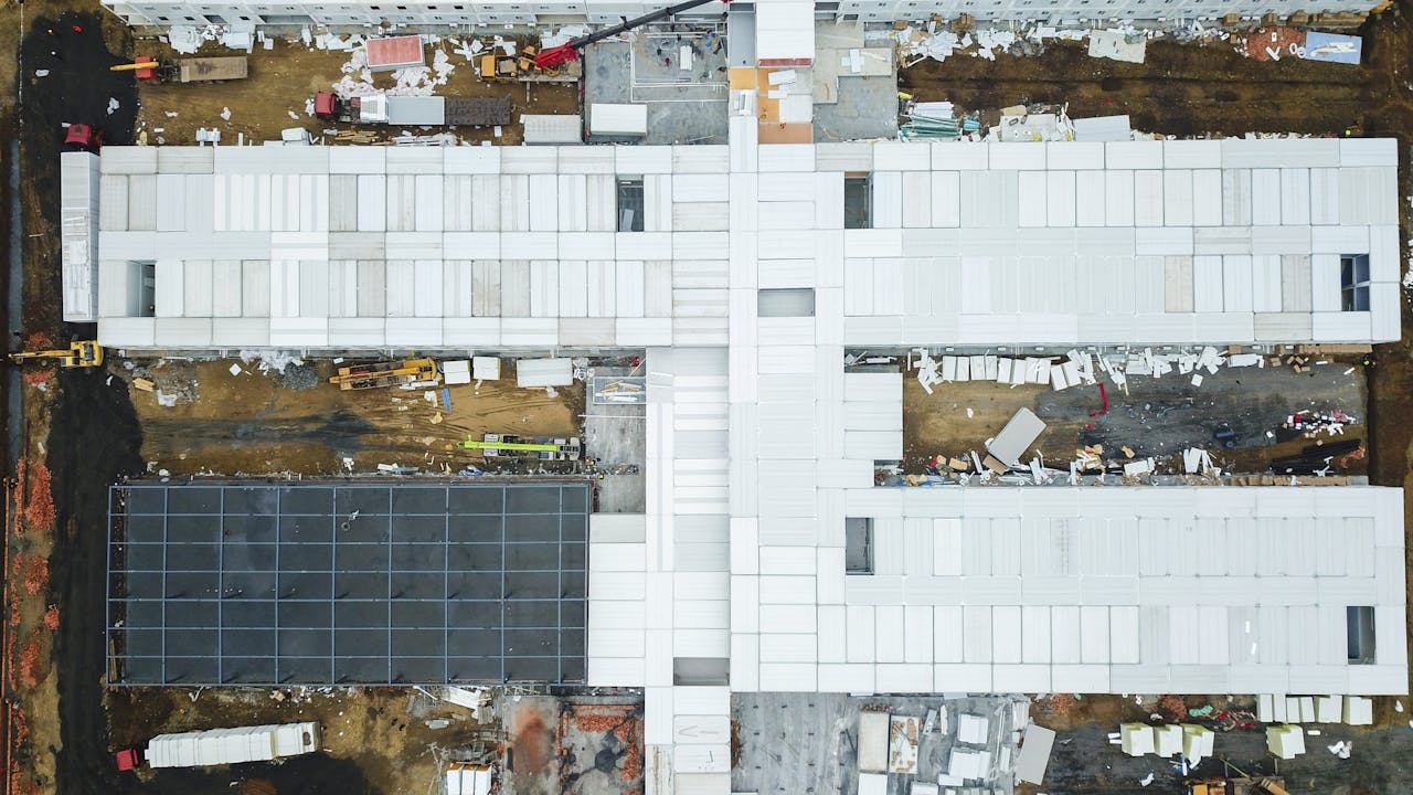
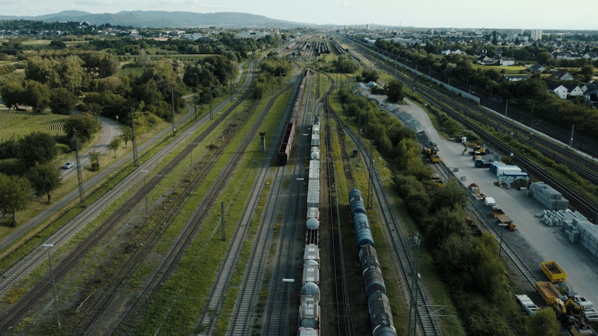
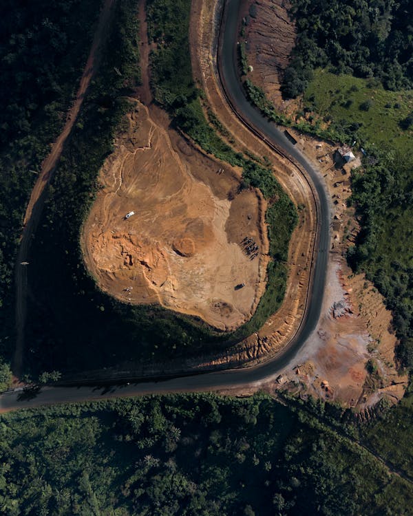
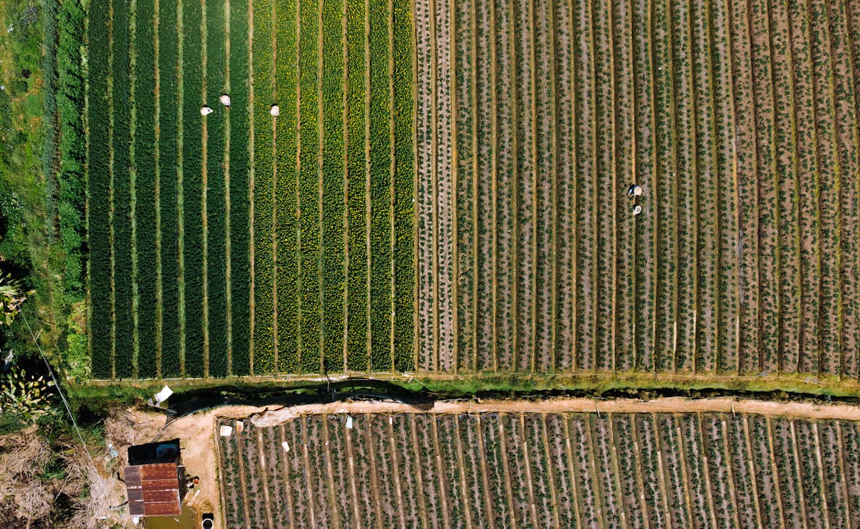
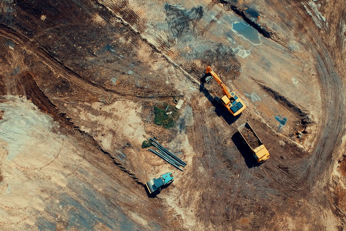
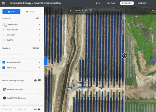
How LiDAR drone mapping supports Long Island City's construction boom — site surveys, progress monitoring, and volumetric analysis.
NYC DOB requirements for 3D scanning: when you need permits, how scanning supports DOB filings, and compliance tips.

How SoHo and Tribeca retailers, galleries, and showroom operators use Matterport 3D virtual tours to drive foot traffic and close deals remotely.
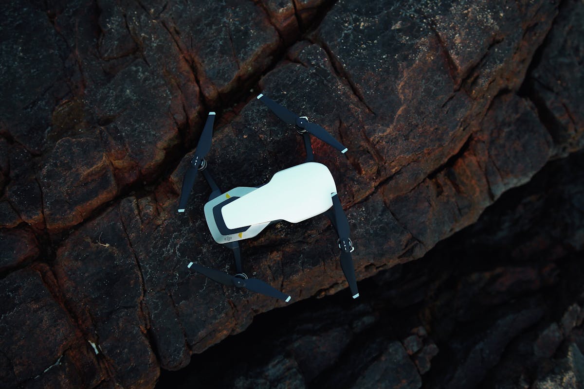
Seven key advantages of dock-based drone systems: cost savings, data consistency, weather resilience, safety, speed, scalability, and frequency.
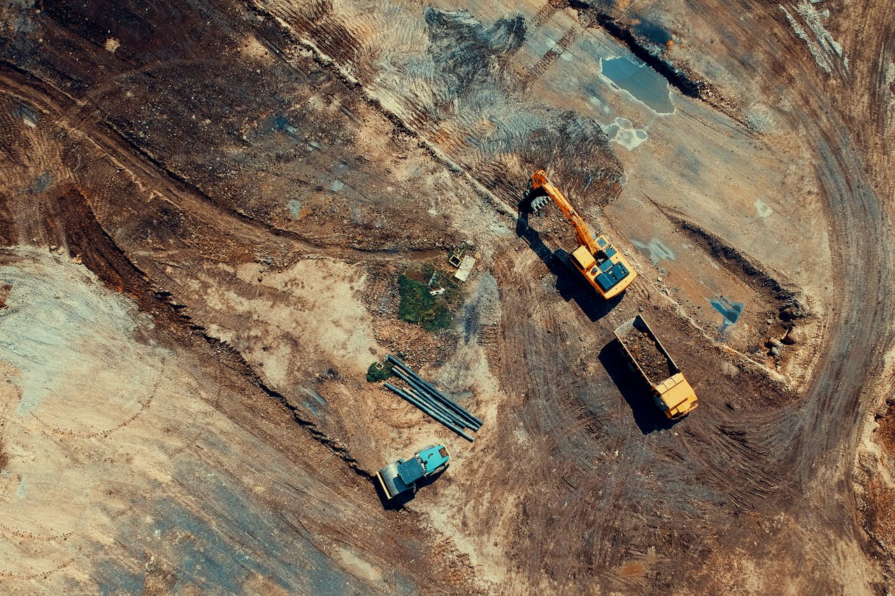
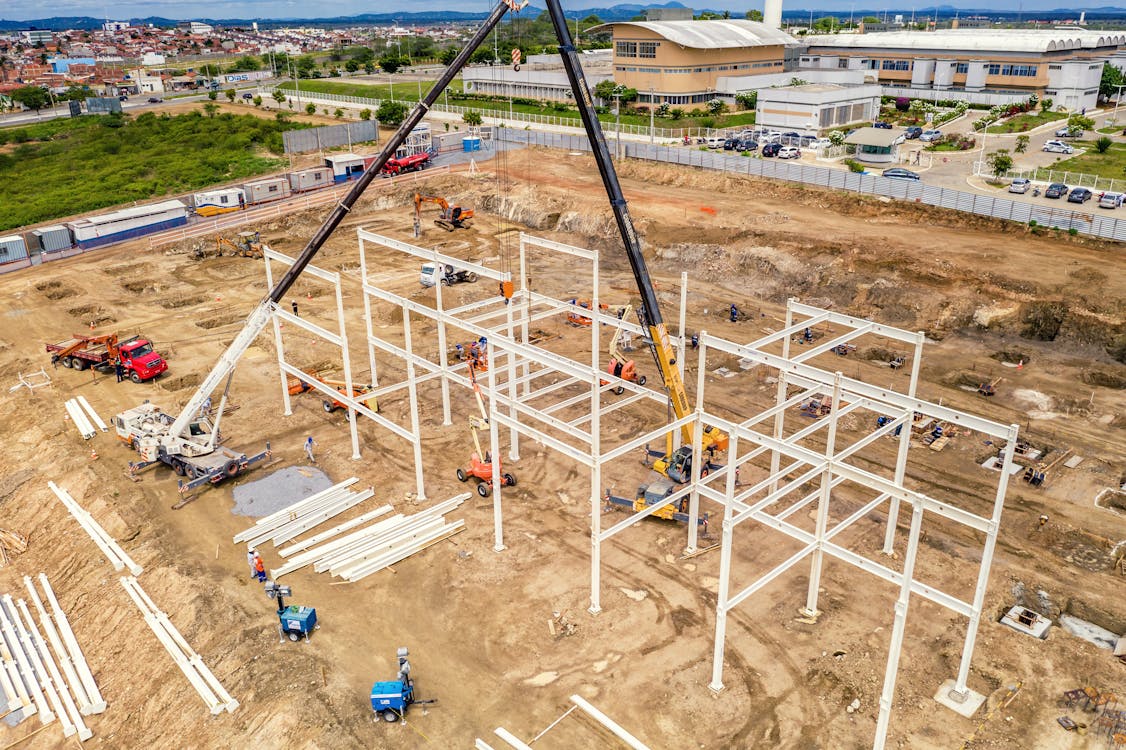
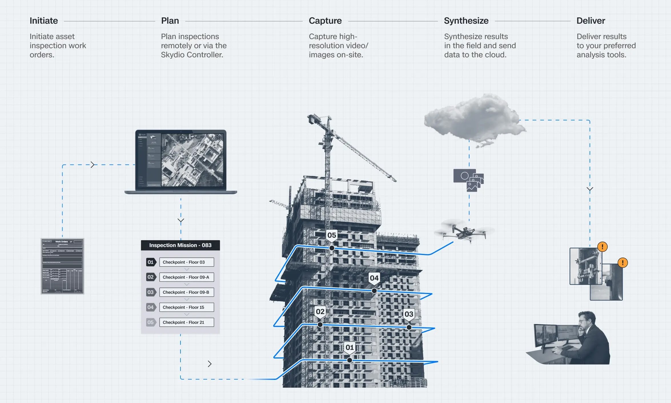
How dock-based drones automate construction monitoring. Daily progress tracking, volumetric analysis, and safety documentation without pilot scheduling.
How dock-based drones create construction timelapses. Identical daily flights, data management, processing workflows, and stakeholder applications.
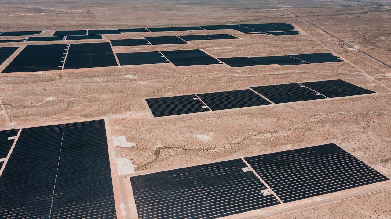
How dock-based drones automate solar farm thermal inspection. Detect panel hotspots, track degradation, and reduce O&M costs across European solar assets.

Everything you need to know about BVLOS drone regulations in Europe. EASA SORA process, country-by-country NAA requirements, and U-space deployment status.
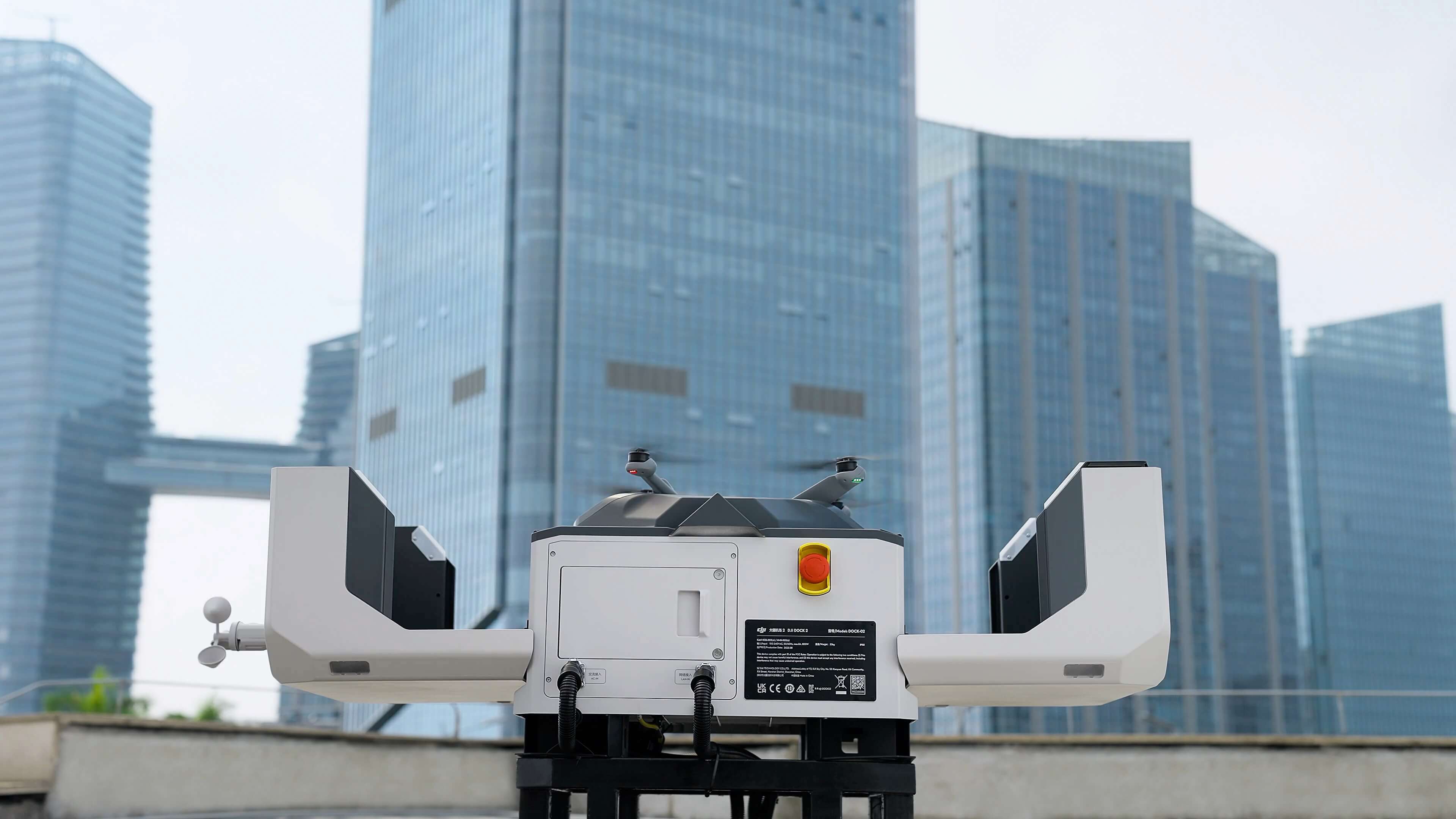
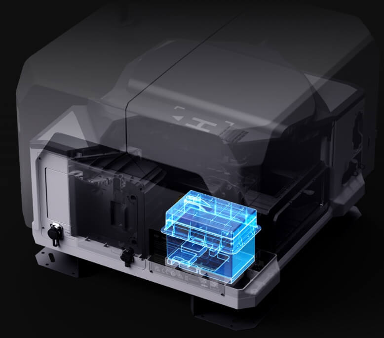
Complete comparison of DJI Dock 2 and Dock 3 for European drone operations. Specs, weather ratings, drone compatibility, and deployment use cases.
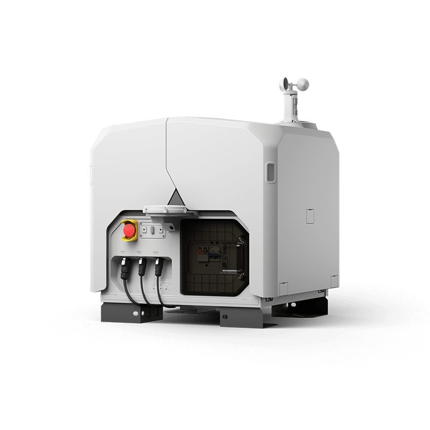
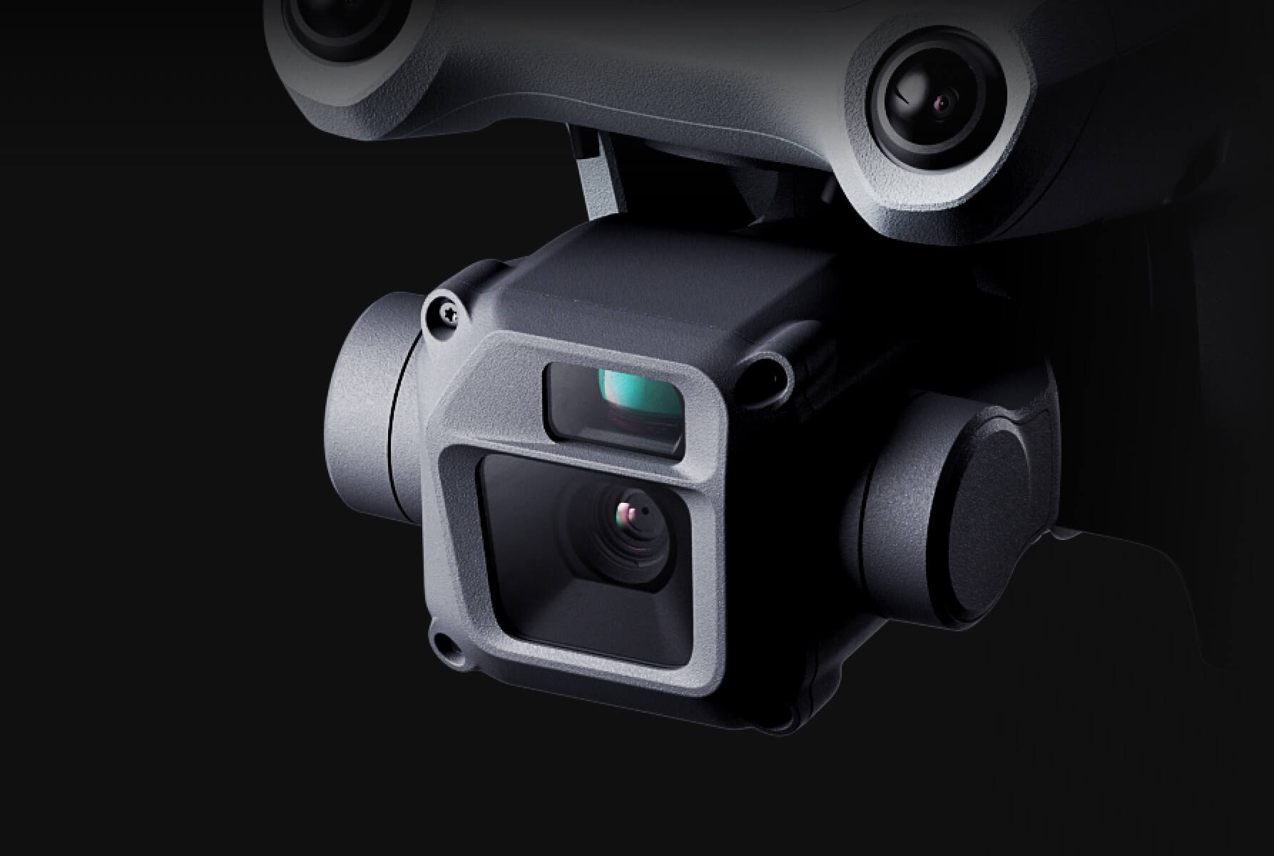
In-depth DJI Dock 3 review covering specs, IP56 weather rating, M4D/M4TD compatibility, vehicle mounting, and European deployment performance.
Compare dock-based vs piloted drone operation costs. European market data, ROI analysis, and break-even timelines.

Dock-based drone operations for North Sea offshore wind inspection. Vessel-mounted deployment, IP56 necessity, turbine inspection, and country context.
Calculate ROI for drone dock deployment on construction sites. Break-even timelines, annual savings analysis, and cost factors for European operations.

IP55 and IP56 weather ratings explained for drone docks. How DJI Dock 2 and Dock 3 handle rain, snow, wind, and extreme temperatures.
Guide to EASA SORA approval for BVLOS dock-based drone operations. ConOps, risk assessment, country timelines, and tips for faster authorization.
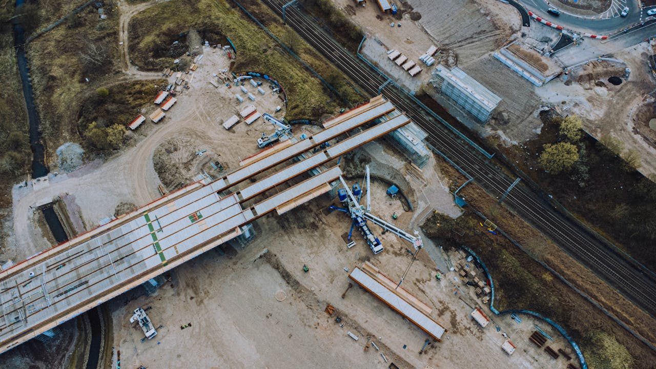
How dock-based drones monitor European roads, bridges, and rail. EU TEN-T network, Dock 3 vehicle mounting, and linear asset inspection.
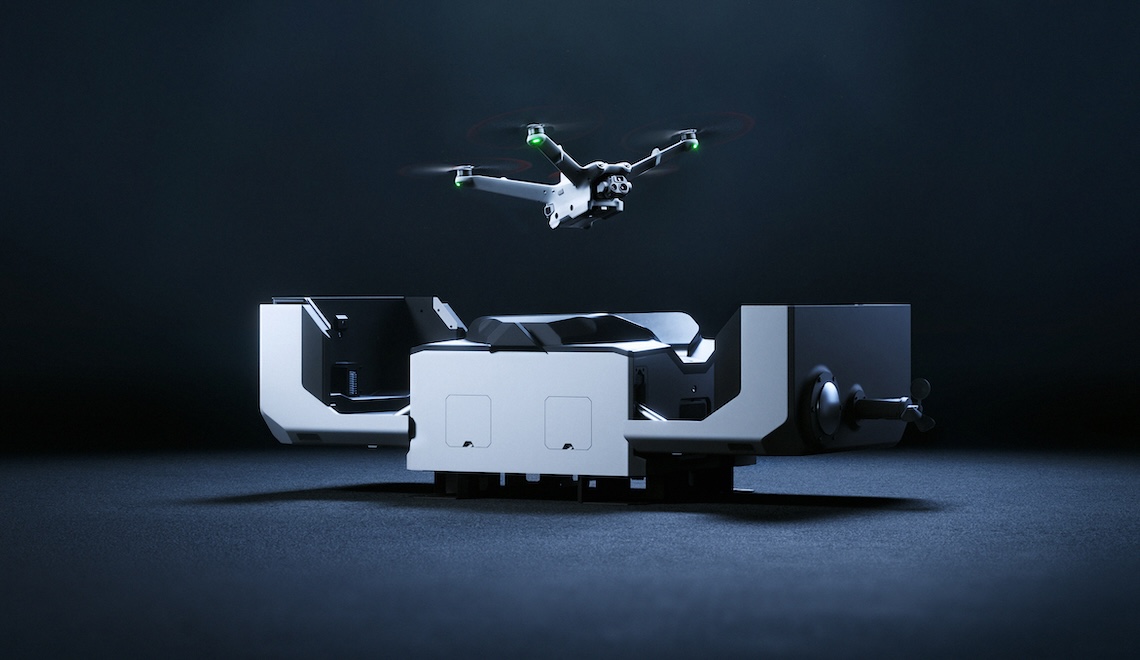
THE FUTURE 3D's proprietary drone dock delivers full BVLOS automation at 25% lower cost. EASA-ready, multi-platform, designed for European conditions.
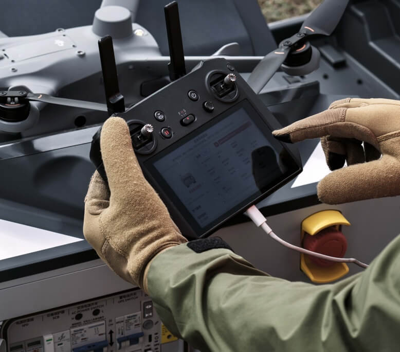
Dock-based drone operation explained: how autonomous docks work, equipment needed, EASA compliance, and use cases across European industries.
State grants fund school safety mapping in 16 states. TX SAFE Grant ($800M+), GA ($61K/school), FL ($3-5K/school). Federal grants do NOT fund mapping.

School safety 3D scanning costs $0.20-$0.70/sqft with a $1,000 minimum. Breakdown by school size, technology, deliverables. How state grants offset costs.
State-by-state guide to school safety mapping mandates. 16 states with active legislation, funding amounts, and compliance requirements.
Alyssa's Law explained: panic alert requirements, mapping mandates, and which states passed it. How schools comply using 3D scanning.

What 4D Gaussian Splatting is, how it extends 3DGS with temporal reconstruction, key research, and commercial applications in film, sports, and AV.

DIY vs professional Gaussian Splatting decision framework. Compare free tools (Polycam, Luma AI) against pro GS services.
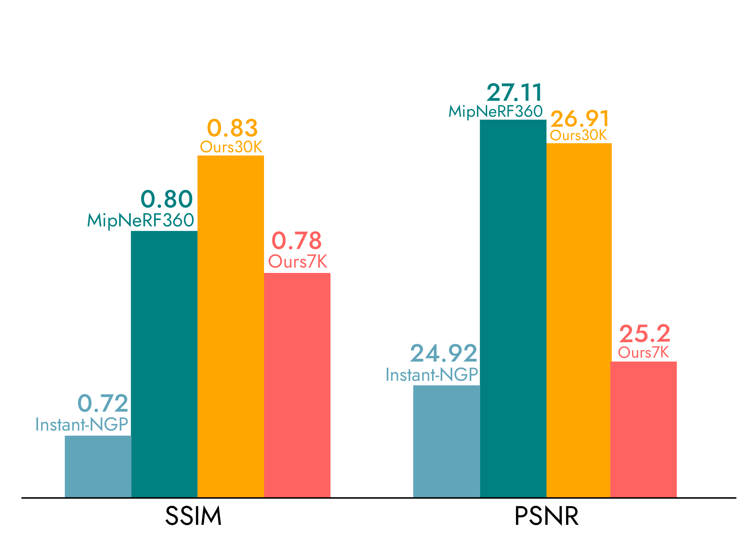
Gaussian Splatting accuracy: 7.82cm mean error explained, comparison to LiDAR and photogrammetry, and when GS accuracy suffices.
Gaussian Splatting in 2026: OpenUSD and glTF standardization, commercial tools, professional services, and industry adoption.
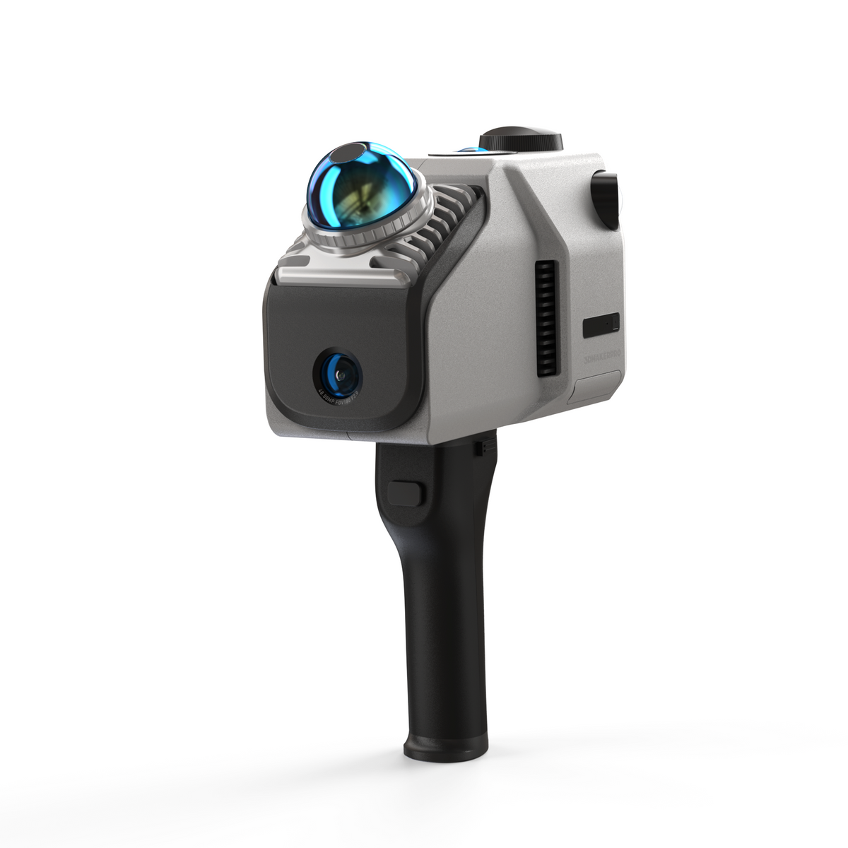
3DMakerPro Eagle review with verified specs. Standard vs Max comparison, GS output, accuracy limits, and when to upgrade to professional scanning.

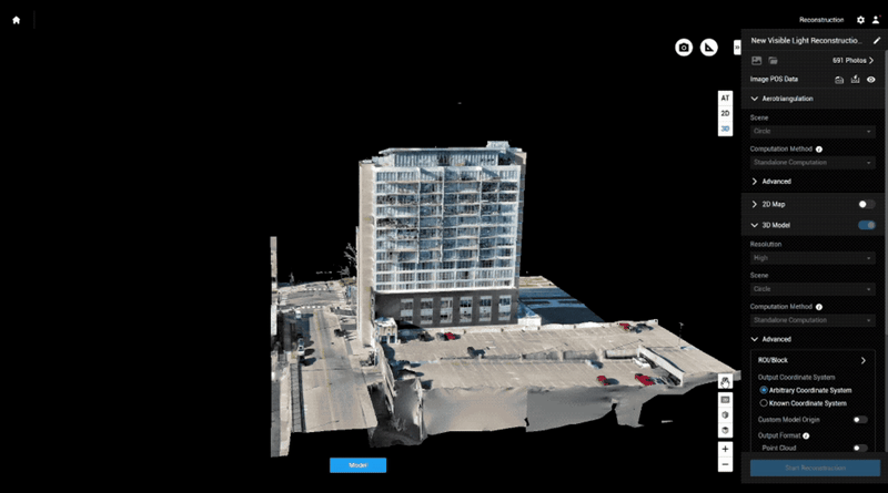
Complete DJI Terra V5.0+ Gaussian Splatting guide. Drone-to-GS workflow, Flagship license, processing speeds, output formats, and ecosystem tools.
Step-by-step guide to creating Gaussian Splatting from DJI Matrice 4E drone data. Flight planning, capture settings, DJI Terra processing, and output.
Compare 7 Gaussian Splatting tools: DJI Terra, Polycam, Luma AI, PostShot, Nerfstudio, SuperSplat, SplatForge. Features, pricing, and use cases.
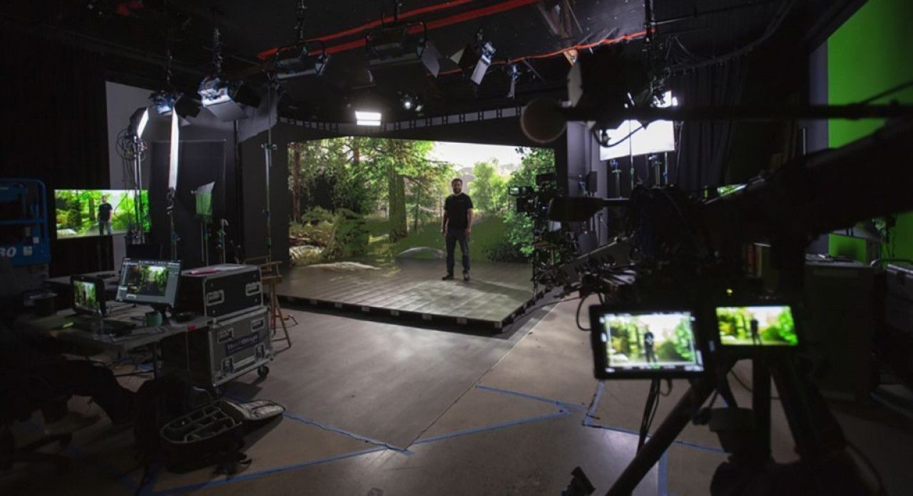
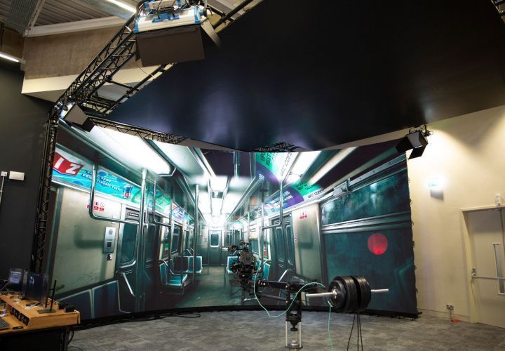
How Gaussian Splatting creates photorealistic LED volume environments. Complete scan-to-Unreal workflow, costs, and real-time rendering guide.

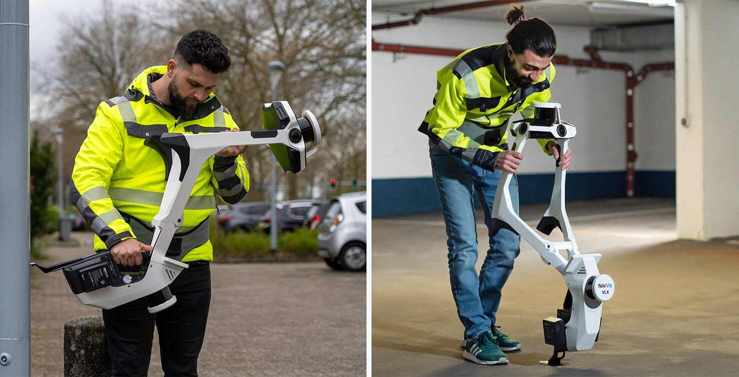
Compare top handheld 3D scanners for 2026. Xgrids L2 Pro, 3DMakerPro Eagle, Polycam, NavVis MLX specs, prices, and GS capabilities.
What professional Gaussian Splatting costs and why. Pricing from $2,250 minimum to $50,000+ film projects. DIY vs professional comparison.

Xgrids Lixel L2 Pro review: specs, LCC Gaussian Splatting output, Revit BIM plugin, accuracy, and comparison to NavVis VLX 3 and consumer scanners.
How manufacturing plants use mobile SLAM scanning for digital twins, equipment documentation, safety compliance, and Industry 4.0 integration.
Detailed mobile SLAM scanning cost breakdown by project type, per-sqft rates, cost factors, and mobile vs tripod pricing comparison for 2026.
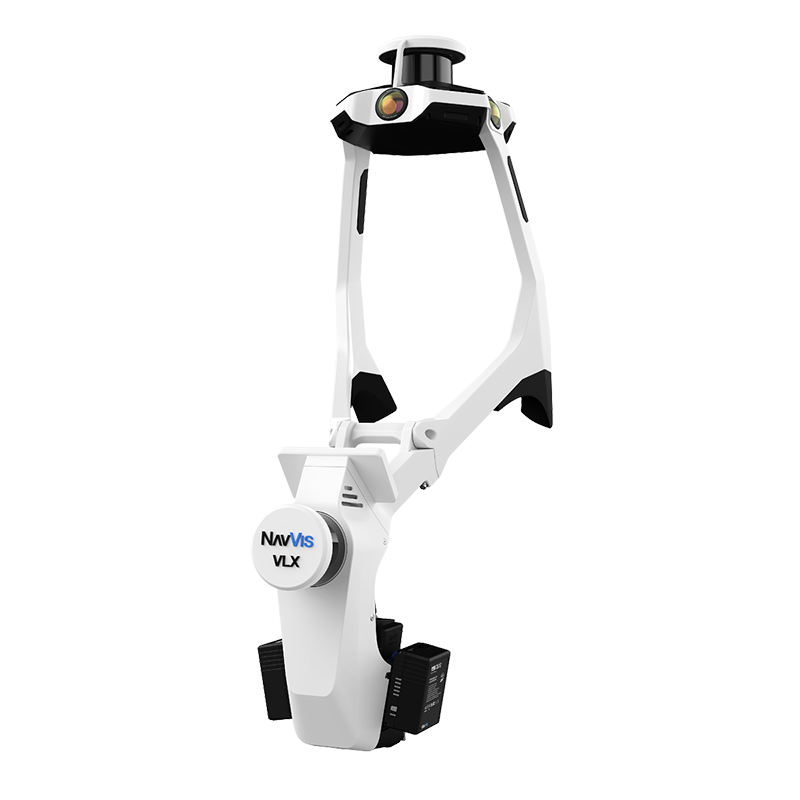
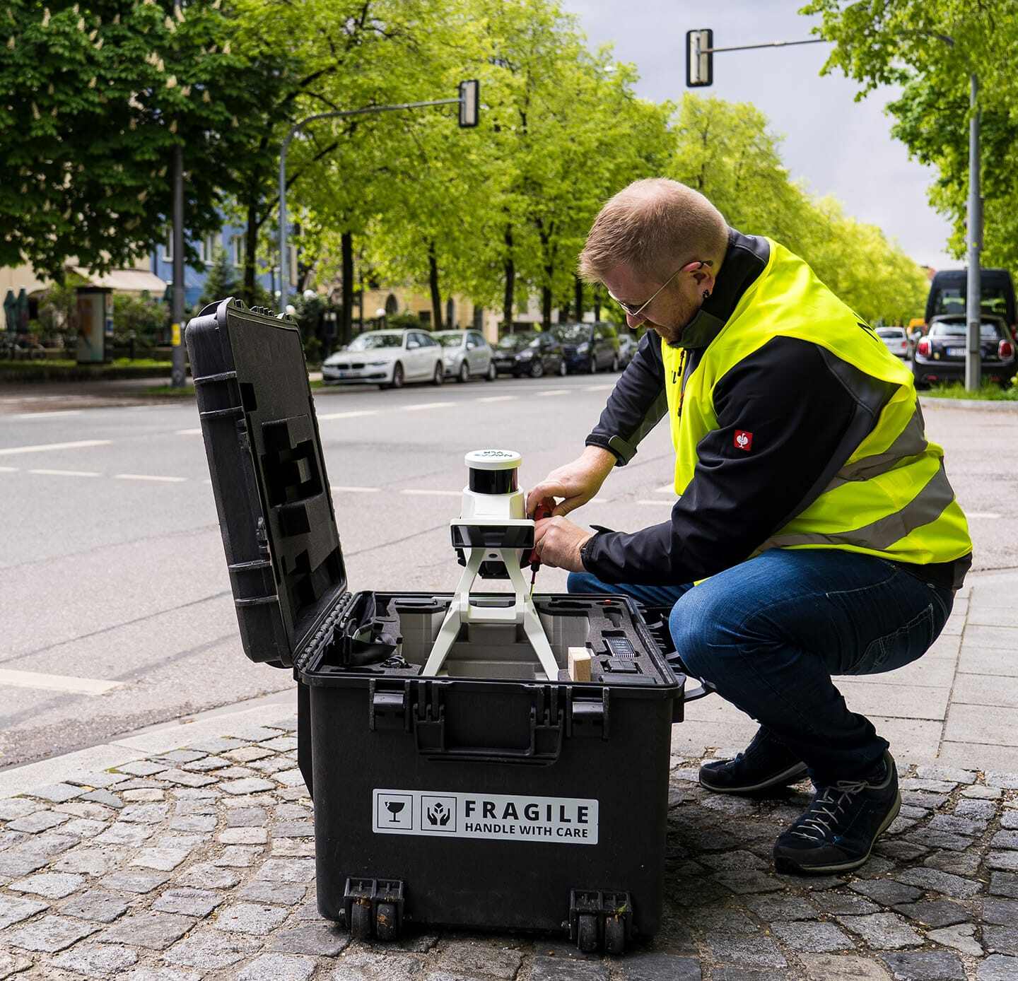
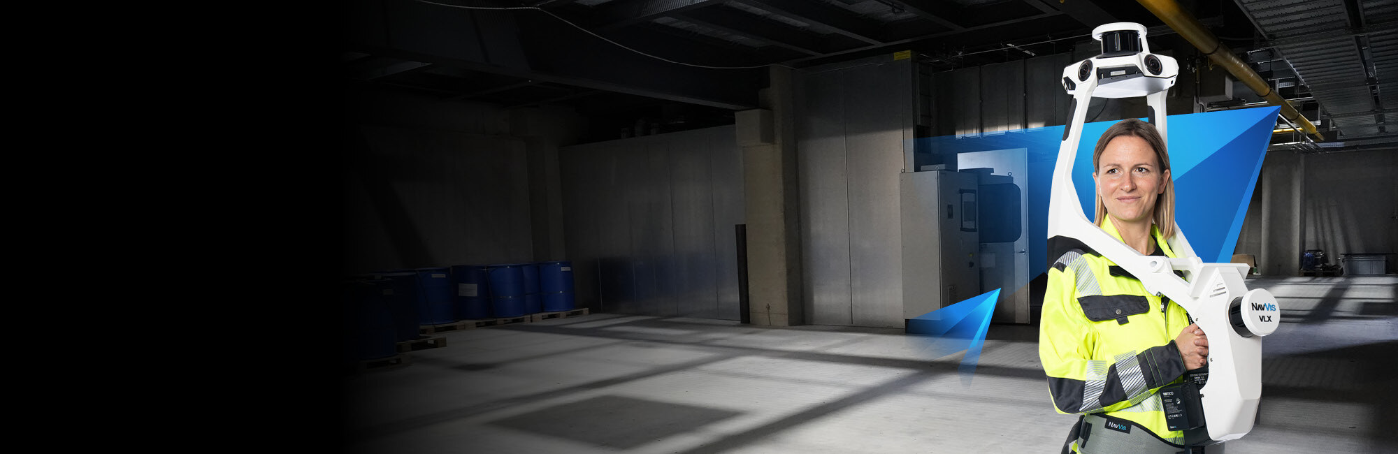
Complete NavVis VLX 3 review with verified specs, real-world capabilities, VLX 3 vs VLX 2 comparison, and how service providers deploy it.
Learn how mobile SLAM scanning documents warehouses 10x faster than tripod methods. Covers costs, process, deliverables, and provider selection.

SLAM scanning explained: how Simultaneous Localization and Mapping works, accuracy factors, key scanners compared, and when to use SLAM vs tripod.
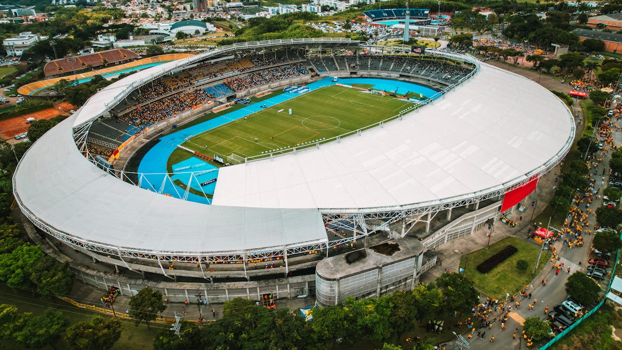
When to use drone LiDAR vs terrestrial laser scanning for stadiums. Equipment comparison, cost differences, and why most projects need both.
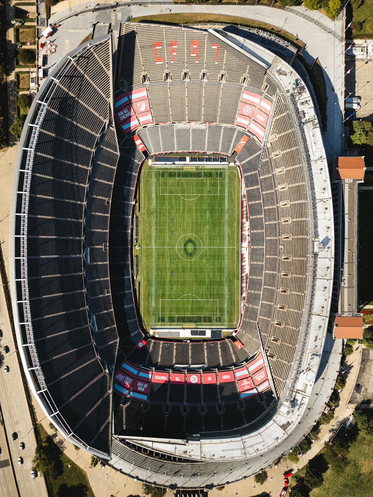
What the Elland Road Stadium scanning project reveals about stadium LiDAR requirements. 5,250 scan positions, multi-sensor approach, and real deliverables.

How Formula 1 circuits are 3D scanned with LiDAR and how EA uses that data for F1 25. Confirmed tracks: Bahrain, Miami, Melbourne, Suzuka, Imola.
How 3D scanning and digital twins are transforming FIFA 2026 World Cup stadiums. Security, crowd simulation, renovation planning, and operations.

How LiDAR drone surveys reveal golf course drainage problems invisible at ground level. Flow analysis, ponding detection, and drainage improvement planning.

Real ROI data from golf course aerial surveys. Documented $160K annual water savings, $50K resodding avoidance, and how DTM data transforms irrigation.

Complete guide to golf course LiDAR drone mapping. Equipment, deliverables, flight planning, and why LiDAR beats photogrammetry for course surveys.
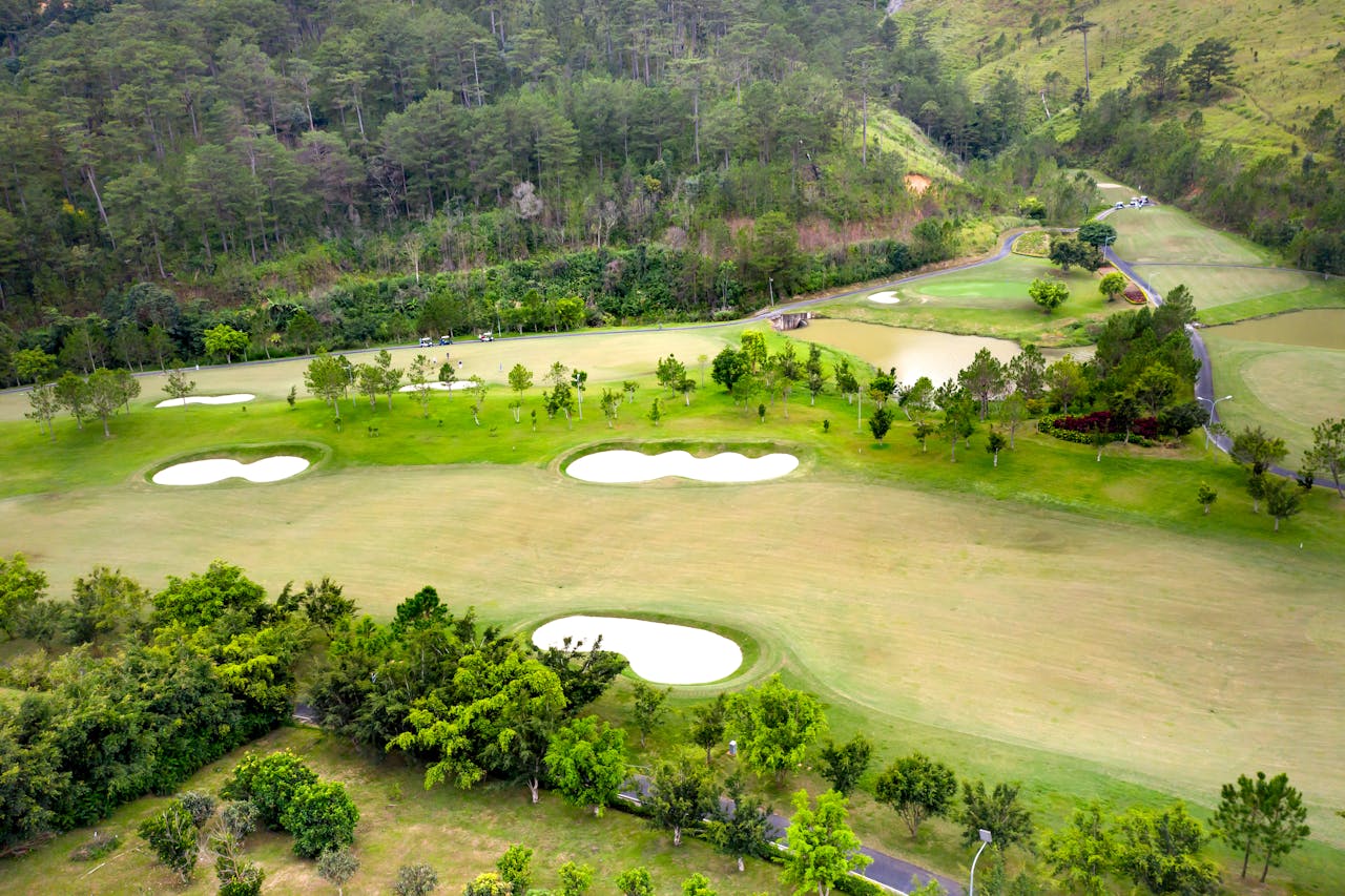
How golf course architects use LiDAR terrain data for renovation design. Cut/fill volumes, as-built comparison, bunker redesign, and design verification.
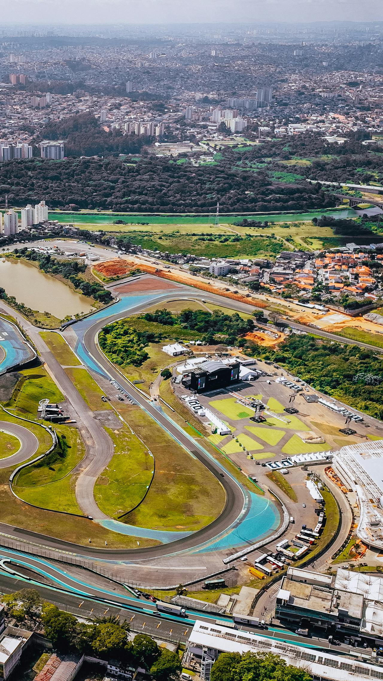
How Formula 1 circuits are 3D scanned with LiDAR. Confirmed circuits, scanning methodology, equipment used, and real-world safety applications.

How 3D scanning and drone photogrammetry support LA28 Olympic venue preparation. Camera planning, rowing course scanning, and broadcast infrastructure.
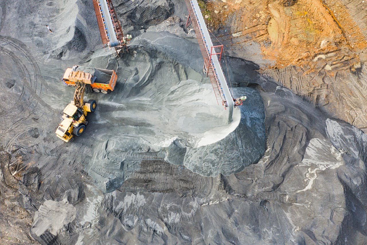
How drone LiDAR surveys measure mining stockpiles with 1-3% accuracy without shutting down operations. Equipment, methodology, and cost savings.

Why Monaco's street circuit is the ultimate 3D scanning challenge. Narrow streets, elevation changes, tunnels, and how scanning supports F1 safety.

How 3D scanning documents NASCAR oval track surfaces. Banking angles, repaving QA, drainage on banked turns, and surface profiling technology.

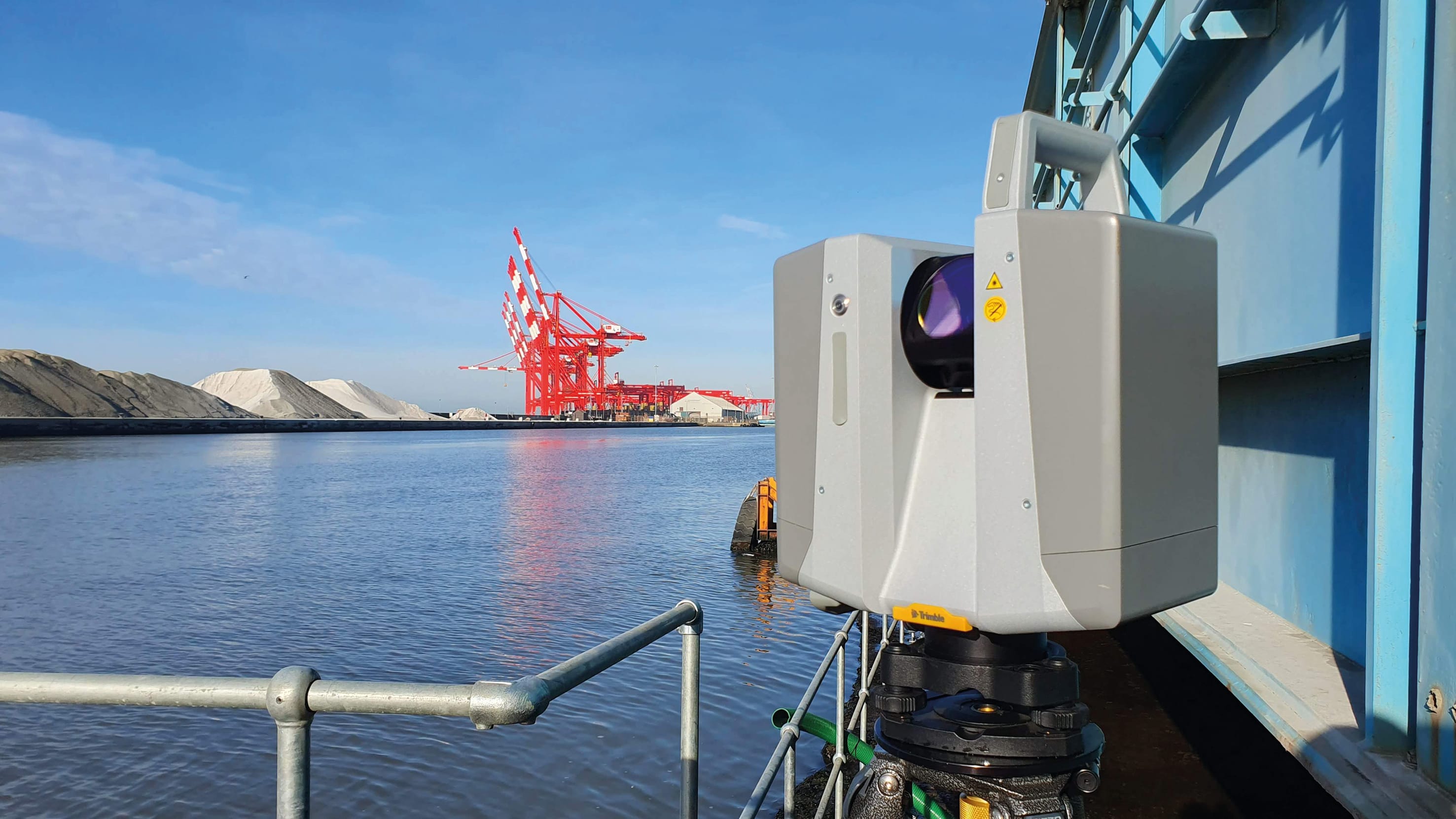
How combined bathymetric and topographic 3D scanning documents port infrastructure. BathyLogger BL200 echo sounder, drone LiDAR, and wharf inspection.

How 3D scanning supports motorsport safety compliance. FIA barrier verification, run-off assessment, spectator zones, and annual track inspection.

How drone LiDAR maps ski resort terrain at 740 acres in 120 minutes. Trail design, avalanche mapping, snow depth measurement, and vegetation analysis.
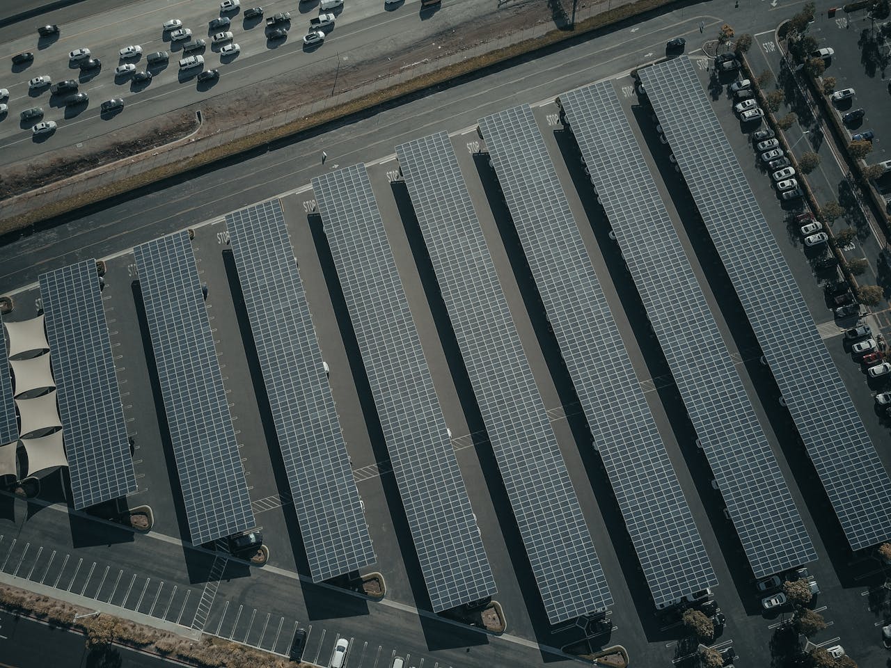
How thermal drone inspection covers 50-100 MW of solar panels per day. Fault detection rates, AI anomaly classification, equipment, and regulations.

How sports broadcast production teams use 3D scanning data for camera placement, cable routing, broadcast compound design, and venue infrastructure planning.

What stadium and arena 3D scanning costs in 2026. Interior laser scanning, aerial LiDAR, and combined project estimates with real pricing ranges.

How 3D scanning creates digital twins of theme park rides and attractions in Orlando. Roller coaster documentation, ride maintenance, and facility planning.

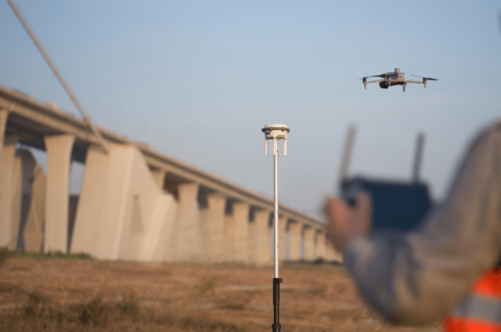
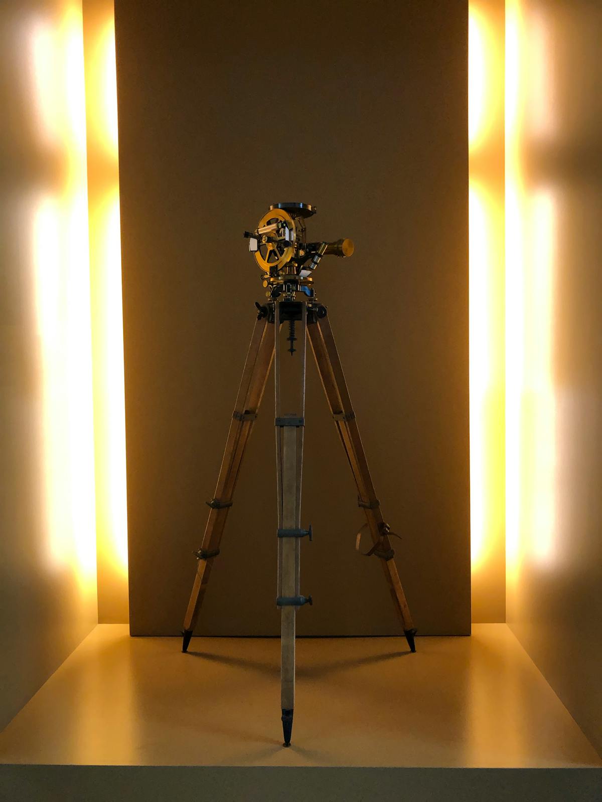
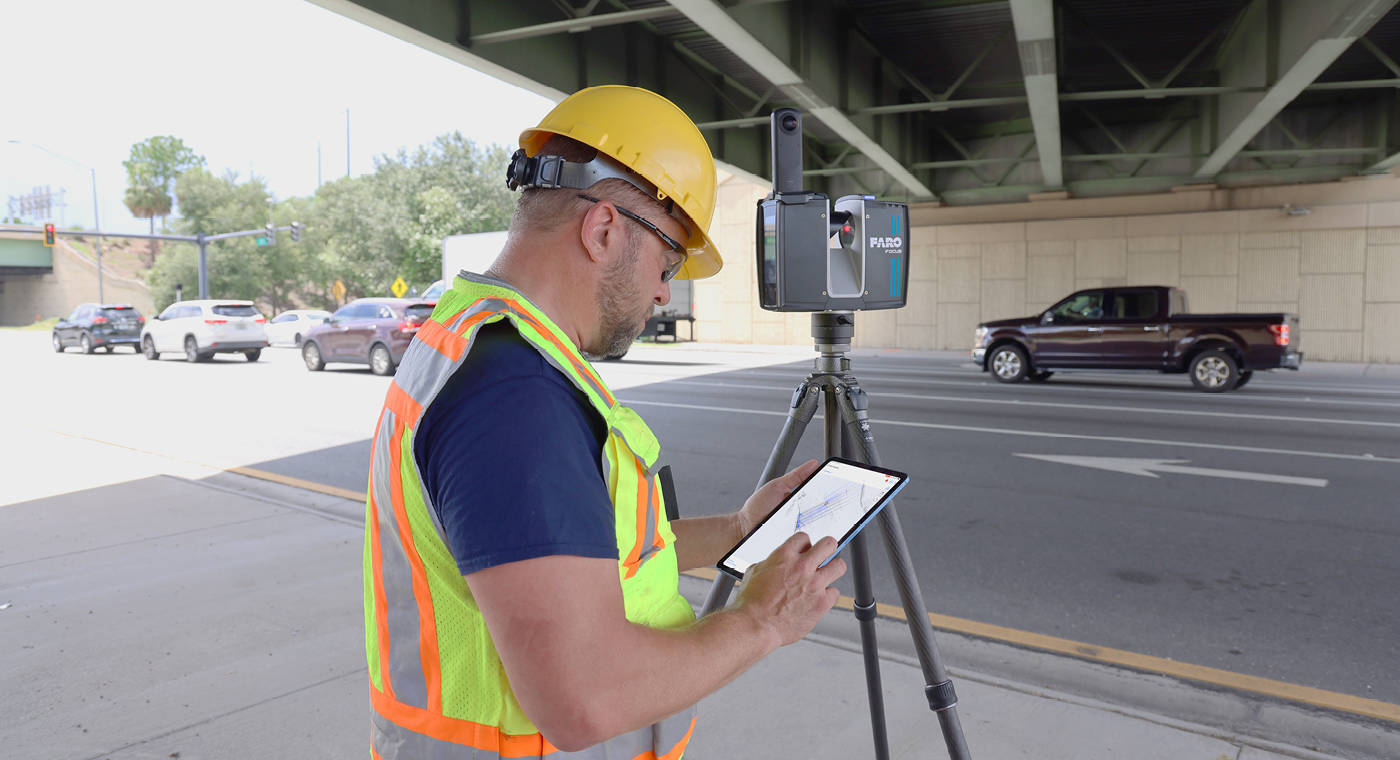
Survey control points ensure 3D scans are accurate and usable. Learn how georeferencing works and when you need a licensed surveyor.

Compare drone, helicopter, and manned aircraft LiDAR. When to use each for topographic surveys, corridor mapping, and forestry.

What aerial surveys cost in 2026. Drone photogrammetry, drone LiDAR, and helicopter LiDAR pricing with real service ranges.
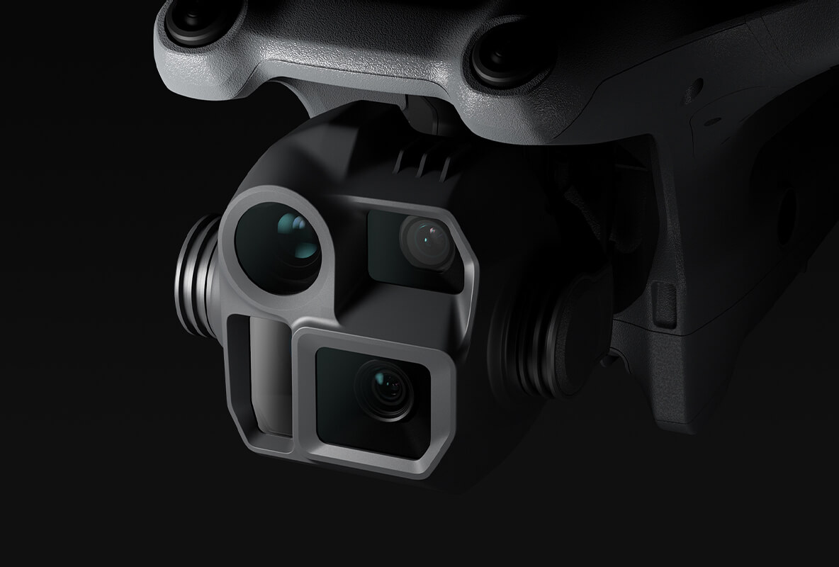
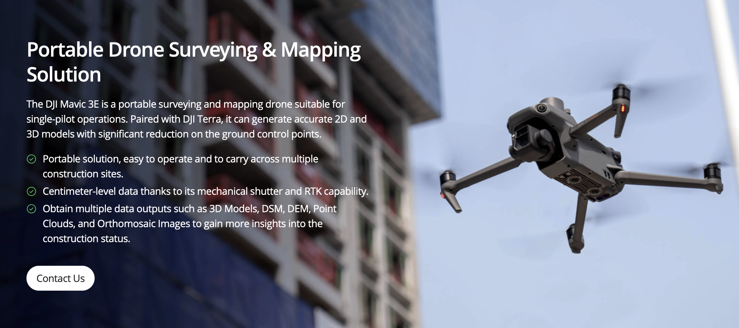
Top 5 survey drones ranked by use case. DJI M350 RTK, Mavic 3E, WingtraOne, eBee X, and M4E compared.
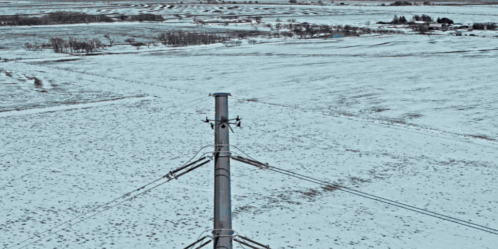
How drones and helicopters map linear corridors — power lines, pipelines, highways. Methods, accuracy, deliverables, and costs.
How drone topographic surveys work, accuracy standards, deliverables (DEM, DTM, contours), and pricing for 2026.
Fixed-wing mapping drone guide — coverage, accuracy, flight time, top models, and when to choose fixed-wing over multirotor.
When helicopter LiDAR beats drone LiDAR — corridor mapping, large-area surveys, power line inspections, and beyond.
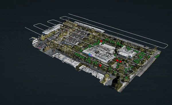
What orthomosaic maps are, how they're created from drone imagery, accuracy standards, applications, and costs.
Compare orthomosaic maps and point clouds — what each delivers, when to use them, and when you need both for your project.
What oblique aerial imagery is, how it differs from nadir photography, and its use in inspections, urban mapping, and 3D modeling.

How school districts use 3D scanning for facility condition assessments, renovation planning, ADA compliance, and capital improvement projects.

How 3D scanning and Matterport virtual tours help schools document facilities for emergency planning, first-responder coordination, and safety compliance.

How drone photography and videography create stunning aerial campus tours. Bird's-eye views for enrollment marketing, campus planning, and virtual open houses.

How K-12 schools use 3D virtual tours for enrollment marketing, parent engagement, safety documentation, and more. Real benefits backed by education data.

How 3D virtual tours help boarding schools showcase dormitories and campus life to international families who cannot visit in person.

How 3D virtual tours help charter schools compete for students, demonstrate facility quality, and fill seats.

Everything schools need to know about 3D virtual tours: Matterport scanning, pricing, enrollment impact. The definitive guide for administrators.

How European universities use 3D virtual campus tours to recruit international students. Implementation guide and best practices.
How Matterport 3D virtual tours work for schools and campuses. Features, pricing, use cases, and why professional scanning beats DIY for education.

How Miami-Dade County public schools can implement 3D virtual tours. Local vendor guide with pricing, procurement process, and case examples.

THE FUTURE 3D is an NYC DOE Approved Vendor (#THE770638). What it means and how schools can hire us using DOE budget.

Preschool virtual tours help parents see classrooms and safety features before visiting. Build trust and attract families.

School virtual tour pricing explained: K-12 from $750, universities from $2,000. See the full cost breakdown including add-ons, hosting, and volume discounts.

How universities use 3D virtual campus tours to recruit international students. Reach prospects worldwide and boost enrollment from global markets.

How to plan and host virtual open house events using 3D tours. Reach more families, increase enrollment, and showcase your school to out-of-area prospects.

Virtual tours influence 45% of enrollment decisions. How schools use 3D tours to attract families and compete.

How UK schools, academies, and multi-academy trusts use 3D virtual tours for admissions marketing and Ofsted preparation. Pricing and implementation guide.

Comparing virtual and in-person school campus tours. Learn when each format works best and why the most effective schools use both.
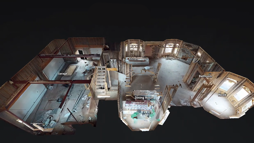
How 3D laser scanning replaced tape measures for as-built documentation. Compare speed, accuracy, and cost of modern vs traditional methods.

The complete guide to as-built documentation for facility managers — covering maintenance, space planning, compliance, and how to keep records current.

Pre-loss as-built documentation strengthens insurance claims and speeds recovery. Learn what insurers need and how 3D scanning creates proof.
Most municipalities require as-built drawings before issuing a certificate of occupancy. Learn what's required and how to avoid rejection.
Why renovation projects need as-built documentation. Learn what existing conditions records cost and how 3D scanning prevents costly surprises.
From incomplete field updates to missing hidden elements, these as-built documentation mistakes lead to costly rework. Learn how to avoid them.
Skipping as-built documentation seems like savings — until the first renovation surprise. Learn the hidden costs of change orders and delays.
MEP as-built documentation prevents costly surprises during renovation. Learn why accurate mechanical, electrical, and plumbing records matter.

What changed in 3D laser scanning pricing for 2026: market shifts, new technology impacts, and updated cost expectations vs. previous years.
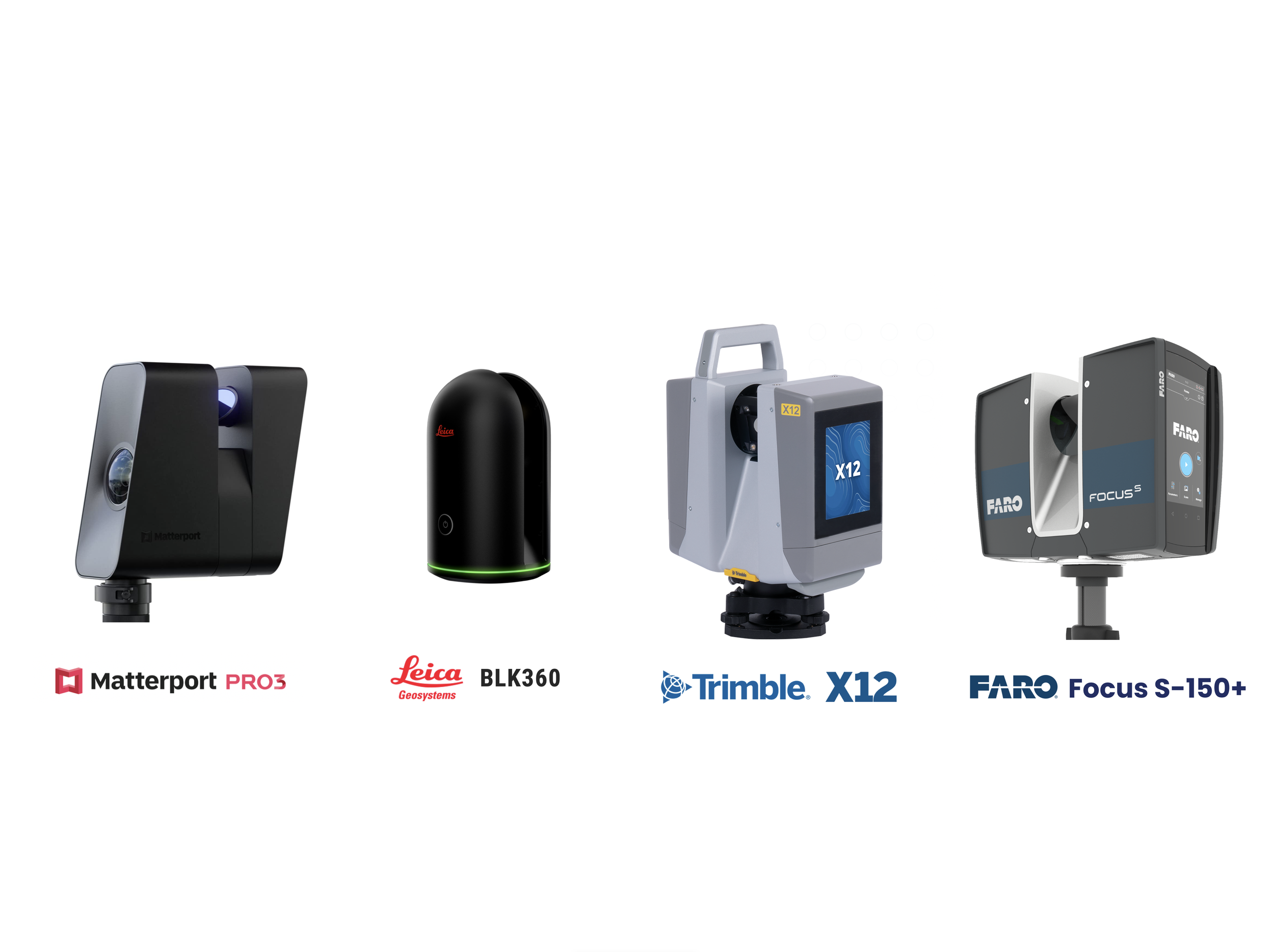
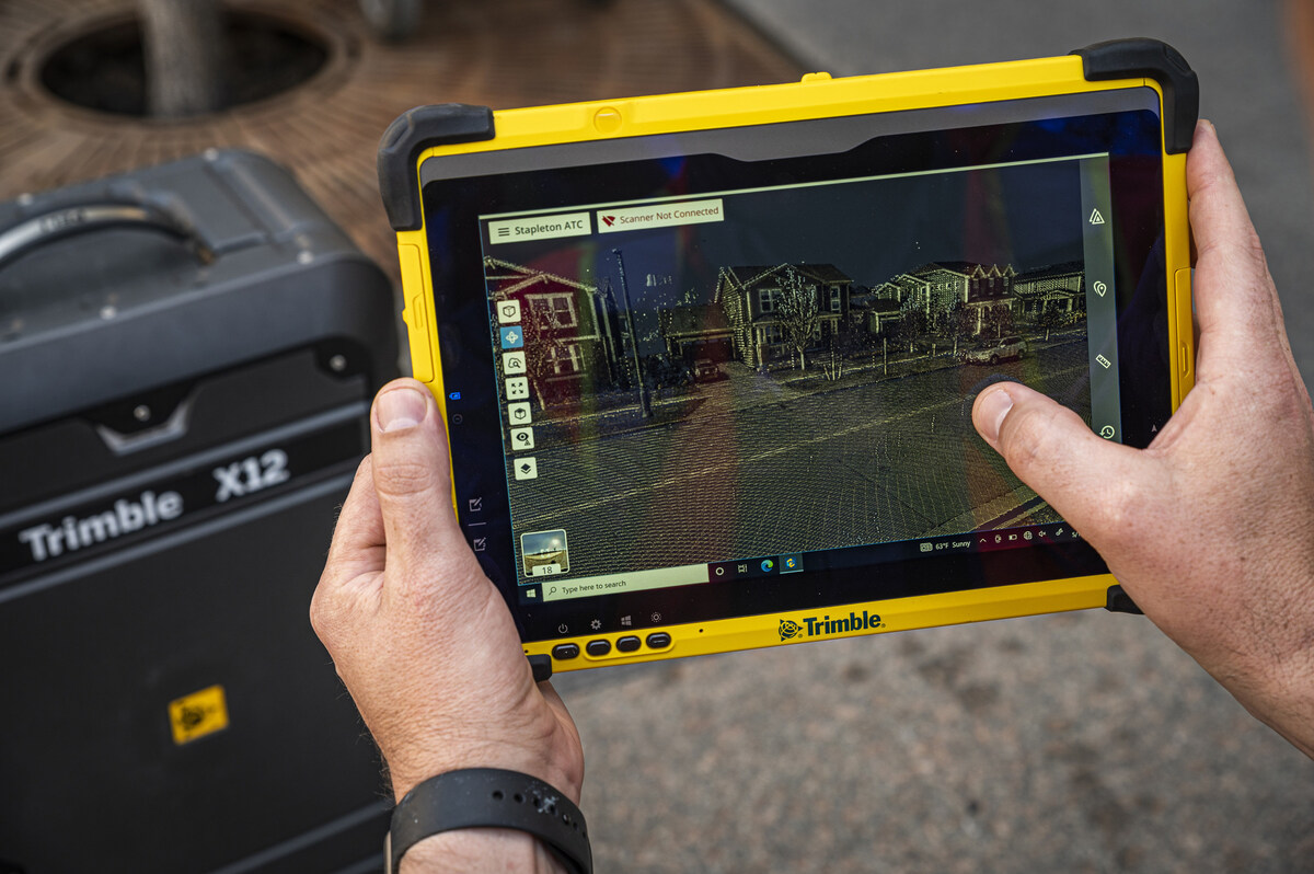
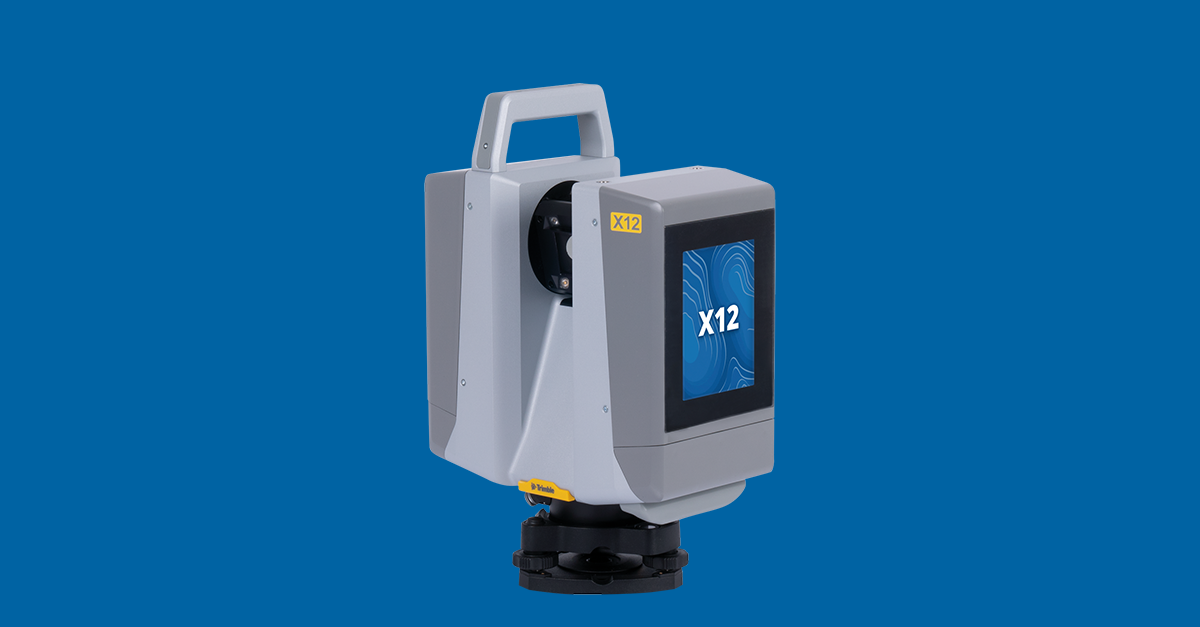
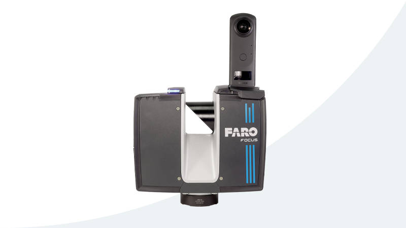
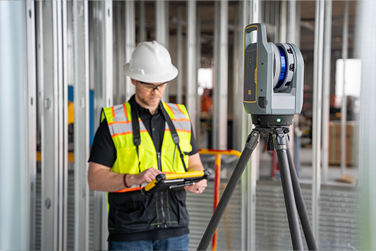
Independent comparison of FARO Focus Premium, Leica RTC360, and Trimble X12 scanners for construction and architecture projects.
How 3D laser scanning supports data center retrofit planning, AI infrastructure upgrades, cable mapping, and digital twin creation.

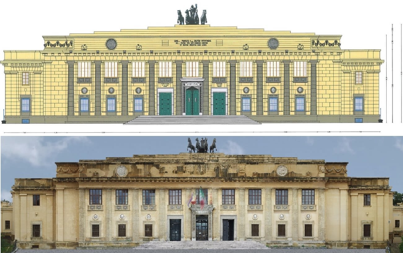
How 3D laser scanning meets HABS, HAER, and Section 106 documentation requirements for historic preservation and heritage building compliance.

Real ROI data on 3D laser scanning for renovations: 30-60% rework reduction, 3-4x return on investment, and practical examples across project types.
Honest analysis of when 3D scanning is worth it for small residential projects. Cost ranges, break-even points, and scenarios where it pays off.
Complete comparison of 3D laser scanning vs. traditional surveying. Covers speed, accuracy, cost, deliverables, and when each method is appropriate.
Avoid costly project failures: the 5 most common mistakes clients make when ordering 3D laser scanning, and how to prevent each one.

How 3D scanning deviation analysis works for construction QA/QC. Covers scan-to-design comparison, tolerance standards, color maps, and when to scan.

20+ questions to ask, red flags to avoid, and evaluation criteria for hiring a professional 3D scanning provider in 2026.
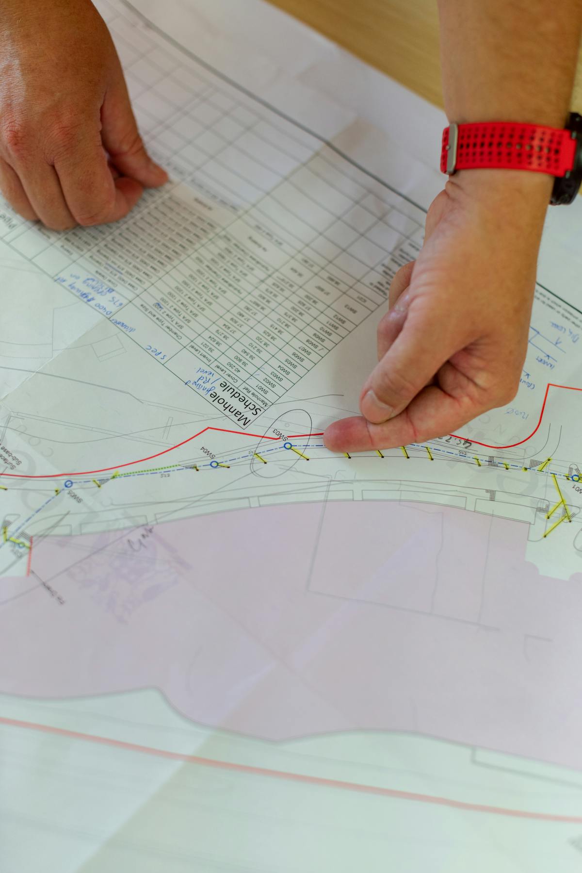
Step-by-step guide to writing a 3D scanning scope of work. Covers accuracy specs, deliverables, formats, timelines, access, and payment terms.

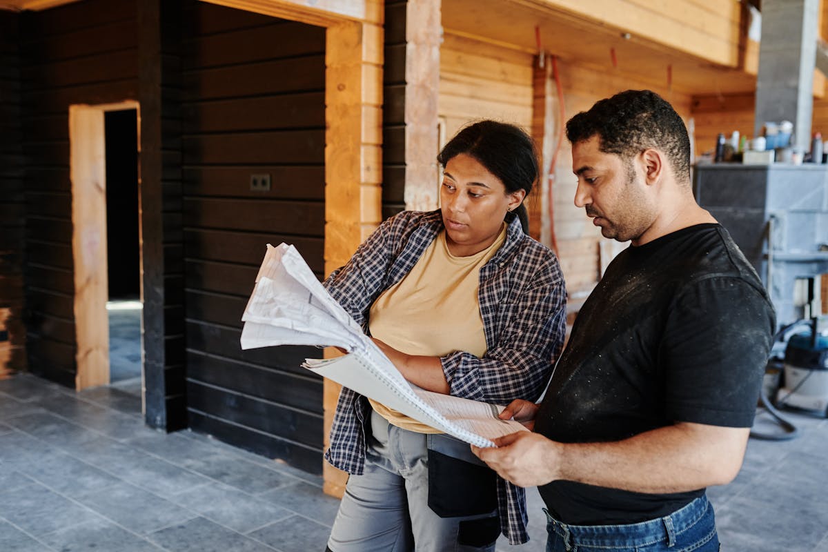
A practical roadmap for engineering firms adding 3D laser scanning. Covers equipment selection, training, workflow integration, and ROI timeline.

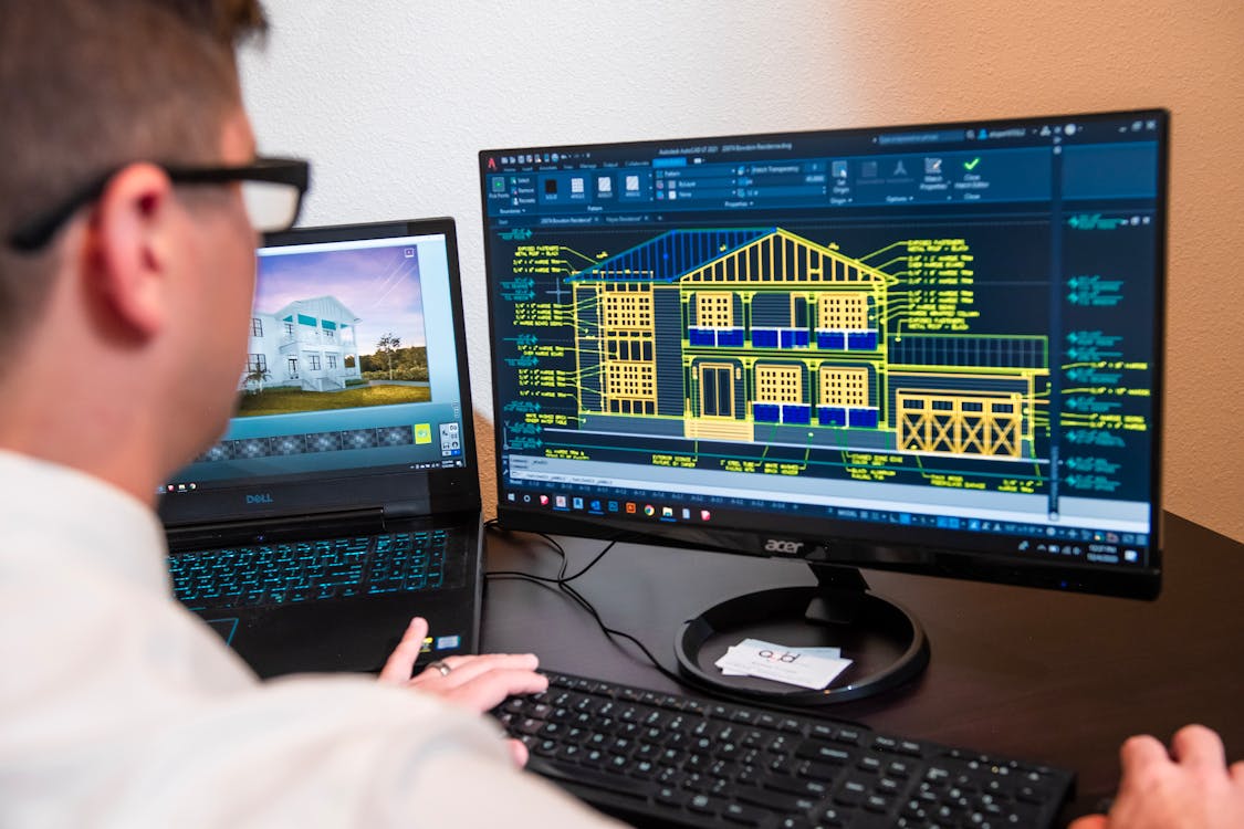
Each LOD level explained with visual descriptions, cost per level, and when to use each. Covers LOD 100, 200, 300, 350, and 400 for BIM projects.
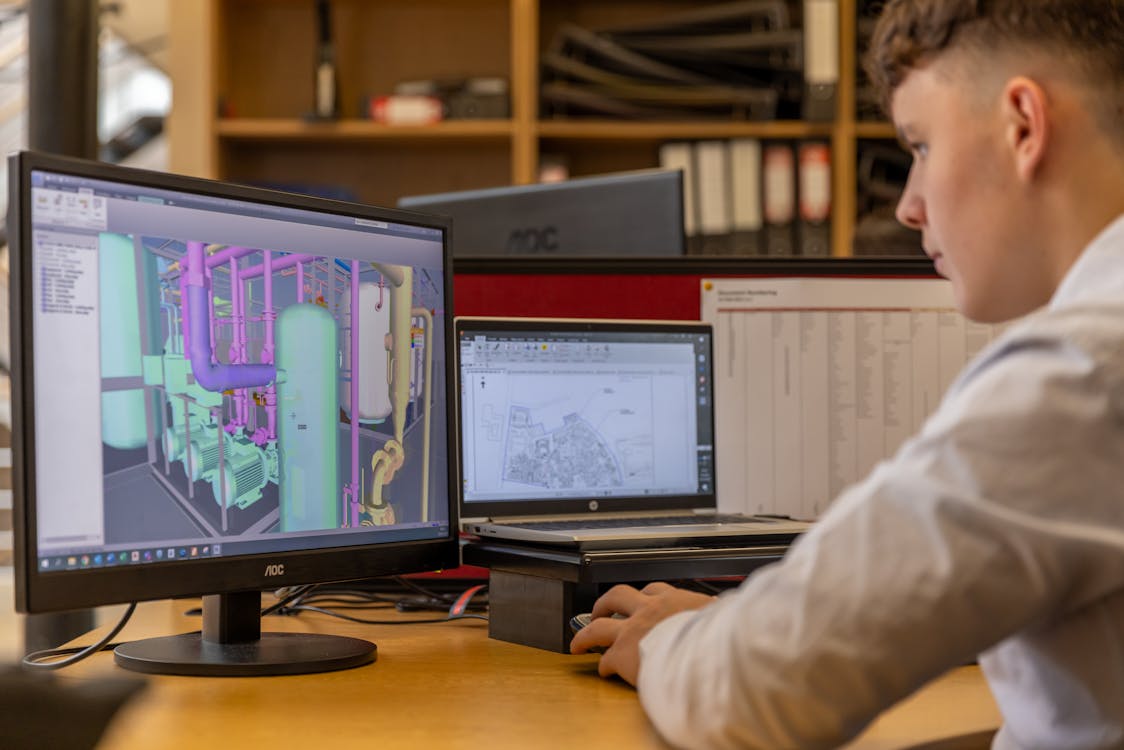
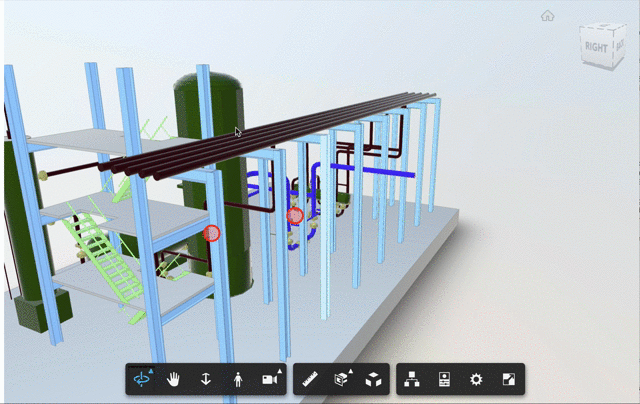
Why MEP scan-to-BIM remains the hardest part of any project. Covers occlusion, LOD requirements, cost implications, and practical solutions.
Compare mobile SLAM scanners and terrestrial laser scanners. Speed vs accuracy tradeoffs, project size thresholds, hybrid approaches, and costs.

CPU, GPU, RAM, and storage recommendations for point cloud processing workstations. Software-specific requirements for ReCap, Cyclone, CloudCompare, and more.

Client preparation checklist for 3D scanning projects. Covers access, furniture, lighting, safety, stakeholder notification, and scheduling.
Complete breakdown of point cloud processing costs including software licenses, workstation hardware, processing time, storage, and training investments.
Learn what determines 3D scanning accuracy, how top scanners compare, and proven techniques to maximize measurement precision on every project.

Discover how 3D scanning for architecture supports renovation design, historic preservation, as-builts, and code compliance. Includes cost, ROI, and workflow.
Learn how 3D scanning for construction reduces rework, supports QA/QC, and cuts project costs. Includes workflow, cost vs savings, and when to scan.

Understand the real limitations of 3D laser scanning: line-of-sight, reflective surfaces, file sizes, weather, and practical mitigation strategies.
Debunking the five most common misconceptions about 3D laser scanning that lead to wasted budgets, missed opportunities, and poor project outcomes.
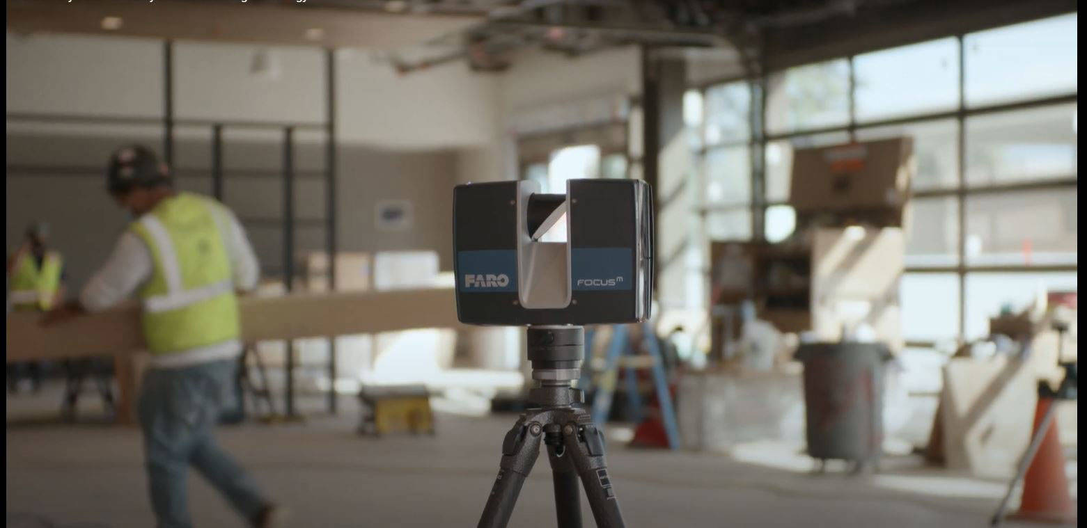
A step-by-step walkthrough of a real 3D laser scanning day: pre-scan prep, equipment setup, room-by-room scanning, field QA, and data delivery.
An honest assessment of AI-powered scan-to-BIM automation in 2026: what works today, what does not, and why human expertise still matters.
Compare the best point cloud software for viewing, processing, and registration. Free and paid options including CloudCompare, ReCap, Cyclone, and more.
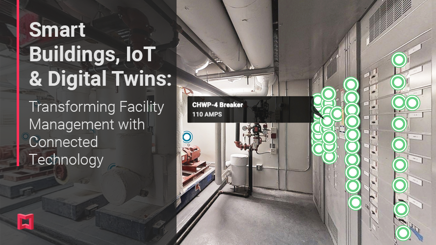
Understand the key differences between digital twins and BIM, how they complement each other, and how 3D scanning powers both technologies.
Compare E57 and LAS point cloud formats. Learn the technical differences, when to use each, and how LAZ compression works for AEC workflows.
Compare laser scanning and photogrammetry across accuracy, speed, cost, and use cases. Learn when each method excels and when a hybrid approach works best.
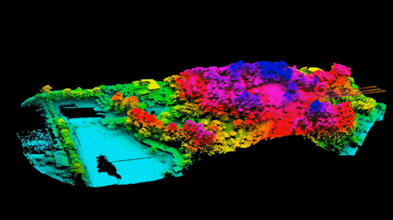
Learn what a LiDAR point cloud is, how aerial and terrestrial LiDAR create point clouds, key AEC applications, equipment, data formats, and cost factors.
Master point cloud processing from registration to noise removal, decimation, and export. Compare top software tools and learn proven best practices.
Compare point cloud to CAD and point cloud to BIM workflows, understand when each is appropriate, and learn how 3D scanning feeds both pipelines.
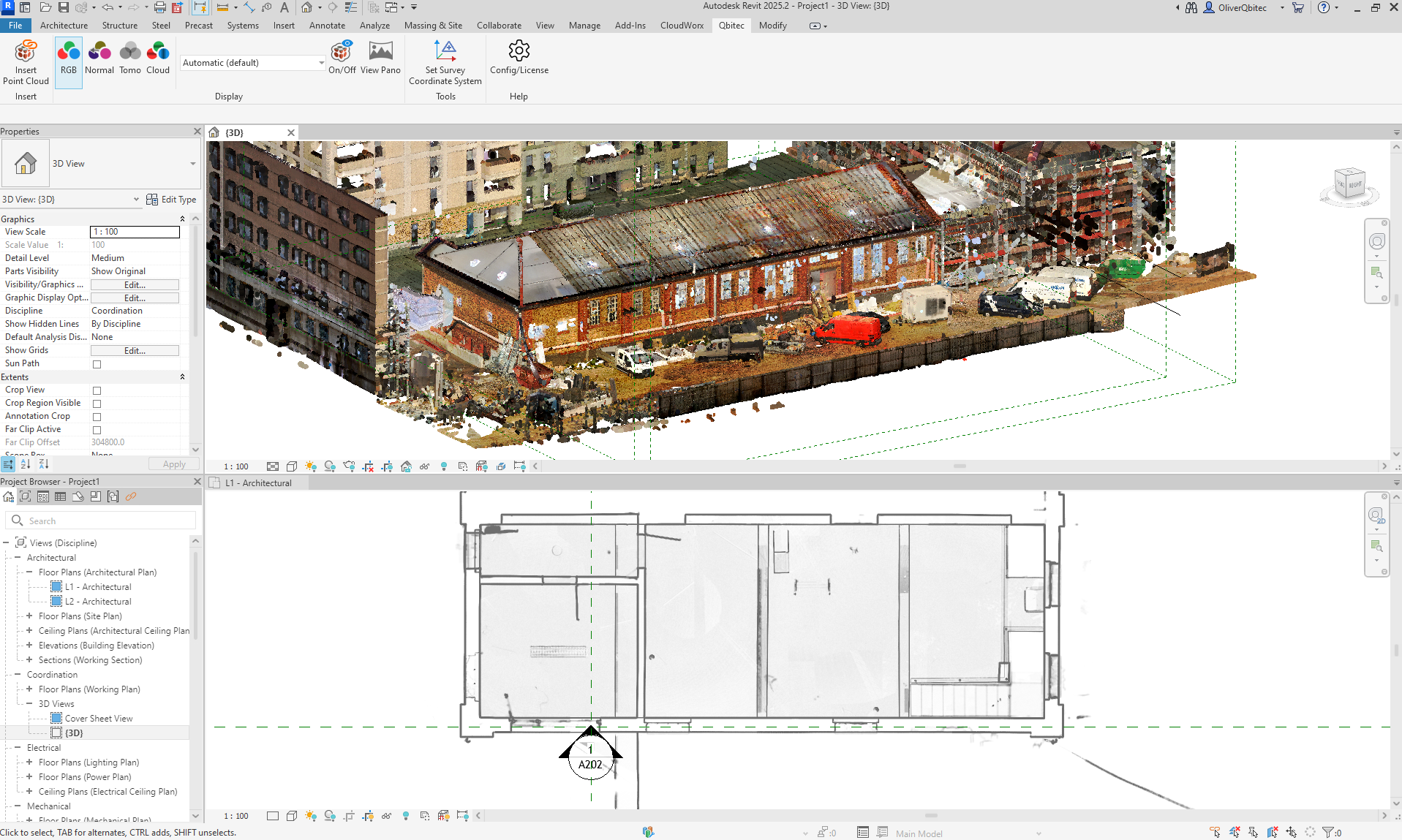
Learn how to import point clouds into Revit, optimize performance with large datasets, and use scan data for Scan-to-BIM modeling workflows.
Understand the key differences between point clouds and BIM models, when to use each, and how 3D scanning bridges the gap for AEC professionals.
Complete breakdown of scan-to-BIM costs in 2026: scanning fees, BIM modeling rates by LOD, total project costs, and how to budget effectively.
Learn the complete Scan-to-BIM pipeline from 3D laser scanning through point cloud delivery to BIM modeling, including LOD levels, timelines, and costs.

Learn what as-built documentation is, why it matters for facility management and renovations, and how 3D scanning creates the most accurate records.
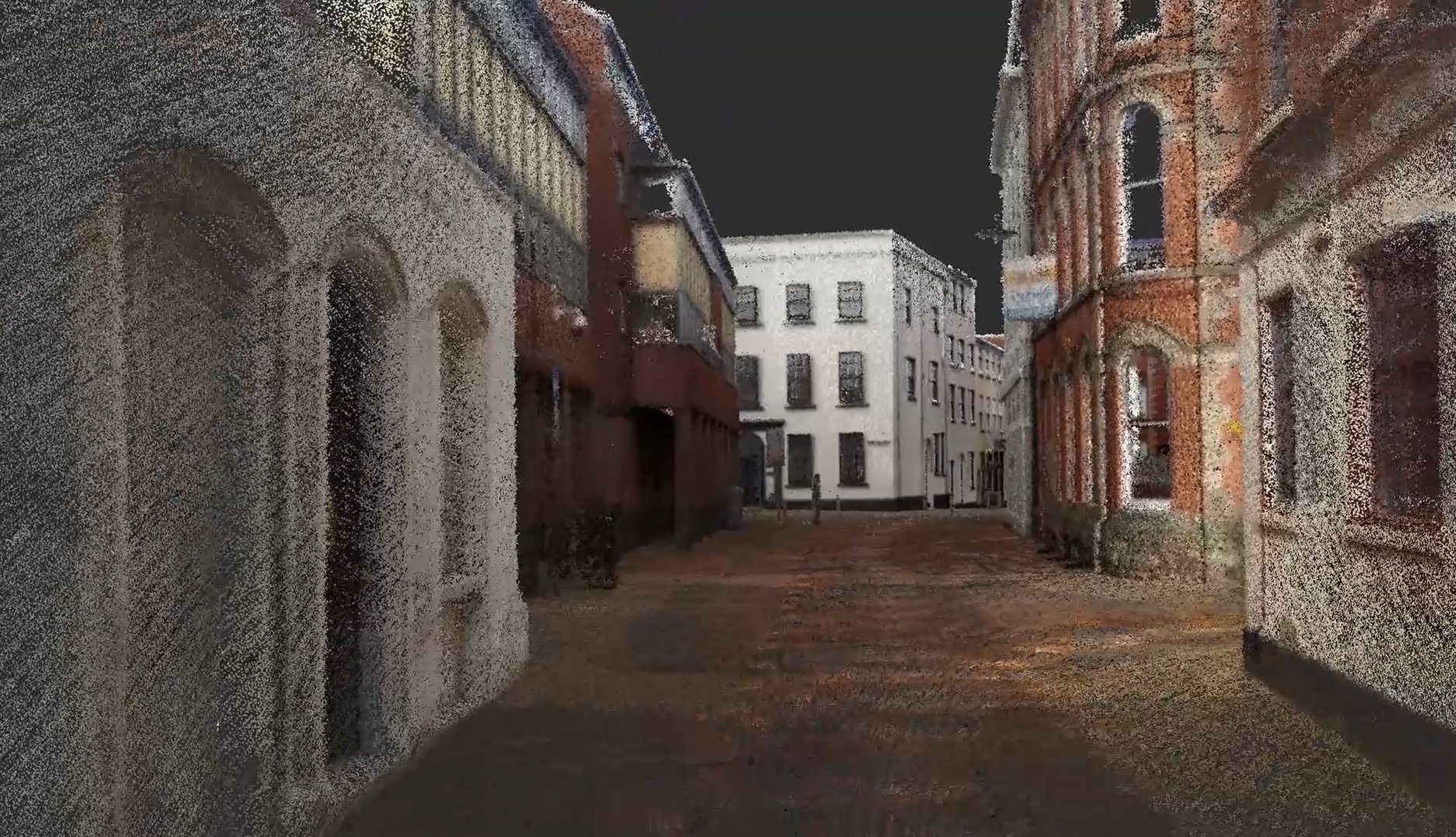
Discover what reality capture means, the technologies behind it (laser scanning, photogrammetry, LiDAR, mobile mapping), and how AEC professionals use it.

Professional tips for higher quality Matterport scans covering positioning, lighting, staging, and common mistakes learned from 500+ completed projects.

How CoStar's Matterport acquisition and Zillow's removal of Matterport integration reshapes the virtual tour industry in 2026.
Compare Gaussian Splatting and Matterport for 3D visualization. Understand the technology, quality differences, and practical applications of each approach.

Learn how adding virtual tours to your Google Business Profile improves local SEO, engagement, and customer trust. Step-by-step integration guide.

Discover how insurance, construction, hospitality, museums, and manufacturing use 3D virtual tours for documentation, marketing, and operations.
Honest assessment of Matterport for architecture and construction versus professional LiDAR scanners. When each tool is appropriate and where they overlap.
Matterport alternatives at every price point in 2026. Compare iGUIDE, CloudPano, Kuula, 3DVista, EyeSpy360, and pro service options.

Compare Matterport plans for commercial and residential use. Understand which subscription tier, features, and pricing fit your property type.
Complete Matterport pricing breakdown for 2026 covering subscriptions, service costs, add-ons, and hidden fees. Learn what virtual tours really cost.
Detailed Matterport Pro2 vs Pro3 comparison covering speed, image quality, LiDAR, outdoor capability, and whether the upgrade investment pays off.
In-depth Matterport vs iGUIDE comparison covering visual quality, floor plan accuracy, pricing, insurance use, and which platform fits your needs.
Compare self-hosting virtual tours versus Matterport Cloud. Analyze costs, control, features, and limitations of each approach for your business.

Step-by-step guide to launching a 3D virtual tour business in 2026. Equipment, pricing, marketing, and scaling strategies from industry professionals.

Data-backed ROI analysis of virtual tours across real estate, hospitality, apartments, and insurance. See the verified numbers that justify the investment.

Compare the real costs of DIY Matterport versus hiring a professional. Camera, subscriptions, time, and quality all factor into the true price.
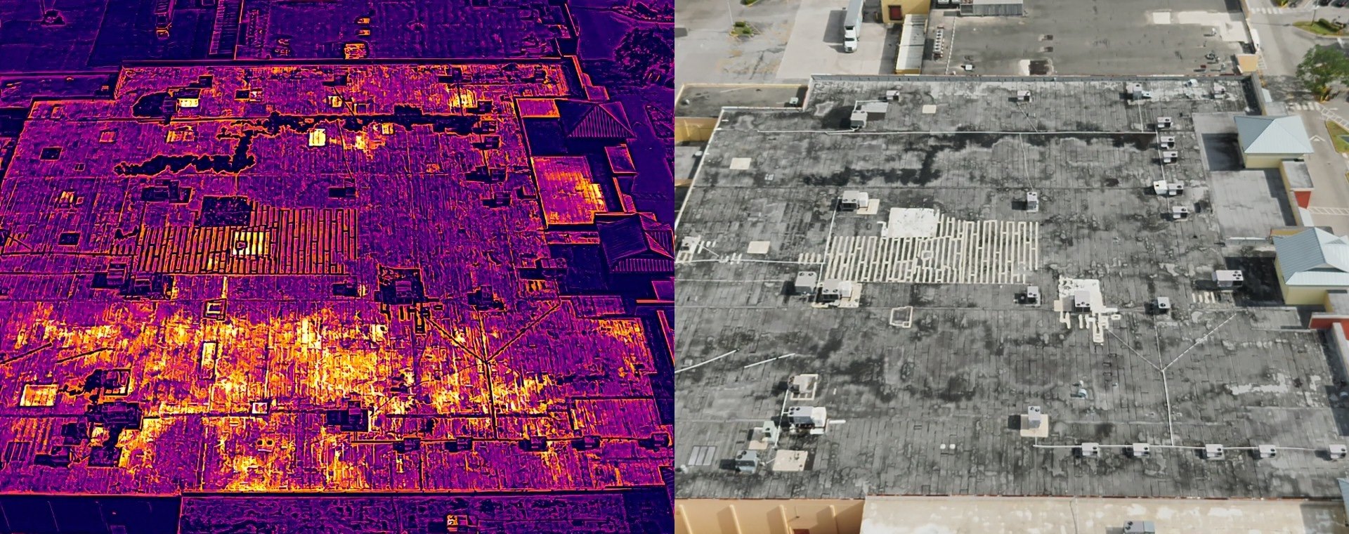
In Florida's climate, building deterioration doesn't always announce itself with cracks or stains. The real danger is what hides beneath the surface.
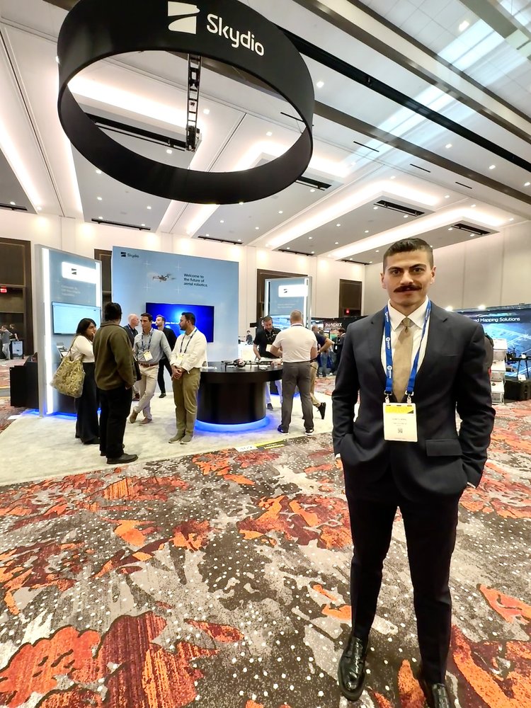
At THE FUTURE 3D, we are driven by innovation. Our team attended the Commercial UAV Expo, exploring the latest advancements in drone technology.
Bridge inspections are critical for maintaining infrastructure safety. THE FUTURE 3D is leading a transformation with AI-powered drones.
In the aftermath of the Surfside condo collapse, Miami has ramped up its inspection requirements for older buildings with AI drone solutions.
In the wake of the tragic Surfside condo collapse, Miami has ramped up building inspection regulations with drone technology.

The integration of cutting-edge drone technology in various industries has revolutionized how businesses operate and gather data.

In the evolving landscape of construction and building management, the drive for efficiency, safety, and precision has never been more critical.
LiDAR technology has experienced revolutionary advancement in recent years, especially in its integration with drones. Discover its potential.
Discover how photogrammetry and 3D modeling work together. Using Autodesk and Pix4D for architecture, archaeology, film, gaming, and urban planning.

Learn what photogrammetry is and how it benefits businesses. Using Agisoft, Pix4D, and DroneDeploy.

Drone photography transforms how we capture the world. DJI and Parrot drones for real estate, construction, agriculture, tourism, and environmental monitoring.

Drones revolutionize videography with cinematic aerial shots. DJI and Parrot UAVs for real estate, weddings, tourism, filmmaking, and inspections.

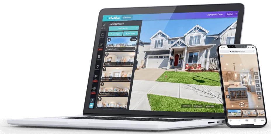
3D Virtual Tours transform business marketing. Matterport-powered experiences for real estate, hospitality.
Virtual tours revolutionize real estate marketing with 3D modeling, VR, and AR. Matterport-powered experiences.
Discover the most profitable industries for 3D laser scanning (LiDAR): AEC, historical preservation, mining, forensics, aerospace, automotive, and more.
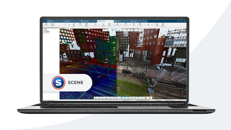
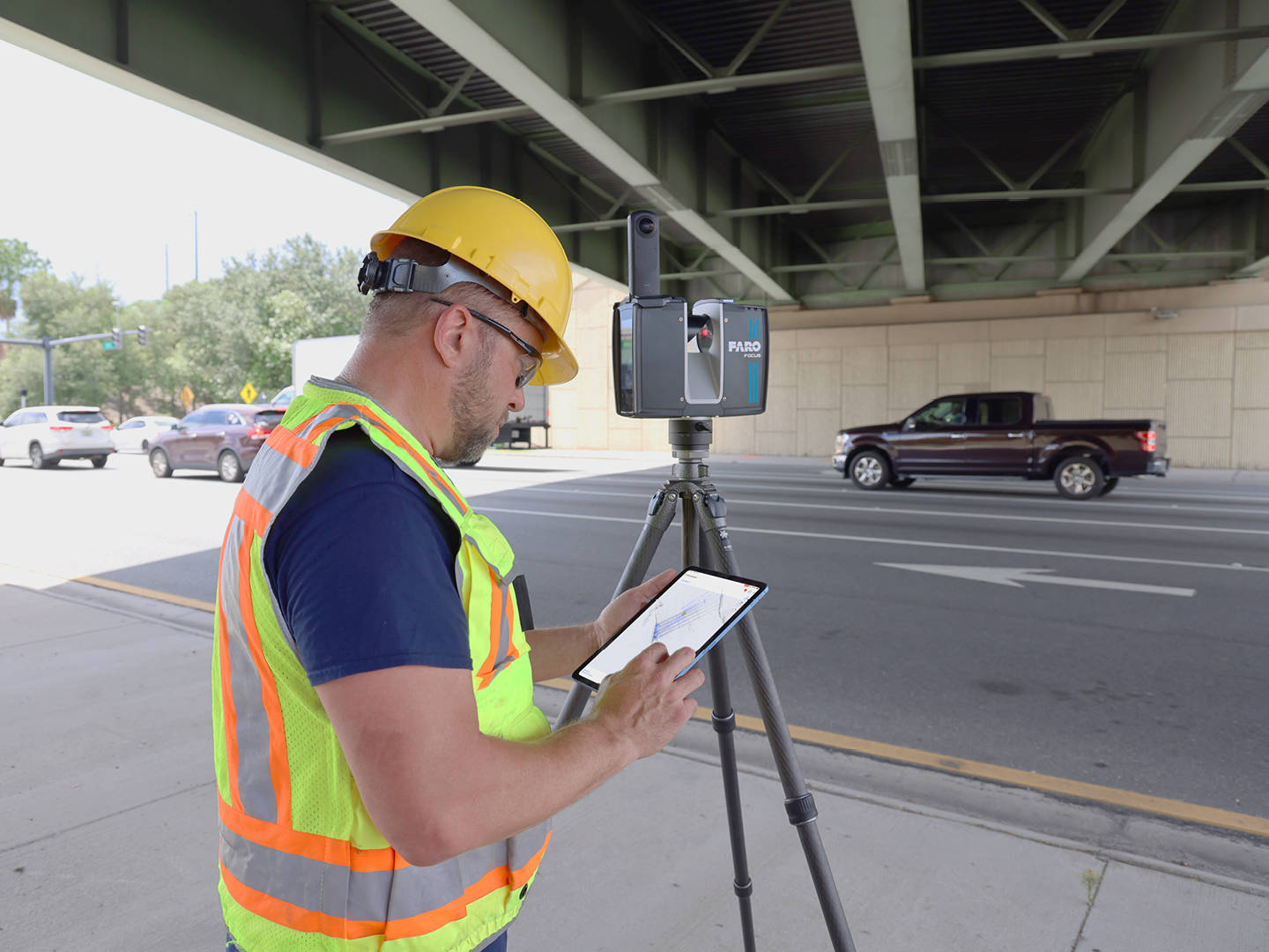
Learn how 3D laser scanning works using Faro and Leica equipment. Applications in AEC, manufacturing, and more.
Digital Twins for manufacturing via 3D Scan to BIM. THE FUTURE 3D delivers precise FARO/Trimble scan data your team models in AutoCAD or Revit.
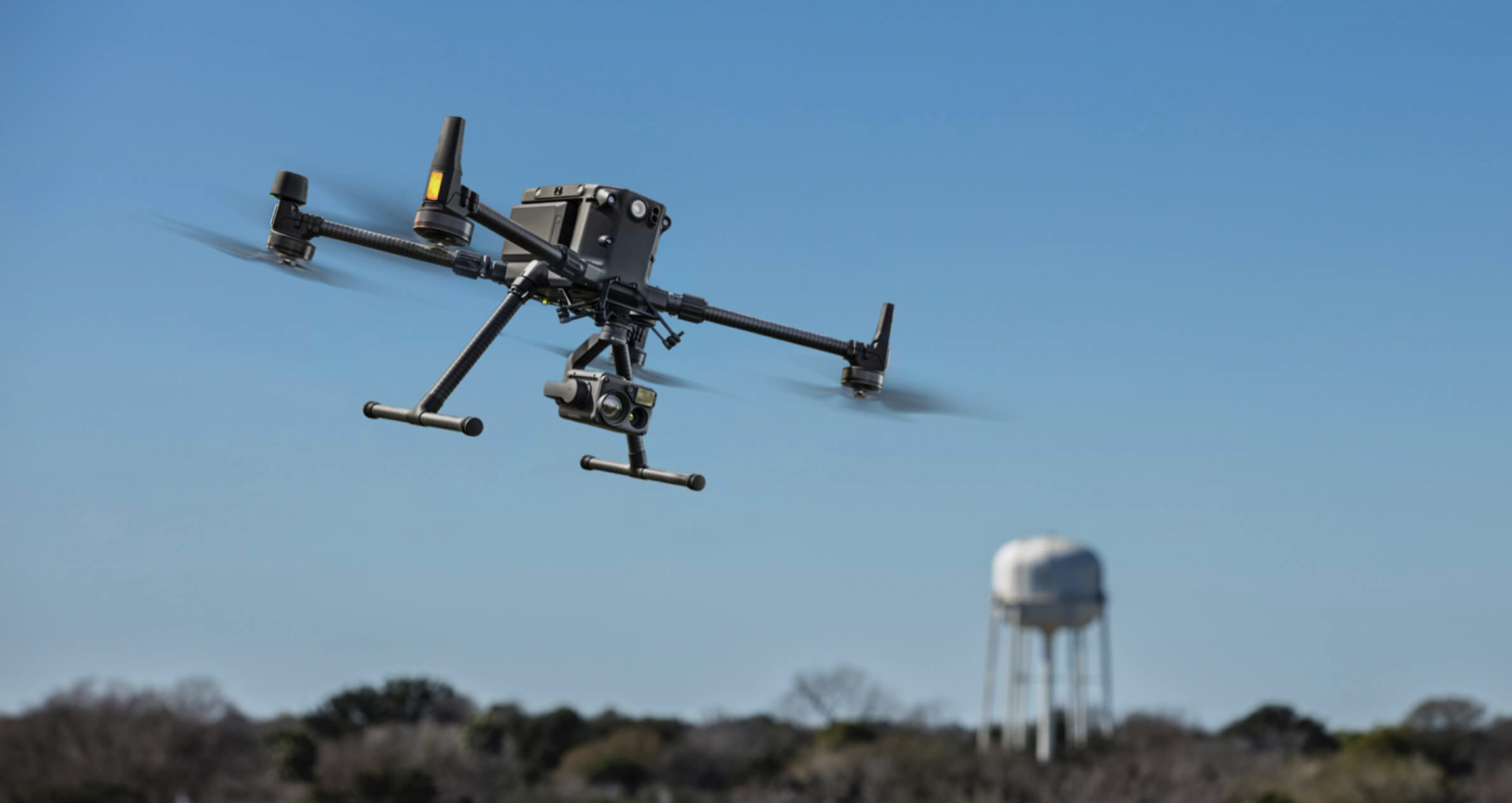
Professional drone photography and videography using DJI Matrice 350 RTK and Mavic 3 Enterprise. Elevate your visuals with aerial perspectives.

Boost your business with Google Maps, Street View, and 3D Virtual Tours. Trusted Photographers helping businesses stand out.
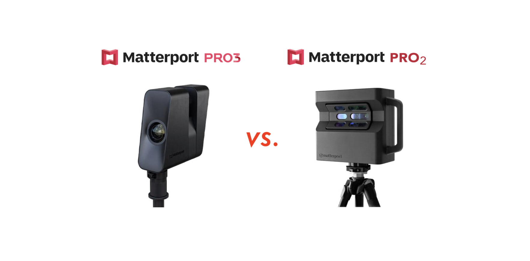
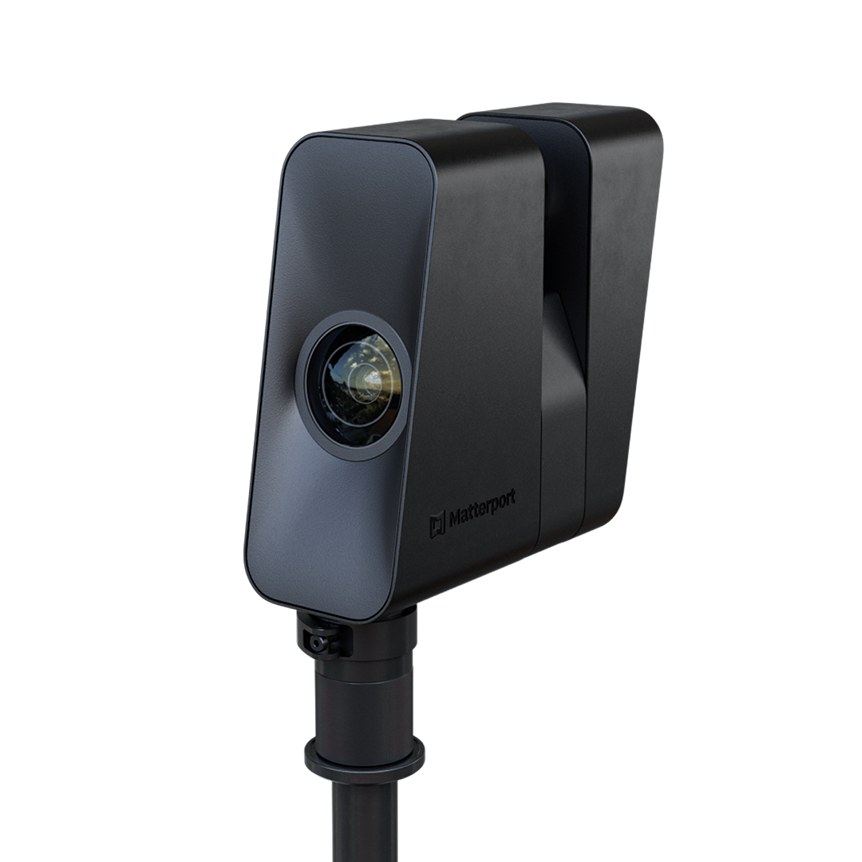
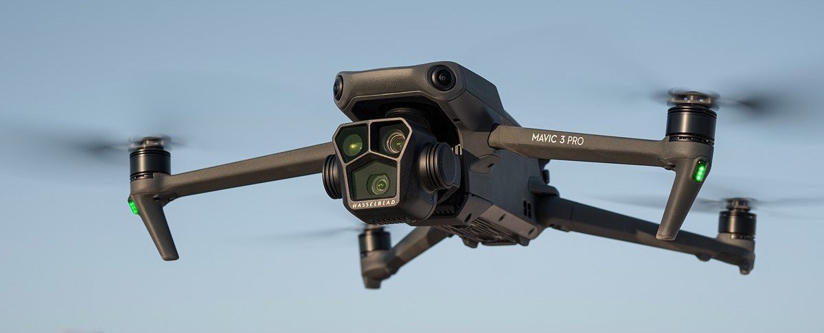
Compare Matterport Pro 3 and Pro 2 cameras for 3D virtual tours. Pro 3 features LiDAR technology for enhanced precision in real estate and construction.

Compare LiDAR and photogrammetry drone technologies to choose the right tool for your project needs, from precision surveying to visual documentation.
Drone inspections revolutionize commercial inspections with improved safety, efficiency, and accuracy using advanced equipment like DJI Matrice 350 RTK.

LiDAR drone surveying creates precise Digital Elevation Models (DEMs) for construction, agriculture, and environmental studies using advanced technology.
LiDAR drone topography mapping uses laser pulses to create precise 3D terrain representations for construction, agriculture, and environmental research.
Facade orthomosaics and vertical surface orthomosaics create detailed building exterior images using drone photogrammetry with DJI Mavic 3 Enterprise RTK.
Aerial construction timelining and drone photogrammetry provide remarkable benefits for tracking construction progress and making data-driven decisions.

Drone services for building facade inspections offer accuracy, safety, and cost efficiency in Miami.

THE FUTURE 3D integrates the latest AI, thermal imaging, and LiDAR technologies to offer superior commercial drone services in Miami.
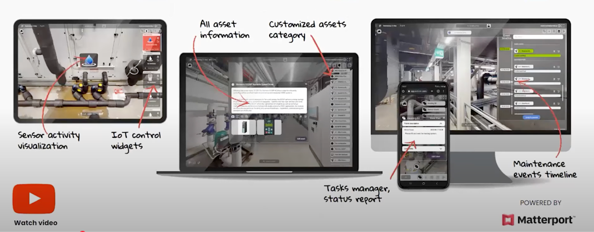
Digital Twins and BIM files have taken facility management by storm, providing numerous benefits in planning, construction, and maintenance.

The collaboration between Matterport and Autodesk Construction Cloud is revolutionizing 3D modeling and project visualization for construction professionals.
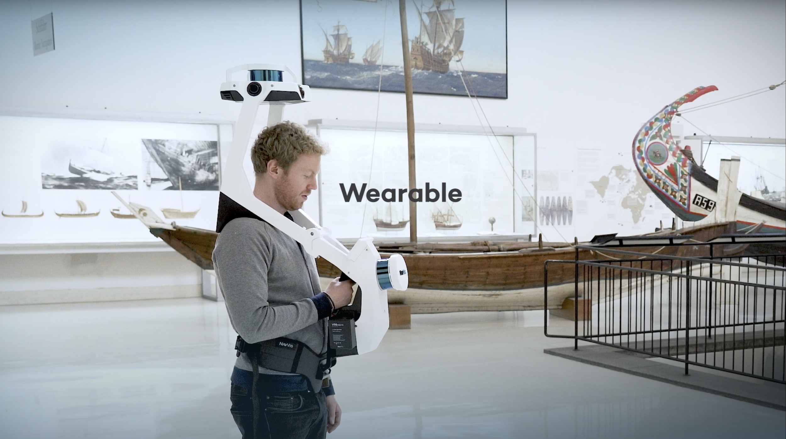
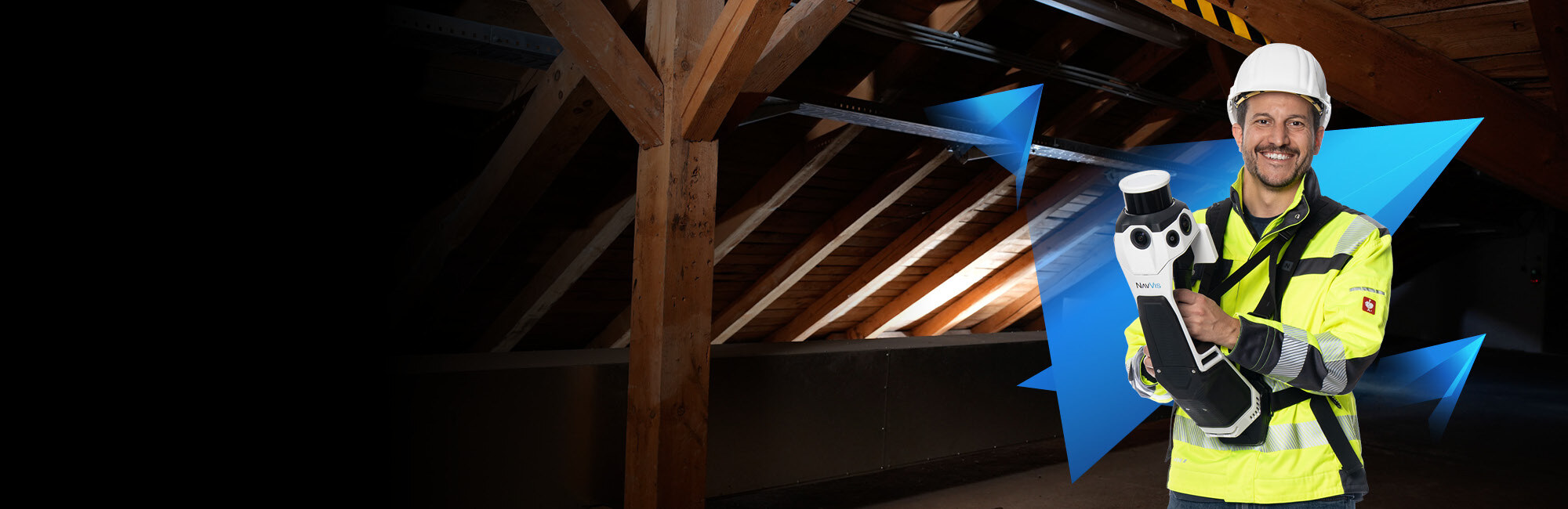
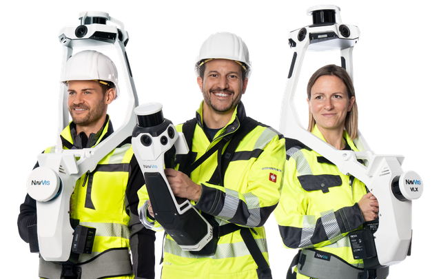
The NavVis VLX SLAM Scanner is a mobile mapping system that captures high-quality data 10x faster than traditional terrestrial laser scanners.

Discover the power of 3D scanning services with Matterport Pro3 and Pro2 cameras to create stunning virtual tours for real estate, retail stores, and museums.
LiDAR scanning and drone technology are transforming cell tower inspections, improving safety, efficiency, and accuracy for utility companies.
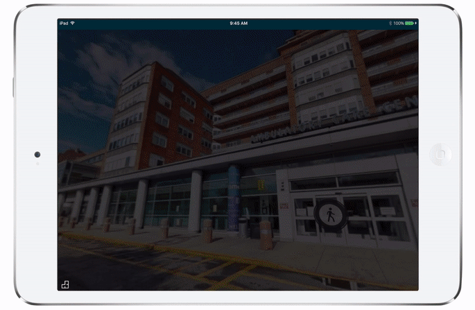
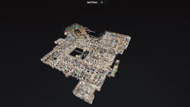
Discover why hospitals nationwide are turning to 3D Virtual Tours for enhanced patient experience and improved facility management.
A comprehensive comparison of leading laser scanners for construction and architecture needs, including range, accuracy, and software compatibility.
Discover the countless benefits of incorporating Matterport 3D Virtual Tours into educational institutions for accessibility and engagement.
Discover the benefits of utilizing Matterport 3D Virtual Tours for retail chain stores and brands to revolutionize customer experience.
In today's competitive real estate market, Matterport 3D Virtual Tours provide enhanced visualization and accessibility for potential buyers nationwide.

The construction industry has been going through a digital transformation, with Building Information Modeling (BIM) leading the change.

Lidar drones have emerged as a valuable technology for utility companies to streamline operations, improve safety, and reduce costs.
Lidar drones enable efficient and safe inspections of utility assets, helping companies streamline operations and reduce costs.

Drone technology has advanced significantly, and its application has expanded into construction for photogrammetry and aerial inspection.

The construction industry is evolving with drones equipped with cameras, RTK modules, and LIDAR sensors transforming data collection.
Whether you're exploring 3D scanning for the first time or ready to start your project, our team of experts is here to guide you every step of the way.