
Historic preservation documentation in the United States follows a framework of federal standards, regulatory processes, and professional guidelines that have evolved over nearly a century. The introduction of 3D laser scanning into this framework represents one of the most significant advances in heritage documentation methodology since the establishment of the Historic American Buildings Survey (HABS) in 1933.
But using scanning for historic preservation is not as simple as pointing a laser scanner at an old building. The federal documentation standards have specific requirements for accuracy, deliverable formats, and archival practices. Section 106 compliance has its own procedural requirements. And the preservation community has legitimate questions about how digital data fits into an archival system designed around physical drawings and photographs.
This guide covers how 3D laser scanning integrates with the established framework of historic preservation documentation — the standards it must meet, the regulatory processes it supports, and the practical considerations for scanning teams working on heritage projects.
The Federal Documentation Framework
Historic American Buildings Survey (HABS)
HABS is the oldest federal preservation program in the United States, established in 1933 as a make-work project during the Great Depression and formalized as a permanent program through a tripartite agreement between the National Park Service (NPS), the American Institute of Architects (AIA), and the Library of Congress.
HABS documentation records significant examples of American architecture through measured drawings, large-format photographs, and written historical data. The HABS collection at the Library of Congress contains documentation for more than 40,000 structures and is one of the most significant architectural archives in the world.
HABS documentation standards require:
- Measured drawings — Accurate architectural drawings (plans, elevations, sections, details) at specified scales
- Large-format photography — Archival-quality photographs documenting the building’s current condition, context, and significant features
- Written historical data — Narrative documentation of the building’s history, significance, and physical description
Historic American Engineering Record (HAER)
HAER was established in 1969 to document significant engineering and industrial sites — bridges, canals, mills, factories, and infrastructure that falls outside HABS’s architectural focus. HAER follows similar documentation standards but adapted for engineering structures:
- Measured drawings — Engineering drawings documenting structural systems, mechanical operations, and site context
- Large-format photography — Same archival standards as HABS
- Written historical and process data — Documentation of the engineering significance, construction methods, and operational history
Historic American Landscapes Survey (HALS)
HALS, established in 2000, documents significant American landscapes — designed landscapes, vernacular landscapes, and ethnographic landscapes. HALS follows a similar tripartite structure with measured drawings, photographs, and written documentation adapted for landscape documentation.
How 3D Scanning Meets Federal Documentation Standards
The NPS has increasingly recognized 3D laser scanning as a valid documentation method for HABS/HAER/HALS projects. Scanning does not replace the traditional deliverables — it enhances the process of creating them and adds a new dimension of documentation that traditional methods cannot achieve.
Measured Drawings from Scan Data
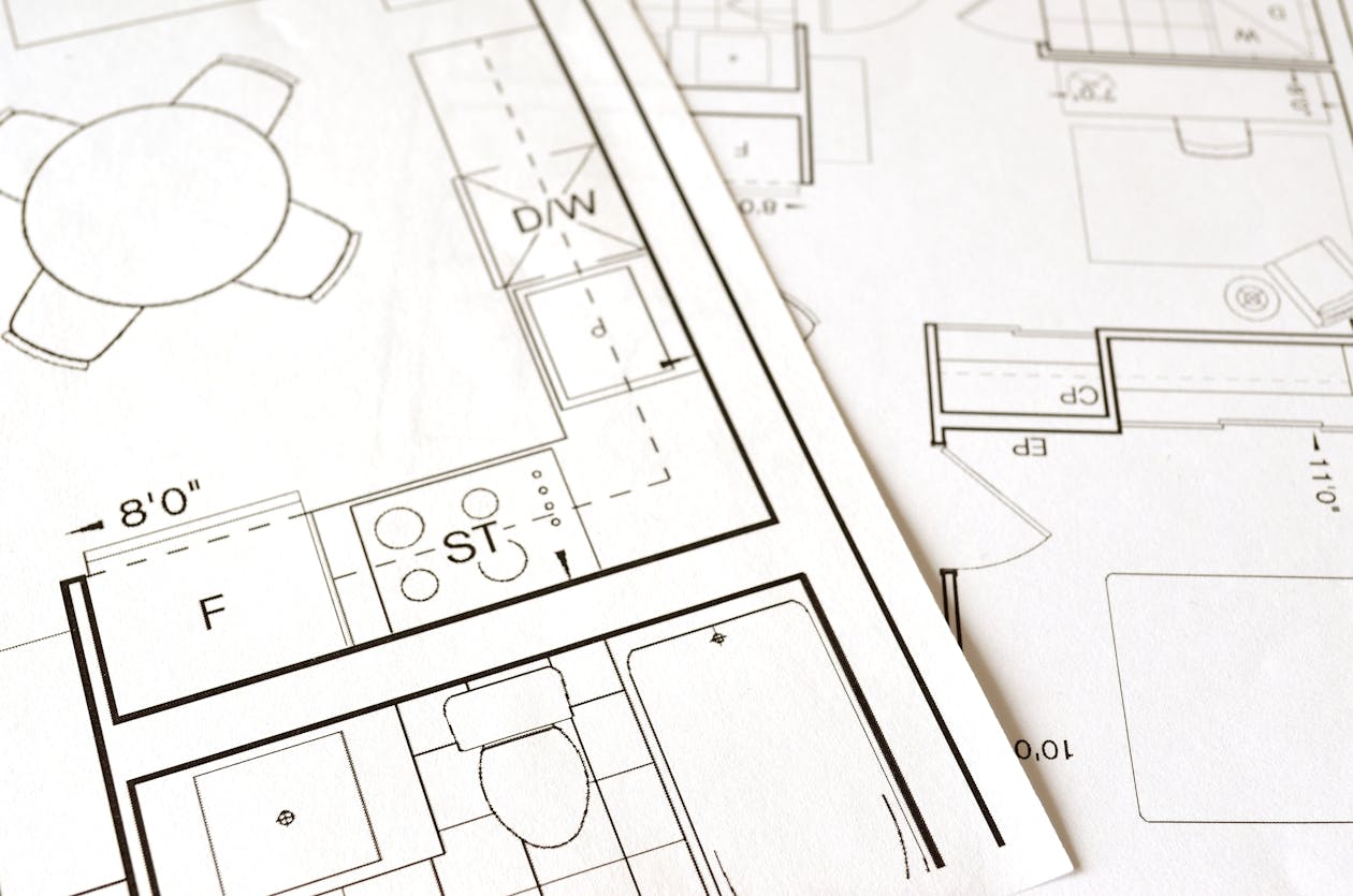
The most direct application of scanning in HABS/HAER documentation is the production of measured drawings. Traditionally, these drawings are produced through painstaking on-site measurement with tape measures, plumb bobs, and total stations. The measurements are then drafted into drawings — a process that is both time-intensive and limited by the measurer’s ability to reach and record every dimension.
3D laser scanning transforms this process:
- The building is scanned — A comprehensive point cloud captures the geometry of every visible surface with 1-3mm accuracy
- Drawings are extracted from the point cloud — Architects use the point cloud as a measured reference to produce plan, elevation, and section drawings in CAD software
- Accuracy is superior — The point cloud contains millions of measurements, far more comprehensive than any manual measurement campaign. Complex moldings, ornamental details, and irregular geometries that are extremely difficult to measure manually are captured precisely by the scanner.
- The point cloud is archived — In addition to the traditional deliverables (drawings, photographs, written data), the raw point cloud data serves as a permanent, comprehensive record of the building’s geometry at the time of documentation.
Photography Standards
HABS/HAER photography standards require large-format, archival-quality photographs. 3D scanning does not replace this requirement — the scan data and the photographic documentation serve different purposes. However, modern laser scanners capture high-resolution color imagery alongside the point cloud, which can supplement the traditional photographic documentation:
- Panoramic imagery — 360-degree color panoramas from each scan position
- Ortho-rectified images — Geometrically corrected images of facades and surfaces, produced from the point cloud, that eliminate the perspective distortion present in conventional photographs
- Detail documentation — Close-range scans of ornamental features, inscriptions, and deterioration patterns
Digital Data as a HABS Deliverable
The Library of Congress has developed guidelines for accepting digital documentation alongside traditional HABS deliverables. Point cloud data, while not yet a standard required deliverable, is increasingly included in HABS documentation packages as supplementary material. The key challenge is archival format — the Library of Congress requires data in formats that can be accessed and interpreted decades from now, which means open, non-proprietary formats are preferred.
E57, the open point cloud file format, is the most suitable archival format for scan data because it is:
- An open, published standard (ASTM E2807)
- Not dependent on any specific software vendor
- Capable of storing both geometry and color data
- Widely supported across point cloud software platforms
For more on point cloud file formats and their archival suitability, see our guide on point cloud file formats.
Section 106 Compliance

Section 106 of the National Historic Preservation Act (NHPA) of 1966 requires federal agencies to consider the effects of their undertakings on historic properties. This consultation process is the most common regulatory context in which 3D scanning is applied to historic preservation.
The Section 106 Process
The Section 106 process follows a structured sequence:
- Initiate the process — The federal agency identifies that its undertaking (construction, demolition, renovation, infrastructure project) may affect historic properties.
- Identify historic properties — The agency, in consultation with the State Historic Preservation Office (SHPO), identifies properties in the Area of Potential Effects (APE) that are listed or eligible for the National Register of Historic Places.
- Assess effects — The agency determines whether its undertaking will have an adverse effect on the identified historic properties.
- Resolve adverse effects — If adverse effects are determined, the agency consults with the SHPO, the Advisory Council on Historic Preservation (ACHP), and other stakeholders to develop measures to avoid, minimize, or mitigate the adverse effects.
Where 3D Scanning Fits in Section 106
3D scanning can play a role at multiple stages of the Section 106 process:
During identification (Step 2):
- Scanning can document the current condition of properties within the APE to inform significance assessments
- Scan data helps architectural historians evaluate character-defining features, structural conditions, and integrity
During effects assessment (Step 3):
- Scan data provides a precise baseline of existing conditions against which proposed changes can be evaluated
- Before/after comparison — scanning before construction documents the pre-project condition; scanning after construction documents the result
During mitigation (Step 4):
- HABS/HAER-level documentation is one of the most common mitigation measures for adverse effects. When a historic property will be demolished or significantly altered, documentation to HABS/HAER standards preserves a permanent record.
- 3D scanning significantly improves the quality and comprehensiveness of this mitigation documentation
- Scan data provides a dimensional record that goes far beyond what traditional measured drawings alone can capture
SHPO Expectations
State Historic Preservation Offices vary in their familiarity with and acceptance of 3D scanning as a documentation tool. Some SHPOs actively encourage scanning; others are more cautious. When planning a Section 106 mitigation documentation project that will include scanning:
- Consult the SHPO early — Discuss the documentation approach during the development of the Memorandum of Agreement (MOA), not after work begins
- Propose scanning as supplementary to traditional HABS deliverables, not as a replacement. This addresses concerns about archival longevity and accessibility.
- Provide sample deliverables — If the SHPO is unfamiliar with scanning, offer samples of previous scanning projects showing the quality and utility of the data
- Address archival concerns — Explain the archival format (E57), its open-standard status, and the plan for long-term data preservation
Accuracy Requirements for Heritage Documentation
Heritage documentation demands specific accuracy levels depending on the documentation purpose and the features being recorded.
General Accuracy Standards
| Documentation Level | Accuracy Requirement | Typical Application |
|---|---|---|
| HABS Level I (Full documentation) | 1/8” (3mm) or better | Complete measured drawing documentation |
| HABS Level II (Selective documentation) | 1/4” (6mm) or better | Documentation of selected features |
| HABS Level III (Basic documentation) | 1/2” (12mm) or better | Preliminary or abbreviated documentation |
| Condition assessment | 1/4” - 1/2” (6-12mm) | Deterioration monitoring and conservation |
| Structural analysis | 1/8” (3mm) or better | Structural evaluation of existing conditions |
Survey-grade terrestrial laser scanners achieve 1-3mm accuracy at typical building scanning distances, which meets or exceeds the requirements for all HABS documentation levels.
Feature-Specific Considerations
Heritage buildings present unique scanning challenges that generic commercial scanning does not:
- Ornamental detail — Carved stone, decorative metalwork, terra cotta ornamentation, and plasterwork require high-density scanning from close range to capture the geometry accurately
- Irregular geometry — Historic buildings are rarely plumb, level, or square. The scanner captures the actual geometry, including structural settlement, wall lean, and floor slope — all of which are important documentation for preservation
- Deterioration documentation — Crack patterns, spalling, erosion, and material loss are captured in the point cloud and can be measured and tracked over time
- Inaccessible features — Upper facades, tower details, and roof structures that are difficult or dangerous to measure manually can be scanned from accessible positions
Practical Considerations for Heritage Scanning Projects

Building Access and Sensitivity
Historic buildings require careful handling. Scanning equipment does not contact the building (the scanner operates at a distance), but the logistics of placing equipment in sensitive spaces require coordination:
- No physical contact with historic fabric — tripods must be placed on stable surfaces without risking damage to floors, pavements, or furnishings
- Minimal environmental impact — scanning does not generate heat, vibration, or electromagnetic radiation that could affect sensitive materials
- Security and access — many heritage sites have restricted access, limited hours, and security requirements that affect the scanning schedule
- Coordination with ongoing conservation — if conservation work is in progress, scanning must be coordinated to avoid interference
Deliverable Requirements
Heritage scanning projects typically produce a broader range of deliverables than standard AEC scanning:
- Registered point cloud — The primary scan data in archival format (E57)
- Measured drawings — Plans, elevations, sections, and details produced from the point cloud to HABS standards
- Ortho-rectified facade images — Geometrically corrected images of building facades, free from perspective distortion
- Condition documentation — Annotated images or drawings identifying deterioration, damage, or areas of concern
- 3D mesh models — For complex ornamental features, a mesh model created from the point cloud provides a complete 3D geometric record
- Archival photography — Traditional large-format photography per HABS/HAER standards (separate from scan data)
Cost Structure for Heritage Scanning
Heritage scanning projects typically cost more per square foot than standard AEC scanning due to:
- Higher scan density — Ornamental and irregular features require more scan positions at closer range
- Specialized deliverables — HABS-quality measured drawings, ortho-images, and condition documentation require additional processing
- Access logistics — Restricted access, limited hours, and coordination with conservation teams add to field time
- Project management — Heritage projects often involve more stakeholders (SHPO, ACHP, NPS, property owners, preservation consultants) and more review cycles
Typical heritage scanning costs range from $0.30-$1.00+ per square foot for scan data capture and basic processing, with additional costs for specialized deliverables. For project-specific estimates, use our cost calculator or request a quote.
Grant Funding for Heritage Documentation

Several federal and state programs provide funding for historic preservation documentation that can include 3D scanning:
Federal Programs
- National Park Service Historic Preservation Fund Grants — Competitive grants to SHPOs and Tribal Historic Preservation Officers, which can fund documentation projects
- Save America’s Treasures Grants — Matching grants for preservation and documentation of nationally significant historic properties and collections
- African American Civil Rights Grants — Fund documentation and preservation of sites significant in the African American civil rights movement
- Paul Bruhn Historic Revitalization Grants — Subgrants through SHPOs for rehabilitation of historic properties in rural areas
State Programs
Most states offer preservation grant programs through their SHPOs. Eligibility and funding levels vary by state and funding cycle. Heritage documentation — including 3D scanning — is an eligible expense in many of these programs.
Federal Historic Tax Credits
While not a direct funding source for scanning, the Federal Historic Tax Credit program (20% credit for rehabilitation of certified historic structures) often requires documentation of existing conditions before and after rehabilitation. 3D scanning provides the comprehensive baseline documentation that supports tax credit applications and compliance.
Grant Application Tips
When including 3D scanning in a grant application:
- Frame scanning as a tool that enhances traditional documentation, not a replacement for it
- Quantify the accuracy and comprehensiveness advantages over manual measurement
- Include the archival value of point cloud data as a permanent record
- Reference the NPS’s recognition of scanning as a valid documentation method
- Provide cost comparisons showing the value proposition — scanning often produces more comprehensive documentation at comparable cost to traditional methods
Frequently Asked Questions
Does 3D scanning replace traditional HABS documentation?
No. 3D scanning enhances and improves the process of creating traditional HABS deliverables (measured drawings, photographs, written data) but does not replace them. The scan data serves as a comprehensive measured reference from which higher-quality drawings can be produced, and the raw point cloud provides supplementary documentation beyond what traditional methods capture.
Will the SHPO accept scan data as mitigation documentation?
Most SHPOs accept scan data as supplementary documentation when accompanied by traditional HABS-standard deliverables. The level of acceptance varies by state. Early consultation with the SHPO during the MOA development phase is essential to confirm the documentation approach. We recommend proposing scanning as an enhancement to, not a substitute for, traditional deliverables.
What is the long-term archival viability of point cloud data?
Point cloud data in open formats (E57, LAS) has strong archival viability. These are published standards not dependent on any single software vendor. The Library of Congress has begun accepting digital data alongside traditional HABS collections. The primary risk is media degradation — digital data should be stored on redundant media with regular migration to current storage technologies, following standard digital archival practices.
Can scanning capture interior decorative details like murals and painted surfaces?
Yes, with limitations. The laser scanner captures the 3D geometry of surfaces, including relief decoration, carved details, and textured surfaces. Color imagery from the scanner’s integrated camera documents painted surfaces and murals at moderate resolution. For high-resolution documentation of painted surfaces, scanning is typically supplemented with close-range photogrammetry or high-resolution photography. Learn more about how 3D scanning works.
How does scanning help with ongoing preservation monitoring?
Scanning creates a precise baseline record of a building’s condition at a specific point in time. By re-scanning at intervals (annually, after weather events, or at preservation milestones), changes can be quantified — settlement, crack growth, material loss, structural movement — with millimeter-level precision. This temporal comparison capability is one of scanning’s most valuable contributions to preservation practice.
What accuracy does THE FUTURE 3D achieve for heritage scanning?
Our survey-grade terrestrial laser scanners achieve 1-3mm accuracy, which meets or exceeds HABS Level I documentation requirements. For ornamental detail and condition documentation, we use high-density scan settings and close-range positioning to capture sub-millimeter surface detail. Learn more about our 3D laser scanning services and as-built documentation capabilities.
Planning a heritage documentation project? Get a quote from THE FUTURE 3D. We have the equipment and expertise to deliver HABS/HAER-quality scan data for Section 106 compliance, preservation planning, and archival documentation. Explore our 3D laser scanning services or learn more about our approach to as-built documentation.
Ready to Start Your Project?
Get a free quote and consultation from our 3D scanning experts.
Get Your Free Quote

