
“Should we use laser scanning or photogrammetry?” This question comes up in nearly every conversation about 3D documentation projects. The answer is never a simple one-or-the-other recommendation — it depends entirely on what you are documenting, what accuracy you need, what your budget allows, and what you plan to do with the data.
Both technologies capture 3D data from the physical world. Both produce point clouds. Both have legitimate use cases where they outperform the other. And increasingly, the best projects use both together in a hybrid approach that leverages the strengths of each. For foundational context on how these technologies work, see our guide on how 3D scanning works.
This guide provides a direct, practical comparison based on real-world project experience — not theoretical specifications — to help you choose the right approach for your next project.
How Laser Scanning Works
3D laser scanning uses a device that emits laser pulses toward surrounding surfaces and measures the time each pulse takes to return. Since light travels at a known speed, the time-of-flight calculation reveals the precise distance from the scanner to the surface. By rotating the laser emission point across 360 degrees (horizontally and vertically), the scanner captures millions of distance measurements per second — each one becoming a single point in a 3D point cloud.
Modern terrestrial laser scanners like the Leica RTC360 and FARO Focus Premium capture up to 2 million points per second, producing dense, highly accurate representations of their surroundings. Each scan position captures everything visible within line-of-sight, typically covering a 360-degree field of view.
The scanner operates independently of lighting conditions. It works equally well in complete darkness, under fluorescent lighting, and in bright sunlight. This makes it the preferred choice for interior spaces, mechanical rooms, and environments where lighting is variable or poor.
How Photogrammetry Works
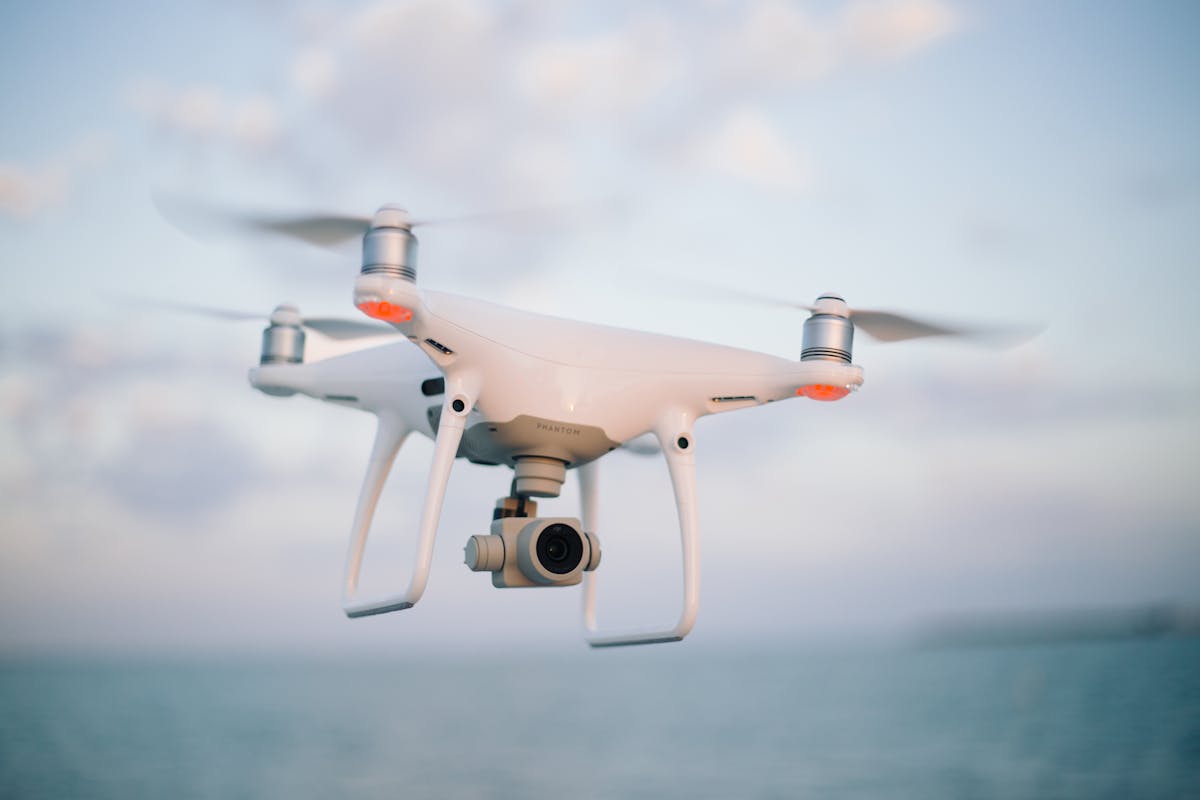
Photogrammetry reconstructs 3D geometry from overlapping 2D photographs. A camera — typically mounted on a drone for aerial work, or handheld for ground-level documentation — captures hundreds to thousands of photographs of the subject from different angles and positions.
Software like Pix4D, Agisoft Metashape, or DroneDeploy processes these images using Structure from Motion (SfM) algorithms. The software identifies matching features across overlapping photographs, calculates the camera position for each image, and triangulates the 3D position of every feature point. The result is a dense point cloud, a 3D mesh, or both.
Photogrammetry depends on visual information — surface texture, color variation, and identifiable features. It performs best on well-lit, textured surfaces and struggles with featureless areas (blank white walls, uniform glass facades) and reflective surfaces.
Head-to-Head Comparison
Accuracy
| Method | Typical Accuracy | Best-Case Accuracy | Accuracy Factors |
|---|---|---|---|
| Laser Scanning | 1-3mm (terrestrial) | Sub-millimeter at close range | Scanner quality, registration method, range |
| Photogrammetry | 10-50mm (aerial drone) | 1-5mm (close-range, controlled) | Image overlap, GCP quality, lighting, texture |
Laser scanning wins on accuracy for most building-scale applications. The measurement is direct — a laser pulse measures a physical distance. Photogrammetry’s accuracy is derived (computed from image analysis) and depends on more variables.
For projects requiring 1-3mm accuracy — BIM modeling, as-built documentation, MEP coordination — laser scanning is the standard. For projects where 10-50mm accuracy is acceptable — site topography, facade documentation, progress monitoring — photogrammetry is often sufficient.
For Florida projects requiring survey-grade data with PSM certification, certified Florida surveyors at Apex combine traditional surveying with modern 3D laser scanning to deliver professionally stamped deliverables.
Speed
| Phase | Laser Scanning | Photogrammetry |
|---|---|---|
| Field capture | 2-8 min per scan position; 50-200 positions per building | 15-30 min drone flight for a large site; minutes for close-range |
| Number of setups | Many (each room may need 2-5 positions) | Few (one flight path, or walk-around) |
| Processing time | Hours to days (registration + cleaning) | Hours to days (image matching + reconstruction) |
| Total project time | 1-5 days field + 2-5 days processing | Hours to 1 day field + 1-5 days processing |
Photogrammetry is generally faster for field capture, especially for large outdoor areas. A single drone flight can cover acres of terrain in 30 minutes. Laser scanning requires individual setups at each position, which takes more field time for building interiors.
However, photogrammetry processing is computationally intensive. Generating a dense point cloud from 500+ images can take hours or days on high-end hardware. Laser scanning processing (registration and cleaning) is typically faster for equivalent datasets.
Cost
| Cost Factor | Laser Scanning | Photogrammetry |
|---|---|---|
| Equipment (purchase) | $50,000-$150,000 (terrestrial scanner) | $2,000-$15,000 (drone + camera) |
| Equipment (rental) | $1,000-$3,000/week | $200-$500/week |
| Software | $5,000-$15,000 (Cyclone, SCENE) | $250-$5,000/year (Pix4D, Metashape) |
| Training | Significant — scanner operation and processing | Moderate — drone piloting and processing |
| Project cost (typical building) | $8,000-$25,000 | $3,000-$12,000 |
| Project cost (large site) | $15,000-$50,000+ | $5,000-$20,000 |
Photogrammetry has a lower cost of entry and lower per-project cost for most applications. The equipment is dramatically less expensive, software subscriptions are more affordable, and field crews can cover ground faster.
Laser scanning costs more but delivers higher accuracy and works in conditions where photogrammetry cannot (dark interiors, featureless surfaces, weather-independent operation).
Best Use Cases
Laser Scanning Excels At:
- Interior building documentation — Rooms, corridors, mechanical spaces, and ceiling plenums where photogrammetry struggles with lighting and texture
- BIM-ready as-built surveys — Projects requiring 1-3mm accuracy for Scan-to-BIM conversion
- Complex MEP systems — Pipes, ducts, conduit, and equipment with intricate 3D geometry
- Dark or poorly lit environments — Basements, mechanical rooms, server rooms, tunnels
- Historic preservation — Heritage structures requiring millimeter-precision documentation
- Industrial facilities — Refineries, power plants, and manufacturing facilities with dense piping and equipment
- Construction verification — Comparing built conditions against design models with tight tolerances
Photogrammetry Excels At:
- Large-area site mapping — Construction sites, mining operations, agricultural land, and infrastructure corridors
- Topographic surveys — Terrain modeling, contour generation, and volumetric calculations
- Building facade documentation — Exterior elevation records and condition assessments
- Orthomosaic generation — Creating measurable, geo-referenced aerial maps
- Construction progress monitoring — Regular drone flights documenting construction milestones
- Budget-constrained projects — When 10-50mm accuracy is acceptable and cost is a primary concern
- Textured 3D models — When photorealistic visual quality is important for presentation or marketing
Environmental Factors
| Condition | Laser Scanning | Photogrammetry |
|---|---|---|
| Dark interior | Excellent — works in total darkness | Poor — needs visible light and texture |
| Bright sunlight | Excellent — unaffected by lighting | Good — if not overexposed |
| Rain | Limited outdoor — water droplets create noise | Not possible — camera lenses fog and images blur |
| Wind | Unaffected (tripod-mounted) | Affects drone stability and image sharpness |
| Reflective surfaces | Moderate — creates noise on glass/metal | Poor — confuses feature matching algorithms |
| Featureless surfaces | Good — measures distance regardless of texture | Poor — no features to match between images |
| Vegetation | Good — laser penetrates canopy gaps | Limited — sees only visible canopy surface |
| Moving objects | Poor — creates ghosting artifacts | Poor — motion blur ruins feature matching |
The Hybrid Approach: Using Both Together
The most effective documentation strategy for many projects combines both technologies:
Typical hybrid workflow:
- Drone photogrammetry captures the building exterior, surrounding site, and rooftop — providing site context, facade documentation, and topographic data
- Terrestrial laser scanning captures the building interior — providing millimeter-accuracy geometry for BIM modeling, as-built documentation, and MEP coordination
- Data integration — The exterior photogrammetry model and interior laser scan are combined into a single unified dataset using common survey control points
This approach gives you the best of both worlds: cost-effective, wide-area exterior coverage from photogrammetry, and high-accuracy interior documentation from laser scanning.
When Hybrid Makes Sense
- Renovation projects that need both interior as-built documentation and exterior facade records
- Campus-scale projects where interior scanning of individual buildings is combined with aerial site mapping
- Construction documentation that requires interior progress monitoring (scanning) and aerial progress photography (drone)
- Infrastructure projects where corridor mapping (photogrammetry) meets facility documentation (scanning)
THE FUTURE 3D offers both 3D laser scanning and drone photogrammetry as complementary services. For projects that benefit from both technologies, we plan and execute an integrated capture strategy that delivers a unified dataset.
Equipment Comparison
Here is how the most common equipment in each category compares:
| Equipment | Type | Points/sec | Range | Accuracy | Typical Cost |
|---|---|---|---|---|---|
| Leica RTC360 | Terrestrial LiDAR | 2M | 130m | 1.9mm @ 10m | ~$65,000 |
| FARO Focus Premium | Terrestrial LiDAR | 2M | 200m | 2mm @ 25m | ~$75,000 |
| NavVis VLX 3 | Wearable SLAM | 2.56M (4 sensors) | 30m/sensor | 5mm (3mm w/control) | ~$80,000 |
| DJI Matrice 350 RTK | Drone platform | N/A (camera) | Unlimited (flight) | 10-30mm (w/GCPs) | ~$12,000 |
| DJI Zenmuse L2 | Drone LiDAR | 240K | 250m | 8mm (vertical) | ~$4,500 |
Making Your Decision: A Quick Framework
Ask these five questions:
-
Is the primary subject indoors or outdoors?
- Indoors → Laser scanning
- Outdoors → Consider both; photogrammetry often wins on cost
-
What accuracy does the downstream use require?
- 1-3mm (BIM, as-built) → Laser scanning
- 10-50mm (topography, facades, progress) → Photogrammetry
-
What is the project area?
- Single building interior → Laser scanning
- Large outdoor site → Photogrammetry
- Both → Hybrid approach
-
What are the lighting conditions?
- Poor or variable → Laser scanning
- Good natural or controlled → Either works
-
What is the budget?
- Budget-constrained with centimeter accuracy acceptable → Photogrammetry
- Quality-focused with millimeter accuracy required → Laser scanning
Frequently Asked Questions
Is laser scanning more accurate than photogrammetry?
For building-scale applications, yes. Terrestrial laser scanning achieves 1-3mm accuracy compared to photogrammetry’s typical 10-50mm for aerial drone work. However, close-range photogrammetry of small objects can achieve sub-millimeter accuracy, rivaling or exceeding laser scanning for specific applications.
Can drone photogrammetry replace laser scanning for BIM projects?
For most BIM projects, no. BIM modeling workflows (particularly for interior as-built documentation) require the 1-3mm accuracy that terrestrial laser scanning provides. Drone photogrammetry is excellent for exterior and site documentation but lacks the accuracy needed for interior BIM conversion at standard LOD specifications.
Which technology is faster?
Photogrammetry is faster for field capture of large outdoor areas — a drone can cover acres in minutes. Laser scanning is faster for interior documentation per room (2-8 minutes per setup) but requires more setups. Processing time is comparable for both technologies.
Does THE FUTURE 3D use both technologies?
Yes. We deploy both terrestrial laser scanning and drone photogrammetry depending on project requirements. For projects that benefit from both, we execute integrated capture plans that deliver unified datasets combining interior scanning with exterior aerial documentation.
Can I combine laser scanning and photogrammetry data?
Yes. Both technologies produce point clouds that can be combined into a single unified dataset. The key requirement is shared survey control points that allow the two datasets to be aligned in the same coordinate system. Professional scanning providers like THE FUTURE 3D routinely deliver combined datasets.
What about photogrammetry for interior scanning?
Interior photogrammetry is possible but significantly less reliable than laser scanning. Interior environments typically have poor lighting, featureless surfaces (white walls), and limited space for camera movement — all of which degrade photogrammetry quality. Laser scanning is the clear choice for interior documentation.
Need help choosing the right technology for your project? Get a quote from THE FUTURE 3D and we will recommend the optimal capture approach — laser scanning, photogrammetry, or both — based on your specific requirements. Explore our photogrammetry services for more details. For a deeper dive into LiDAR-specific technology, see our LiDAR point cloud guide for AEC professionals.
Ready to Start Your Project?
Get a free quote and consultation from our 3D scanning experts.
Get Your Free Quote

