Construction timelapses are one of the most immediately valuable outputs of dock-based drone operations. A permanently installed dock flying identical missions every day produces perfectly registered aerial imagery that, when sequenced, reveals the entire construction narrative from groundbreaking to completion.
Unlike traditional timelapse setups using fixed cameras, drone-based timelapses capture the full site from an overhead perspective, covering areas that no single ground-mounted camera can reach. And unlike piloted drone timelapses, which suffer from scheduling gaps and positional variation, dock-based flights are automatic, daily, and precisely repeatable.
Why Dock-Based Timelapses Are Superior
Perfect Positional Consistency
A dock-based drone follows the exact same flight path every time. Same waypoints, same altitude, same camera angle, same speed. This means every frame in the final timelapse is captured from an identical position, eliminating the subtle drift and variation that makes hand-flown or even RTK-flown piloted timelapses look uneven.
RTK positioning on the Matrice 3D (Dock 2) and Matrice 4D (Dock 3) provides centimetre-level accuracy on every flight. Over a 12-month project, the positional consistency between the first and last frame is measurable in centimetres, not metres.
No Scheduling Gaps
The fundamental problem with piloted construction timelapses is consistency. A pilot cannot fly every single day for a multi-year project. Weather cancellations, pilot availability, site access issues, and budget constraints all create gaps in the sequence. A weekly or fortnightly piloted schedule produces a timelapse with noticeable jumps.
A dock flies every day, automatically. If weather prevents a scheduled flight, the dock retries when conditions improve. Over a 12-month project, a dock typically captures 300+ flights compared to perhaps 24-50 piloted visits.
Consistent Lighting Conditions
By scheduling flights at the same time each day (typically mid-morning when shadows are moderate and consistent), dock-based timelapses achieve remarkably uniform lighting across frames. The automatic scheduling eliminates the lighting variation caused by piloted flights happening at different times of day depending on pilot availability.
The Technical Workflow
Step 1: Flight Path Design
Before the dock is deployed, the timelapse flight path is planned to capture the desired perspectives:
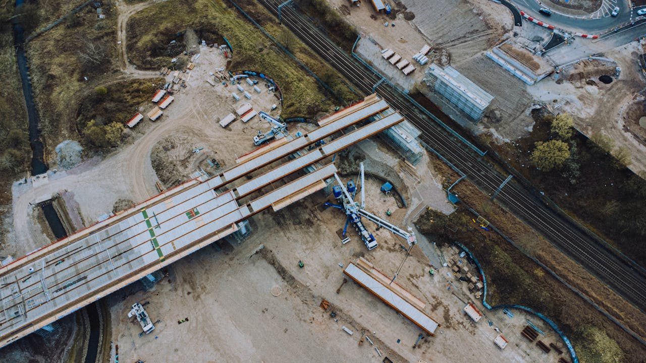
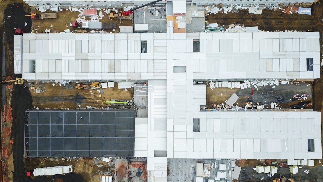
Nadir (top-down) pass — A grid flight covering the entire site, used for orthomosaic generation and overhead timelapse frames. The camera points straight down, capturing the site as a map view.
Oblique passes — One or more orbits or waypoint routes at 30-45 degree camera angles, capturing the site from perspectives that show vertical construction progress. These produce the most visually compelling timelapse footage for stakeholder presentations.
Point-of-interest hovers — Fixed positions where the drone pauses to capture specific elements: a tower crane, a building facade, an excavation face. These produce focused timelapses of individual structures.
Step 2: Daily Automatic Execution
Once programmed, the dock executes the flight path daily without intervention:
- Pre-flight weather check (wind, precipitation, temperature)
- Automatic launch
- Execute nadir grid, oblique passes, and POI hovers
- Automatic return and landing
- Battery charge and data upload
- Ready for next scheduled flight
The entire cycle typically takes 20-40 minutes depending on site size and the number of passes.
Step 3: Data Management
Each daily flight produces:
- High-resolution still images (48 MP on M4D, 20 MP on M3D) — hundreds per flight
- GPS/RTK metadata embedded in each image
- Flight log with environmental conditions
- Optional: LiDAR point cloud data (M4D with LiDAR module)
Data is automatically uploaded from the dock to the cloud management platform (DJI FlightHub 2 for DJI docks, or THE FUTURE 3D’s management system for our proprietary dock).
Step 4: Processing
The raw imagery is processed into timelapse outputs:
Orthomosaic timelapse — Daily orthomosaic maps are generated from the nadir flights. When sequenced, these show the entire site evolving over time in a top-down view. Particularly effective for showing earthworks, foundation work, and site-wide progress.
Video timelapse — Oblique and POI images from matching positions are sequenced into video. Stabilisation algorithms correct for minor positional variations. Colour grading normalises lighting differences across frames.
Split-screen comparisons — Before/after or multi-date comparisons using matching frames from different dates. Effective for milestone documentation.
Use Cases for Construction Timelapses
Stakeholder Reporting
Monthly progress reports supported by aerial timelapse footage are more compelling than written descriptions or ground-level photographs. Decision-makers can see the pace and pattern of construction activity without visiting the site.
A 30-second timelapse covering 3 months of work communicates progress more effectively than a 20-page report. European infrastructure projects with multiple stakeholders (client, contractor, local authority, funding body) particularly benefit from shared visual documentation.
Planning Compliance Documentation
In many European jurisdictions, construction projects must demonstrate compliance with planning conditions through regular documentation. Automated aerial timelapses provide date-stamped, georeferenced evidence of site conditions at every stage.
This documentation is particularly valuable for:
- Environmental compliance (dust, water management, habitat protection)
- Working hours compliance (activity visible in timestamped imagery)
- Phasing conditions (demonstrating that construction follows the approved sequence)
- Section 106 or heritage monitoring (for projects near listed buildings or archaeology)
Dispute Resolution
Construction disputes often hinge on demonstrating what happened and when. An unbroken daily aerial record provides objective evidence of site conditions, delivery sequences, and activity patterns.
Unlike manually produced records, dock-based timelapse data is automatically generated and timestamped, making it difficult to challenge as selective or biased documentation.
Marketing and Communications
Completed construction timelapses are valuable marketing assets for:
- Contractor portfolios and tender submissions
- Developer marketing of completed projects
- Engineering firm case studies
- Local authority project communication with residents
A well-produced aerial timelapse of a major construction project typically generates significant engagement when shared on professional platforms and project websites.
Insurance and Risk Documentation
Time-stamped aerial documentation of site conditions provides evidence for insurance purposes:
- Pre-existing conditions documented before construction begins
- Progressive documentation of safety measures and site management
- Evidence of weather events and their impact on the site
- Documentation of third-party works and their condition
Equipment Recommendations
For Most Construction Sites (10-200 hectares)
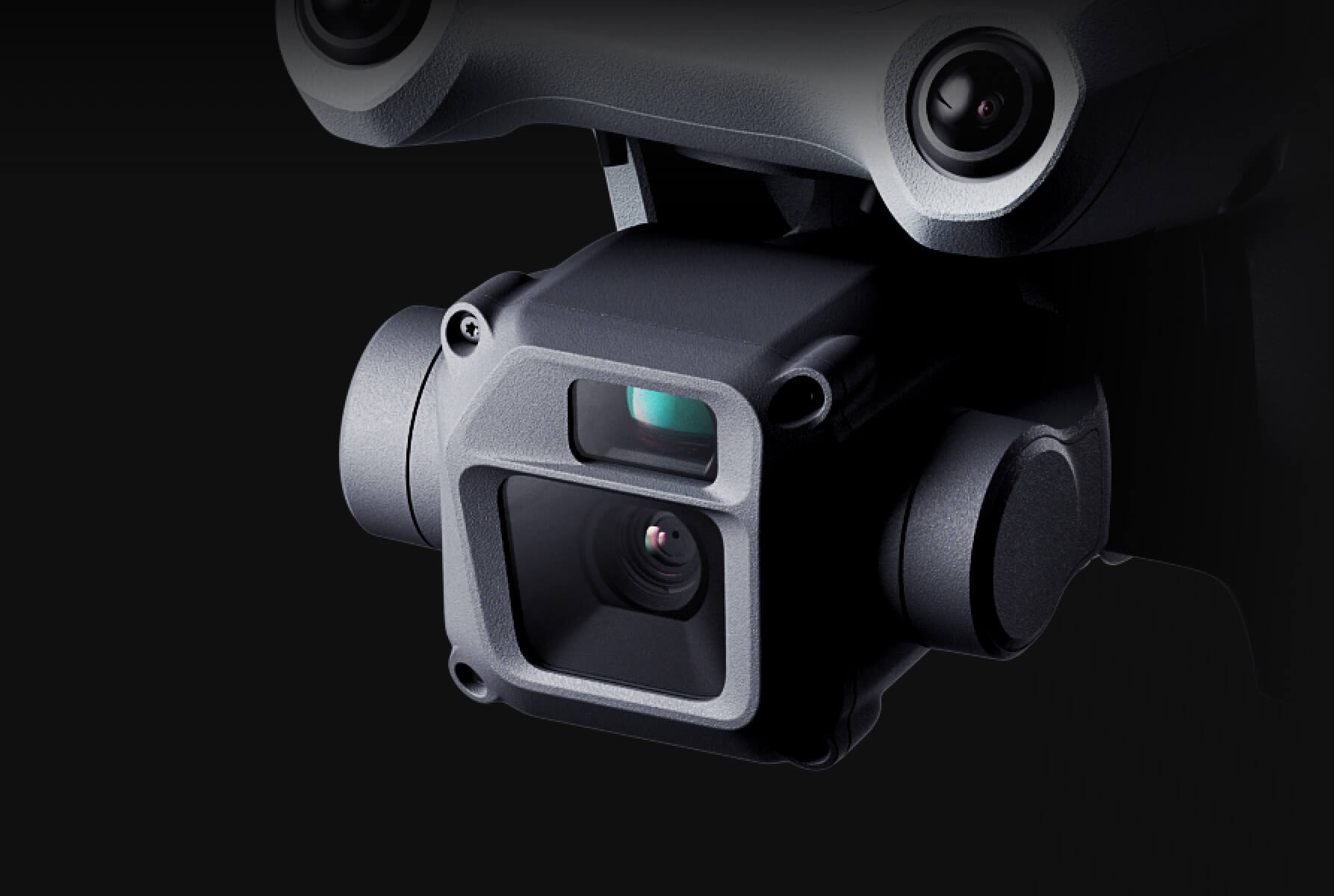
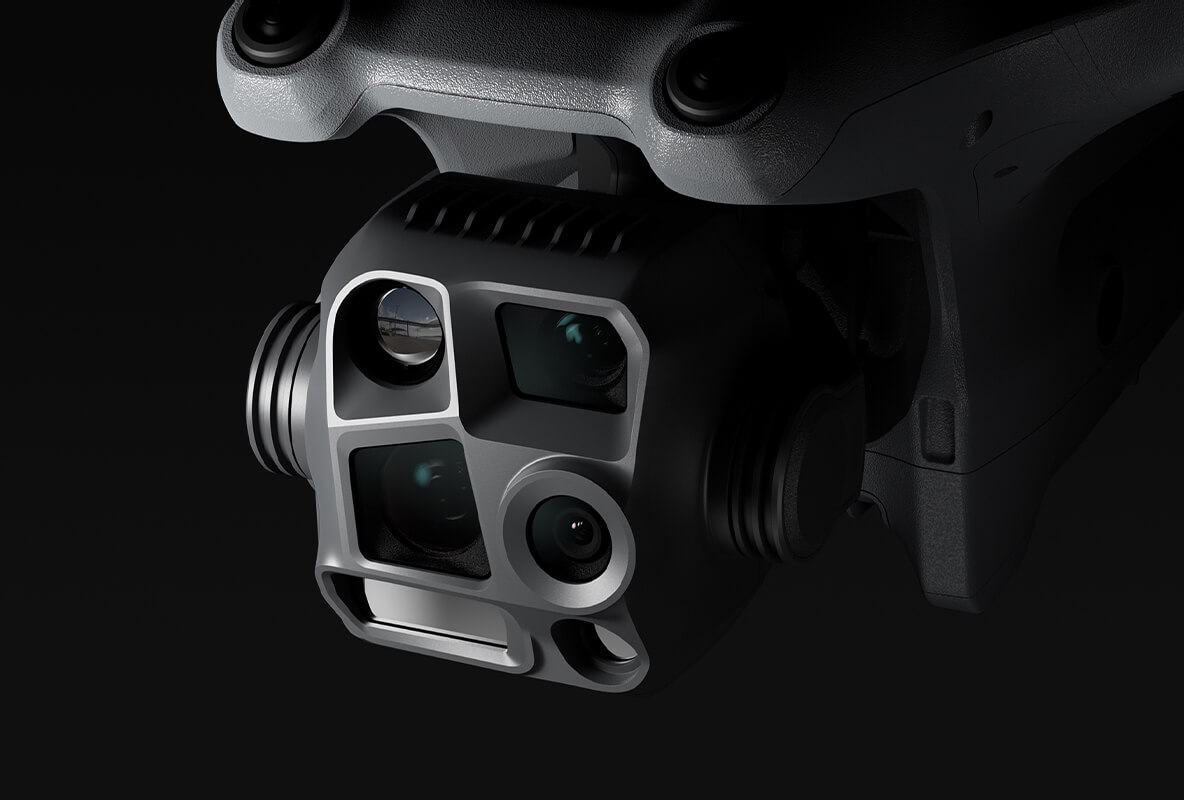
DJI Dock 3 with Matrice 4D — Best timelapse quality (48 MP camera, LiDAR for volumetric data), highest positional accuracy, IP56 for year-round operation. The 4D’s mechanical shutter eliminates rolling shutter distortion common in aerial imagery of moving machinery.
DJI Dock 2 with Matrice 3D — More affordable option with excellent timelapse capability (20 MP, RTK positioning). IP55 is adequate for sheltered or inland sites. Good choice for projects with moderate budgets or shorter durations.
THE FUTURE 3D Proprietary Dock — 25% lower deployment cost, multi-platform compatible. Recommended for multi-site programmes where the per-unit savings compound significantly, or for projects requiring specific non-DJI payloads.
Practical Considerations
Dock placement for timelapse quality. Position the dock where oblique flight paths have unobstructed views of the primary construction activity. Avoid placing the dock where future construction will block the flight path or create new obstacles.
File storage planning. A daily timelapse flight producing 200-400 images per day at 48 MP generates approximately 3-5 GB per day, or 1-1.5 TB per year. Plan cloud storage and local backup capacity accordingly.
Processing pipeline. For large projects, automate the orthomosaic generation pipeline. Daily manual processing is impractical. DJI FlightHub 2 and third-party platforms like DroneDeploy offer automated processing from dock-uploaded imagery.
Timeline management. Start timelapse flights before construction begins (during site clearance or enabling works) and continue after practical completion. The most compelling timelapses include empty site, construction, and finished project phases.
Getting Started
THE FUTURE 3D deploys timelapse-optimised dock systems on construction sites across Europe. We provide flight path design, dock installation, automated data processing, and periodic timelapse compilation.
Learn more at our Dock Operations Hub, plan your deployment with the Dock Deployment Planner, estimate your costs with the ROI Calculator, or request a quote for a complete timelapse monitoring package.
Ready to Start Your Project?
Get a free quote and consultation from our 3D scanning experts.
Get Your Free Quote