Orthomosaic Mapping: The Complete Guide for 2026
An orthomosaic is a geometrically corrected, georeferenced aerial image map assembled from hundreds or thousands of overlapping photographs captured by a drone or aircraft. Unlike a single aerial photo, every pixel in an orthomosaic is corrected for camera lens distortion, terrain displacement, and perspective distortion — making it a true-to-scale, measurable map.
If you need to measure distances, calculate areas, track changes over time, or integrate aerial imagery into GIS workflows, orthomosaic mapping is the standard method used across construction, agriculture, mining, environmental monitoring, and infrastructure management.
What Makes an Orthomosaic Different from an Aerial Photo?
A single aerial photograph looks distorted — objects near the edges appear stretched, buildings lean away from center, and features at different elevations appear at incorrect positions. This happens because a camera projects a 3D world onto a 2D sensor from a single viewpoint.
An orthomosaic eliminates these distortions through a process called orthorectification. Software uses overlapping photos (typically 70-80% forward overlap, 60-70% side overlap) to reconstruct the 3D geometry of the scene, then projects every pixel onto a flat, georeferenced plane. The result is a map where:
- Every pixel has a real-world coordinate (latitude, longitude, elevation)
- Measurements are accurate — distances, areas, and perimeters match ground truth
- Scale is uniform — 1 cm on the map equals the same distance everywhere
- It’s GIS-compatible — loads directly into ArcGIS, QGIS, AutoCAD, Google Earth
How Orthomosaics Are Created: Step by Step
1. Flight Planning
Before takeoff, the survey area is defined in flight planning software (DroneDeploy, Pix4Dcapture, or DJI Pilot). The software calculates the flight path, altitude, speed, and camera trigger interval to achieve the target ground sample distance (GSD) and overlap. Typical settings:
- Altitude: 200-400 feet AGL (lower = higher resolution, smaller coverage)
- Forward overlap: 75-80%
- Side overlap: 65-70%
- GSD target: 1-3 cm/pixel for construction, 3-5 cm for agriculture
2. Image Capture
The drone flies the planned grid pattern automatically, capturing images at calculated intervals. A standard 50-acre site generates 400-800 photographs. Each image is geotagged with GPS coordinates from the drone’s GNSS receiver. For survey-grade accuracy, RTK (Real-Time Kinematic) or PPK (Post-Processed Kinematic) positioning provides centimeter-level photo coordinates.
3. Ground Control Points (Optional but Recommended)
For engineering-grade accuracy, surveyors place ground control points (GCPs) — marked targets with precisely known coordinates — across the survey area before the flight. GCPs provide fixed reference points that anchor the photogrammetric solution. Typical distribution: 5-10 GCPs for sites up to 100 acres.
4. Photogrammetric Processing
Processing software (DroneDeploy, Pix4Dmapper, DJI Terra, or Agisoft Metashape) analyzes all overlapping images simultaneously:
- Feature matching: Algorithms identify matching points across overlapping photos
- Bundle adjustment: Camera positions and orientations are refined to minimize errors
- Dense point cloud generation: A 3D point cloud is computed from the matched features
- Mesh creation: The point cloud is converted to a continuous 3D surface
- Orthorectification: Each pixel is projected onto the corrected surface to remove distortion
- Mosaicking: Corrected images are blended into a single seamless map
5. Quality Control
The final orthomosaic is checked against GCPs or independent check points to verify positional accuracy. Standard accuracy for RTK-equipped drone surveys: 1-3 cm horizontal, 2-5 cm vertical.
Orthomosaic Accuracy: What to Expect
Accuracy depends on equipment, flight parameters, and ground control:
| Factor | Budget Mapping | Standard Survey | High-Accuracy Survey |
|---|---|---|---|
| GSD | 3-5 cm/pixel | 1-3 cm/pixel | 0.5-1 cm/pixel |
| Horizontal Accuracy | 5-10 cm | 2-5 cm | 1-2 cm |
| Vertical Accuracy | 10-15 cm | 3-5 cm | 2-3 cm |
| GPS Method | Autonomous | RTK/PPK | RTK + GCPs |
| Typical Use | Visual reference | Engineering design | Legal survey |
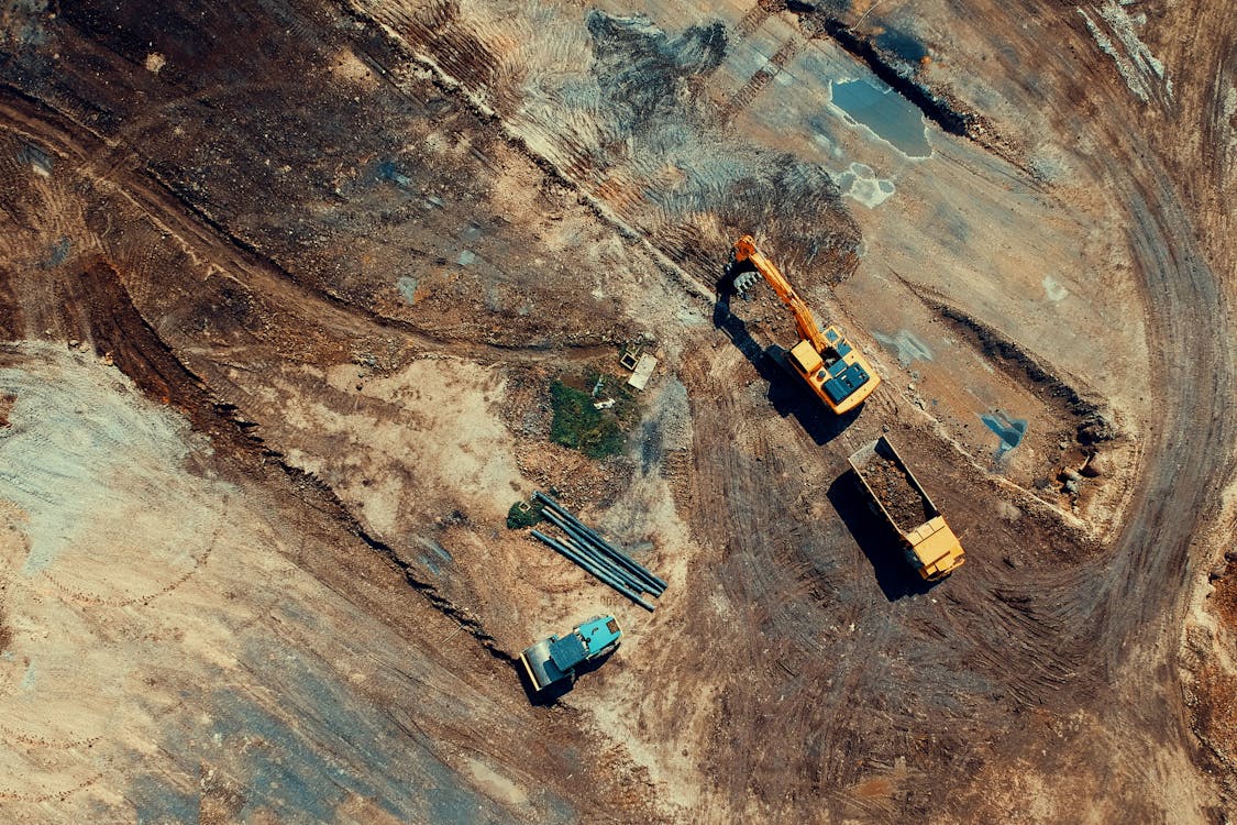
Industry Applications
Construction
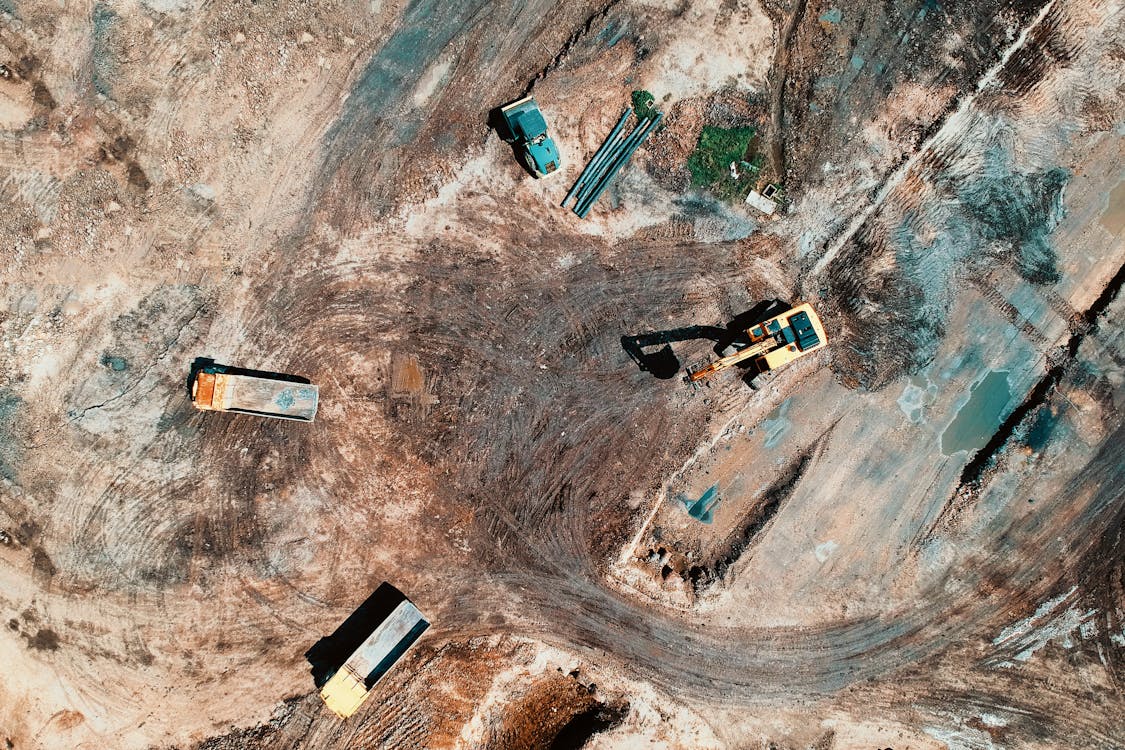
- Progress monitoring: Weekly or monthly orthomosaics overlay design plans to track construction progress, identify delays, and verify earthwork quantities
- Stockpile volumes: Orthomosaics combined with digital surface models calculate material volumes within 1-2% accuracy
- Site planning: Before breaking ground, orthomosaics provide accurate base maps for grading design and layout
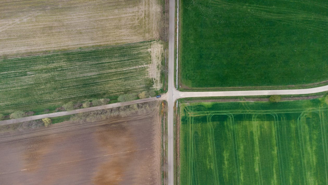
Agriculture
- Crop health analysis: Multispectral orthomosaics (NDVI, NDRE) identify stressed vegetation, irrigation issues, and nutrient deficiencies at the individual plant level
- Drainage design: Elevation data derived from orthomosaic processing reveals low spots and drainage patterns
- Yield estimation: Seasonal orthomosaic comparison tracks crop development and predicts harvest volumes
Mining & Quarrying
- Stockpile measurement: Regular orthomosaic surveys calculate material inventory volumes without disrupting operations
- Pit design: Accurate surface models support mine planning and blast design
- Reclamation monitoring: Before/after orthomosaics document revegetation progress for regulatory compliance
Environmental Monitoring
- Wetland delineation: High-resolution orthomosaics combined with multispectral data map vegetation communities and hydric boundaries
- Erosion monitoring: Temporal orthomosaic comparison quantifies shoreline retreat, slope movement, and channel migration
- Habitat mapping: Species identification and canopy analysis from calibrated multispectral imagery
Orthomosaic vs Point Cloud: When Do You Need Each?
| Feature | Orthomosaic | Point Cloud |
|---|---|---|
| Data type | 2D map (georeferenced image) | 3D dataset (XYZ coordinates) |
| Visual quality | Excellent (photographic) | Moderate (colorized points) |
| Measurement | 2D (area, distance, perimeter) | 3D (volume, cross-section, height) |
| File size | Moderate (100 MB - 2 GB) | Large (1 GB - 50+ GB) |
| Software needed | GIS (ArcGIS, QGIS, Google Earth) | Point cloud (CloudCompare, ReCap) |
| Best for | Visual documentation, GIS integration | Engineering design, BIM, terrain modeling |
Many projects deliver both — the orthomosaic for visual context and the point cloud for 3D analysis. Learn more about point clouds in our point cloud guide.
Deliverable Formats
- GeoTIFF — The industry standard. Georeferenced raster image compatible with all GIS platforms
- ECW — Enhanced Compressed Wavelet. Smaller file size for very large orthomosaics
- KMZ/KML — Google Earth compatible for easy viewing and sharing
- DWG — AutoCAD import for overlay with design drawings
- WMTS — Web Map Tile Service for online map platforms
How Much Does Orthomosaic Mapping Cost?
Pricing depends on area size and accuracy requirements:
- Small sites (up to 10 acres): $1,500 - $3,000
- Medium sites (10-50 acres): $3,000 - $10,000+
- Large areas (500+ acres): $150 - $500 per acre
These are average US rates. Pricing varies by location, terrain complexity, and required deliverables. Get a custom quote for your project →
For a detailed pricing breakdown, see our drone survey cost guide or use our aerial survey cost estimator.
Getting Started
THE FUTURE 3D provides professional orthomosaic mapping services using RTK-equipped drones (DJI Mavic 3 Enterprise, DJI Matrice 350 RTK) and industry-standard processing software (DroneDeploy, Pix4Dmapper). We serve construction sites, farms, mines, and development projects across all 50 US states.
For projects requiring larger coverage, we also deploy fixed-wing drones and helicopter-mounted cameras for orthomosaic mapping of 1,000+ acre sites and corridor projects.
Related resources:
- Aerial Survey & Mapping Overview
- Aerial LiDAR Guide
- Fixed-Wing Drone Mapping Guide
- Photogrammetry vs LiDAR
- Which aerial survey method do I need? (quiz)
Need an orthomosaic map for your project? Request a free quote → or call +1-347-998-1464 for a same-day response.
Ready to Start Your Project?
Get a free quote and consultation from our 3D scanning experts.
Get Your Free Quote

