
As of 2026, 16 U.S. states have passed legislation requiring or funding school safety mapping programs. These laws require schools to produce digital floor plans, interior maps, and emergency documentation and share them with first responders for pre-incident planning. This guide covers every state with active legislation, pending bills, and panic-alert-only states — so school administrators can quickly determine what their state requires and how to comply.
How State Legislation Is Categorized
School safety legislation falls into distinct categories based on what the law requires and how compliance is funded:
- Active Mandates (Tier A): Schools are legally required to provide mapping data. Non-compliance may trigger enforcement actions.
- Funded Programs (Tier B): The state provides grant funding for school mapping, but participation may be voluntary rather than mandatory.
- Pending Legislation (Tier C): Bills have been introduced but not yet signed into law.
- Panic Alert Only (Tier D): The state requires panic alert systems but has no mapping-specific mandate.
- No Mandate (Tier E): No state-level school mapping legislation exists.
Use our interactive compliance checker tool to find your state’s specific requirements.
Tier A: Active Mapping Mandates
These five states legally require schools to provide floor plans and mapping data to first responders.
Texas — TEC §37.108, HB 3, HB 1033, SB 838
Texas has the most comprehensive school safety mapping framework in the country. Under TEC §37.108, all K-12 districts and open-enrollment charter schools must provide emergency response mapping to applicable emergency service districts.
Key requirements:
- Field-verified maps with clear labeling of rooms, doors, and access points
- CAD/911/dispatch compatible digital format
- Aerial imagery overlays and point cloud data
- Life safety asset locations (AEDs, fire extinguishers, cameras, utility shutoffs)
- True-north orientation
- Triennial safety audits through the TEA Sentinel system
- Emergency Operations Plans (EOPs) submitted to TxSSC via Review Portal
Funding: The $800M+ SAFE Grant (88th Legislature) provides substantial school safety funding. Total Texas school safety allocation exceeds $1.1 billion.
Enforcement: Texas Education Agency Office of School Safety and Security; Texas School Safety Center (TxSSC) at Texas State University.
Additional provisions: SB 838 requires counties with populations under 350,000 to hold school safety meetings twice yearly. HB 1033 expanded emergency response mapping requirements.
For full compliance details, see our Texas school safety guide.

New Jersey — SB 2426
New Jersey was one of the first states to address school safety mapping directly. SB 2426 requires boards of education and nonpublic school administrators to provide critical incident mapping data to law enforcement.
Key requirements:
- Critical incident mapping data provided to law enforcement agencies
- Covers both public and nonpublic schools
- Separate from Alyssa’s Law A764 (which covers panic alerts)
Funding: $6.5M state mapping program.
Important distinction: New Jersey has two separate laws. A764 (Alyssa’s Law, 2019) requires panic alert systems. SB 2426 requires mapping data. These are often conflated in media coverage but have different compliance requirements.
For full compliance details, see our New Jersey school safety guide.
Virginia — Code 22.1-279.8
Virginia requires local school boards to create collaborative response graphics as part of their safety audit process.
Key requirements:
- Local school boards must create collaborative response graphics
- Documentation used in mandatory safety audits
- Graphics must support multi-agency response planning
Funding: $6.5M state mapping program.
West Virginia — HB 3166 (Enacted 2025)
West Virginia enacted HB 3166 during the 2025 Regular Session, establishing one of the newest school mapping mandates in the country.
Key requirements:
- County boards of education must develop standardized school safety mapping data by September 1, 2025
- Detailed labels for rooms, doors, hazards, and utilities
- Mapping data shared with the state education board, homeland security, and local first responders at no additional cost to responder agencies
Funding: $4.7M allocated for the program.
Additional: West Virginia also has HB 2394 (Alyssa’s Law) advancing through the House Education Committee for panic alert requirements.
Wisconsin — Act 109
Wisconsin’s Act 109 takes a straightforward approach, requiring schools to submit existing documentation to law enforcement.
Key requirements:
- Every public and private school must submit blueprints to local law enforcement
- Covers both public and private institutions
Funding: $2M state grant to support compliance.
Tier B: Funded Mapping Programs
These eleven states fund school safety mapping through grants or state appropriations. Participation may be grant-dependent rather than universally mandated.
Florida — HB 301, §1006.07(f)-(g)
Funding: $3,000–$5,000 per school through HB 301 mapping grants.
Requirements: Digital school maps integrated with centralized panic alert system for real-time law enforcement access. First responders can tour campuses every three years. Maps must be field-verified, CAD/9-1-1 compatible, with room labeling and emergency asset locations.
Important distinction: Florida has two separate laws. SB 70 (Alyssa’s Alert, 2020) covers panic alert systems. HB 301 separately funds mapping. §1013.13 addresses building documentation standards.
For full compliance details, see our Florida school safety guide.
Georgia — HB 268 “Ricky and Alyssa’s Law” (Signed April 2025)
Funding: $61,000 per school through FY 2026.
Requirements: Schools must maintain up-to-date digital maps and submit updated mapping data to emergency response agencies annually. The law also includes mobile panic alert systems, student record transfers, anonymous reporting, and safety audits. Maps must integrate with NG9-1-1 systems and be printable/shareable.
For full compliance details, see our Georgia school safety guide.
Michigan — Section 97c/97d, SB 173, HB 6012
Funding: Up to $1M per grantee.
Requirements: Standardized mapping data with field verification walkthroughs and responder access. Floor plans overlaid on aerial imagery. Printable formats that require no additional software. GIS/CAD/911 compatible. Covers public, intermediate, and nonpublic K-12 districts plus universities (SB 173).
Indiana — HB 1492 (Secured School Safety Grant)
Funding: $5,000 per school.
Requirements: Digital mapping for critical incidents with walkthrough verification and CAD/911 integration. Covers school corporations, accredited private schools, charter schools, and school safety coalitions.
Nebraska — LB 1329 (School Emergency Response Mapping Fund)
Funding: $525,000–$4M.
Requirements: Standardized mapping data with emergency asset labeling and responder access. Covers public and charter schools.
Illinois — Section 50 (Crisis Response Mapping Grant)
Funding: Competitive grant (varies by district size).
Requirements: Crisis response mapping data with emergency asset labeling and public safety system compatibility. Over 150 schools statewide have been mapped through Esri/GeoComm partnerships.
For full compliance details, see our Illinois school safety guide.
Minnesota — State Legislative Allocation (2024)
Funding: $7M administered through regional emergency communication boards (until June 30, 2026).
Progress: The Metropolitan Emergency Services Board awarded a statewide contract to Critical Response Group (CRG) for school mapping.
Louisiana — School Safety Grant Program
Funding: $2.4M.
Requirements: Schools must create and maintain digital maps with physical walkthrough verification. Maps must be compatible with public safety software platforms.
Maryland — HB 0472 + HB 1328 (2026 Session)
Funding: Safe Schools Fund (amount not specified).
Requirements: School Safety Data Mapping Program for all public and charter schools. HB 1328 (2026 Regular Session, first reader) establishes a School Mapping Data Program through the School Safety Subcabinet.
South Carolina — Statewide Contract
Funding: State-funded through a statewide CRG contract.
Coverage: All 1,200+ K-12 schools in the state. Bills 4740 and 5179 (2025–2026 session) propose extending mapping requirements to higher education institutions.
Kentucky — SB 2 (School Mapping Data Program)
Funding: Varies.
Scope: School mapping data program covering public, private, and charter schools.
Tier C: Pending Legislation
California — AB 598
AB 598 proposes a School Mapping Data Grant Program for districts, county offices of education, and charter schools. The bill was held in committee as of August 2025. A prior bill, AB 2887, required procedures for identifying refuge shelters during evacuations. No active mandate or funded program yet.
Ohio — SB 105
SB 105 proposes requiring wearable panic alert systems. The mapping component remains unclear, but Ohio’s “Alyssa’s law” search volume has surged 250% quarterly, indicating growing public interest and likely legislative momentum.
For full details on Ohio’s trajectory, see our Ohio school safety guide.
Federal — Uniform School Mapping Act
Introduced by Congressman Mast (FL-21), this bill would standardize school maps using federal funds. It has been introduced but is not law and has not advanced through committee.
Tier D: Panic Alert Only
These states have Alyssa’s Law or similar panic alert mandates but no mapping-specific requirements:
| State | Law | Mapping Component? |
|---|---|---|
| New York | Commissioner’s Reg §155.17 | No — safety plans with panic system options only |
| Oklahoma | Alyssa’s Law | Partial — floor plans shared with responders during 911 calls |
| Oregon | Alyssa’s Law | No — panic alarm + Wireless Panic Alarm Grant |
| Utah | Alyssa’s Law | No — $100M for real-time coordination, not mapping |
| Washington | Alyssa’s Law | No — real-time multi-agency coordination only |

Common Technical Requirements Across States
Despite varying legislative language, most states with mapping mandates converge on similar technical standards:
- Digital format — not paper blueprints
- CAD/911/dispatch system compatibility
- GIS-enabled (NG9-1-1 standard preferred)
- Room labeling — rooms, doors, access points, corridors
- Emergency asset locations — AEDs, fire extinguishers, cameras
- Field verification — physical walkthroughs required
- Multi-agency usability — law enforcement, fire, EMS
- Regular updates — annual or triennial depending on state
- Printable AND digital formats
- True-north orientation (Texas-specific but emerging as a standard)
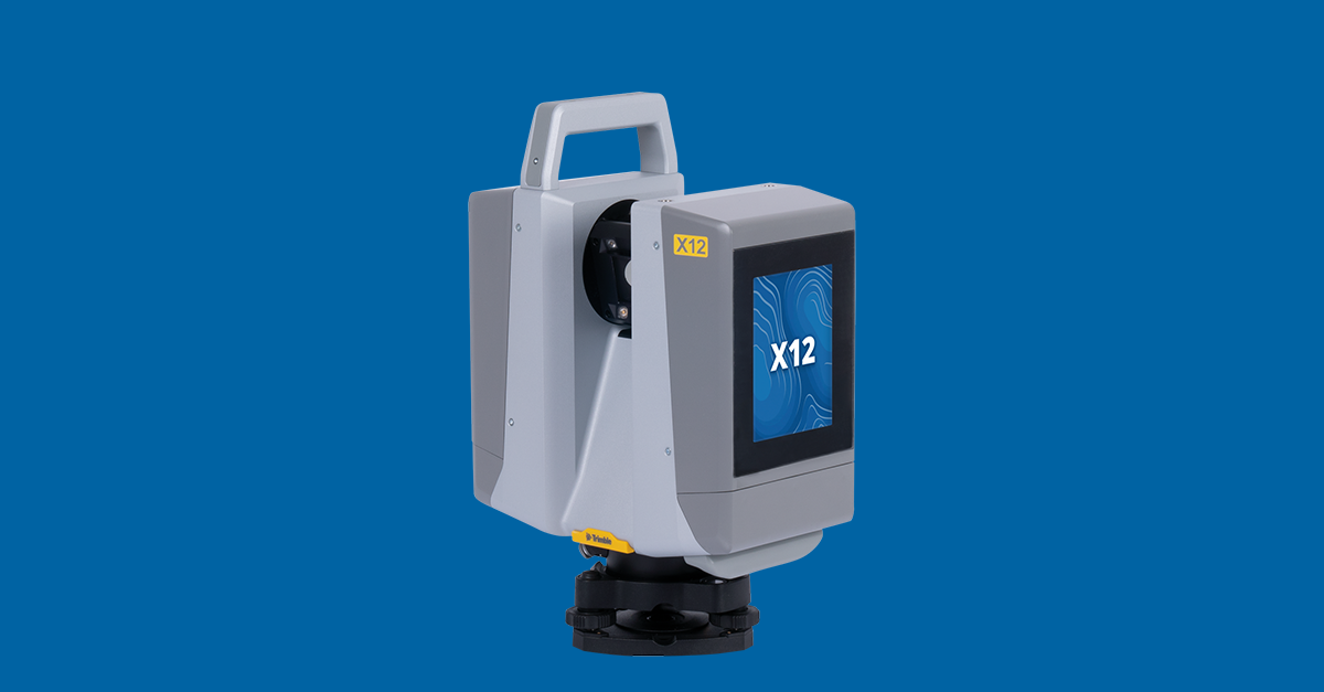
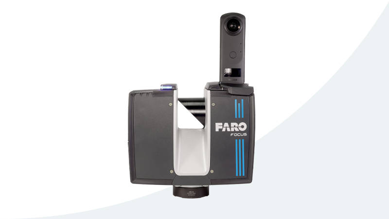
How 3D Scanning Meets These Requirements
3D laser scanning with equipment like the Trimble X12 (±2mm accuracy) or FARO Focus Premium captures the precise existing-conditions data that state-mandated safety documentation is built from:
- Survey-accurate point clouds — the precise 3D foundation your district’s mapping or GIS provider converts into the CAD/911-compatible floor plans state mandates require
- Room measurements with every door, window, access point, and corridor captured
- Emergency equipment locations — fire extinguisher and AED positions captured in the scan data for your mapping team to label
- The scanning process is the field verification — it captures the building’s actual current condition
- Multiple point cloud export formats (E57, RCP, LAS, LAZ, PTS) plus PDF measurement reports and 360° panoramic imagery for different agency needs
3D scanning typically costs $0.20–$0.70 per square foot with a $1,000 minimum project size. For a detailed pricing breakdown, see our school safety mapping cost guide.
Federal Funding: Important Clarification
A common misconception is that federal programs fund school mapping. They do not:
- STOP School Violence Program (BJA, $83M FY25): Funds training, threat assessment, anonymous reporting. Does not fund mapping, scanning, or physical documentation.
- COPS School Violence Prevention Program (SVPP, $73M FY25): Funds security improvements with 25% local match. Does not fund mapping.
School safety mapping is funded exclusively at the state level. Schools should contact their state department of education for grant availability.
For a comprehensive guide to state-level funding, see our state grants guide.
Frequently Asked Questions
How many states have school safety mapping laws?
As of 2026, 16 states have active school safety mapping mandates or funded mapping programs. Five states (Texas, New Jersey, Virginia, West Virginia, Wisconsin) have mandatory requirements. Eleven states (Florida, Georgia, Michigan, Indiana, Kentucky, Nebraska, Illinois, Minnesota, Louisiana, Maryland, South Carolina) fund mapping through grants.
Which state has the most comprehensive requirements?
Texas has the most detailed requirements, including field-verified maps, CAD/911 compatibility, aerial imagery overlays, point cloud data, true-north orientation, and life safety asset labeling. Texas also has the largest funding allocation ($800M+ SAFE Grant) and the most rigorous enforcement through TEA triennial audits.
Do private schools need to comply?
It varies by state. Wisconsin explicitly includes private schools. New Jersey covers nonpublic schools. Texas includes charter schools. Check your state’s specific legislation or use our compliance checker tool for details.
What happens if a school doesn’t comply?
Enforcement varies. Texas conducts triennial safety audits through TEA. West Virginia requires mapping data by a specific deadline (September 2025). In grant-funded states, compliance is typically a condition of receiving the grant rather than a standalone enforcement action. Consult your state’s department of education for specific consequences.
How often do maps need to be updated?
Most states requiring updates specify either annual (Georgia) or triennial (Texas) update cycles. Updates are particularly important after building renovations, additions, or changes to emergency equipment locations. 3D scanning provides the most efficient way to document building changes during renovation projects.
Is there a national standard for school safety maps?
Not yet. The Uniform School Mapping Act would establish federal standards if passed, but it remains in committee. Currently, individual states set their own requirements. However, most states converge on similar technical specs: digital format, CAD/911 compatibility, room labeling, and field verification.
Need Help with Compliance?
If your state requires school safety mapping documentation, we can help. Our 3D laser scanning services deliver survey-accurate point cloud data and existing-conditions documentation — the precise foundation your mapping provider uses to produce the floor plans and mapping data state mandates require. Request a free quote or call +1-347-998-1464 to discuss your district’s needs.
All legislation data verified using official state sources, the Texas Education Agency, CRG Plans state funding database, GeoComm school mapping reports, and Datamark GIS analysis. Check our state compliance guides for the latest information on your state.
Ready to Start Your Project?
Get a free quote and consultation from our 3D scanning experts.
Get Your Free Quote