The Monaco Grand Prix circuit is 3.337 kilometers of public road transformed into the most challenging and iconic racing environment in the world. For 3D scanning teams, it represents a unique technical challenge — narrow streets surrounded by tall buildings, dramatic elevation changes, a tunnel section, and a harbor-front section with complex barrier geometry.
Scanning a street circuit like Monaco is fundamentally different from scanning a permanent racing facility. Every element of the circuit is temporary — barriers, curbing, timing infrastructure, and safety equipment are installed weeks before the race and removed afterward. The scan must capture the complete competitive environment during the narrow window when everything is in place.
Why Monaco Is the Ultimate Street Circuit Challenge
Monaco’s physical characteristics create scanning conditions that are unusual even by motorsport standards:
Narrow Streets
The circuit follows public roads that were designed for normal traffic, not racing. Many sections are barely wide enough for two F1 cars side by side. The proximity of buildings to the racing line means that:
- Terrestrial scanner positions are limited by available space
- Line-of-sight obstructions are frequent (balconies, awnings, utility infrastructure)
- Barrier positions are within meters of building facades, creating complex geometry between the racing surface and surrounding structures
Elevation Changes
The circuit drops 42 meters from the highest point (Massenet) to the lowest point (the harbor chicane). This vertical range is significant for a circuit that is only 3.3 km long. The elevation changes affect:
- Drainage patterns (water flows rapidly downhill through the circuit)
- Scanner positioning (sight lines change dramatically with elevation)
- Drone flight planning (maintaining consistent altitude above ground level requires terrain-following flight modes)
The Tunnel
The tunnel section between Portier and Nouvelle Chicane presents unique scanning conditions:
- No GPS signal (drone positioning is not possible inside the tunnel)
- Artificial lighting creates uneven photographic conditions
- The transition from daylight to tunnel and back is a critical zone for driver visibility analysis
- The tunnel interior includes mechanical and electrical infrastructure mounted on walls and ceiling
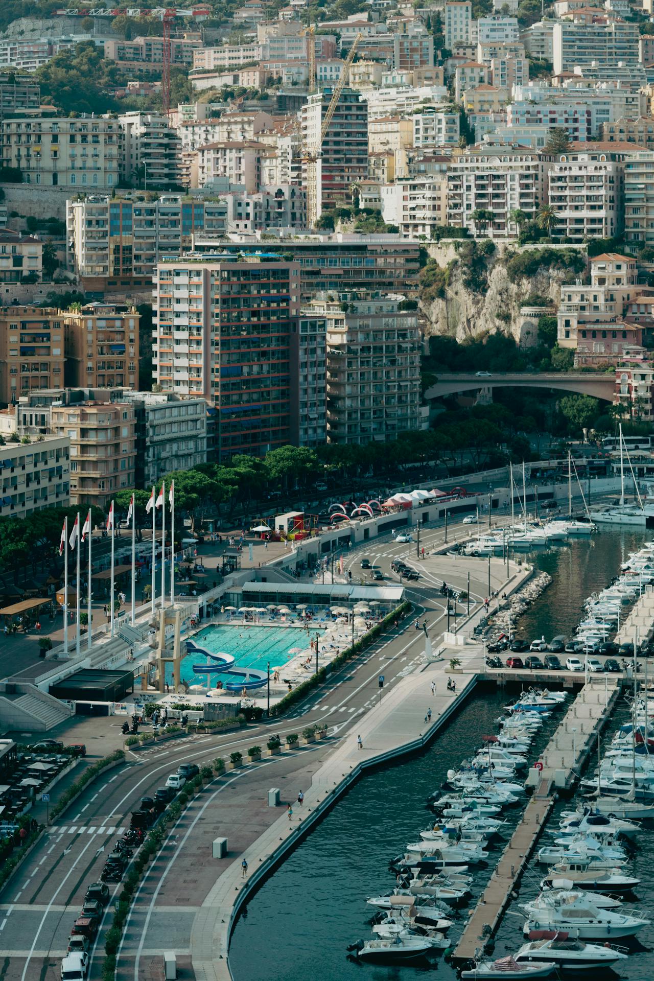
The Harbor Section
The swimming pool complex and harbor-front section include:
- Barrier systems positioned on the waterfront road
- Spectator infrastructure on temporary platforms over water
- Multi-level scanning requirements (track level, waterfront level, elevated hospitality areas)
- Marina infrastructure adjacent to the racing surface
Street Circuit Scanning vs Permanent Track Scanning
| Factor | Permanent Track | Street Circuit (Monaco) |
|---|---|---|
| Scanner positioning | Open pit lane, paddock, run-off areas | Limited by building proximity |
| Aerial access | Unrestricted over track area | Restricted by buildings, airspace |
| Infrastructure | Permanent barriers, fixed kerbs | Temporary barriers, removable kerbs |
| Time window | Year-round access | 2-3 week setup/race window |
| GPS availability | Full coverage | Intermittent (tunnel, building shadows) |
| Complexity per km | Lower | Significantly higher |
| Scan positions per km | 50-100 | 150-300+ |
The scan position density at Monaco is 2-3 times higher than at a typical permanent circuit because the narrow environment creates more occlusions that require additional angles to fill.
The 3.337 km Challenge: What Needs Scanning
A complete Monaco circuit scan must capture:
Track Surface
All 3.337 km of racing surface, including:
- Road surface geometry (crown, camber, grades, superelevation)
- Surface condition (patching, joints, surface texture changes)
- Painted markings (center lines, racing lines, pit entry/exit markings, DRS zones)
- Utility covers (manhole covers, drainage grates, service access panels)
Utility covers are a particular concern on street circuits. They create surface discontinuities that affect car behavior at speed, and their positions must be documented precisely.
Barrier Systems
Every meter of barrier around the circuit:
- Armco rail sections and mounting posts
- TecPro impact-absorbing barriers at high-risk points
- Concrete Jersey barriers at specific locations
- Connection hardware between barrier types
- Gate positions for marshal access
Run-Off and Escape Roads
- Sainte Devote escape road geometry
- Swimming Pool chicane run-off
- Rascasse barriers and clearances
- Each zone where a car can leave the racing surface
Spectator Infrastructure
- Grandstand geometry and sightlines
- Temporary platform structures
- Pedestrian circulation routes for emergency evacuation
- Barrier-to-spectator separation distances
Permanent Infrastructure
- Building facades along the circuit
- Tunnel interior including mechanical systems
- Traffic signal and lighting positions
- Drainage inlet locations and pipe connections
Equipment for Street Circuit Environments
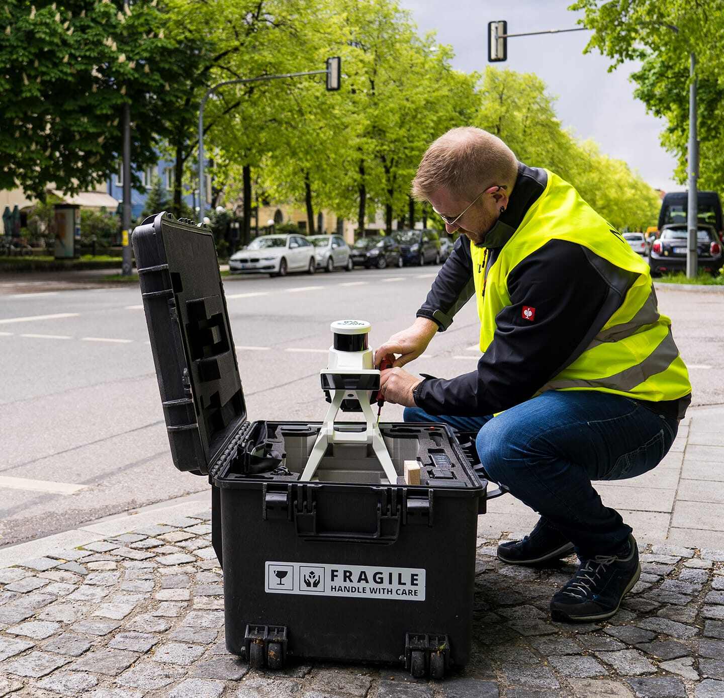
Street circuits require a scanning equipment selection optimized for confined spaces:
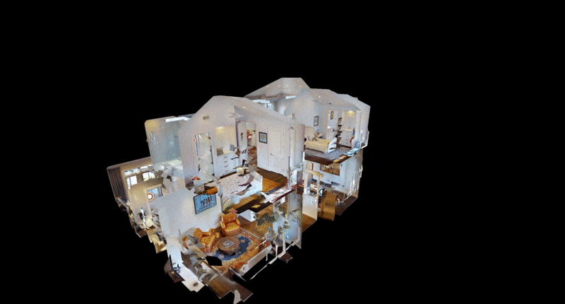
Mobile Mapping (NavVis VLX3)
The most efficient tool for Monaco’s narrow streets. The operator walks the circuit wearing the scanner, capturing continuous data along the racing line, barriers, and adjacent structures. Mobile mapping is particularly valuable for:
- The tunnel section (no GPS required — SLAM-based positioning)
- Narrow sections where static scanner positions are limited
- Rapid coverage of long barrier runs
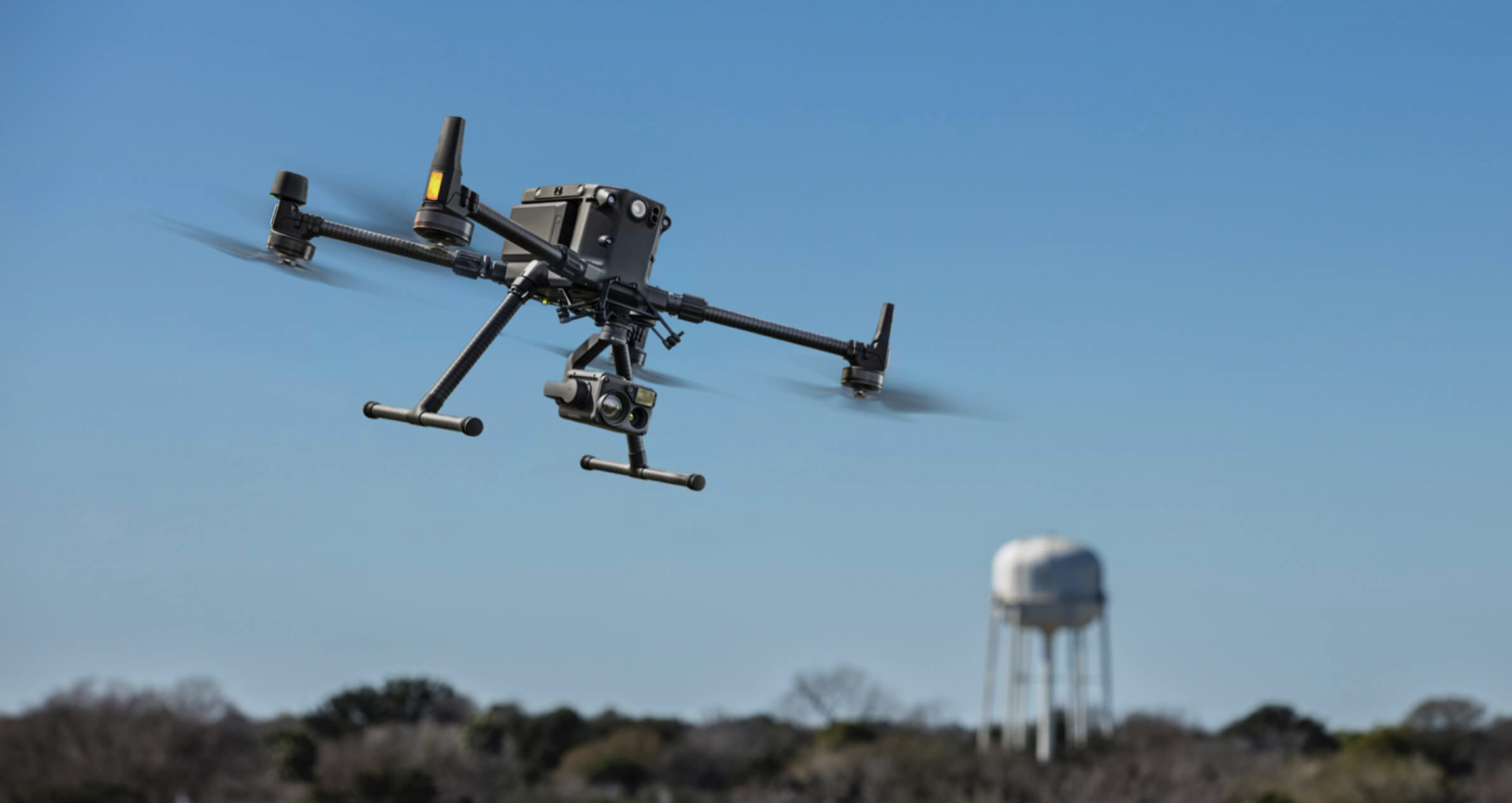
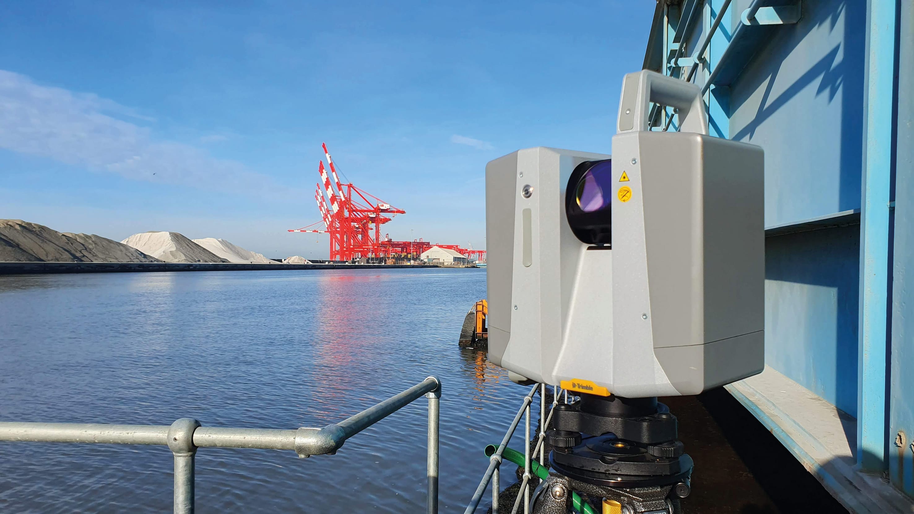
Terrestrial Static Scanners (Trimble X12, FARO Focus Premium)
Used for areas requiring maximum accuracy:
- High-speed corner approaches where barrier clearance is safety-critical
- Pit lane entry and exit geometry
- Grandstand structural documentation
- Specific engineering measurement locations
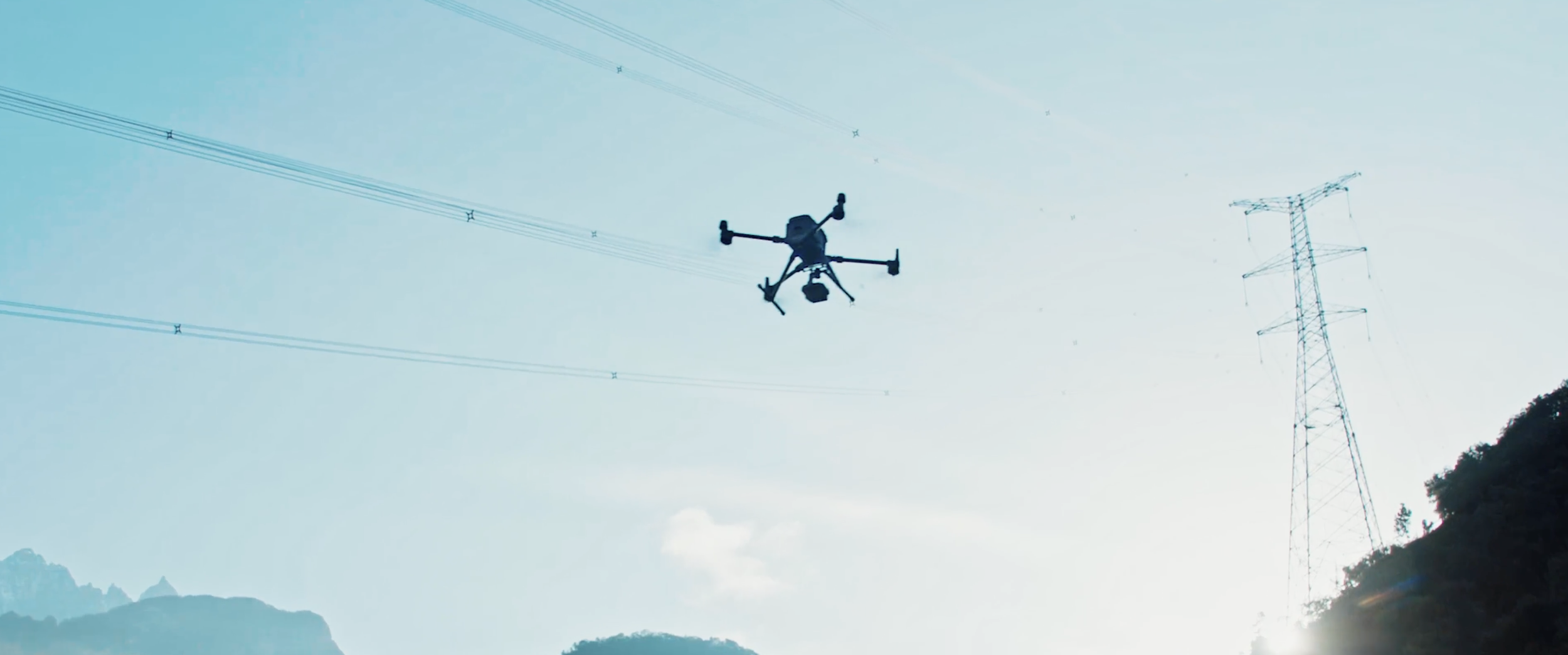
Drone LiDAR and Photogrammetry
Used where airspace permits for:
- Overhead views of the circuit layout
- Elevated sections inaccessible from street level
- Harbor-front area documentation
- Building rooftop reference points
Drone operations at Monaco are constrained by:
- Building proximity and turbulence in narrow streets
- Restricted airspace (proximity to Nice airport and heliport)
- Privacy considerations (residential buildings overlooking the circuit)
Timing and Access Constraints
The scanning window at Monaco is tightly constrained:
- Setup period (2-3 weeks before race): Barriers are installed progressively. Early scanning captures the permanent infrastructure; later scanning captures the complete race configuration.
- Pre-race week: Full barrier configuration is in place. Primary scanning window.
- Race weekend: Limited access between sessions (early mornings, late evenings). No scanning during session periods.
- Post-race: Barriers begin to be removed immediately. Any areas missed during the pre-race window must be captured before teardown begins.
The scanning team must plan meticulously to capture every section within the available time windows. Missed sections cannot easily be re-scanned once barrier removal begins.
How Street Circuit Data Supports Safety and Broadcasting
The scan data from Monaco serves multiple downstream applications:
Safety Engineering
- Barrier clearance verification against FIA standards
- Run-off area adequacy assessment
- Surface drainage analysis for wet-weather events
- Emergency vehicle access route documentation
Broadcast Production
- Camera position planning using the 3D model
- Cable routing for broadcast infrastructure
- Commentary booth sightline verification
- Aerial camera flight path planning
Event Operations
- Spectator flow modeling for ingress and egress
- Emergency evacuation route planning
- Vendor and hospitality structure placement
- Logistics vehicle routing around the circuit perimeter
For more on how 3D scanning supports broadcast production, see our sports broadcast venue scanning services.
Frequently Asked Questions
How is the Monaco tunnel scanned without GPS? Mobile mapping systems like the NavVis VLX3 use SLAM (Simultaneous Localization and Mapping) algorithms that do not depend on GPS. The scanner tracks its position using LiDAR and IMU data relative to the surrounding geometry, maintaining positioning accuracy through the entire tunnel.
Can drones fly over the Monaco circuit? With proper authorization, yes — but with significant restrictions. Building proximity limits safe drone operations in many sections. Drone LiDAR is primarily used for the harbor section and elevated areas where open sky access is available.
How many scan positions does Monaco require? A complete Monaco circuit scan typically requires 500-1,000+ scan positions for terrestrial/static scanning, plus continuous mobile mapping coverage and targeted drone flights. The narrow environment and high occlusion rate drive the elevated position count.
Is Monaco the hardest circuit to scan? It is among the most complex due to the confined environment, tunnel, elevation changes, and temporary infrastructure. Other challenging circuits include Singapore (night race, long street circuit) and Jeddah (high-speed street circuit with concrete walls).
Explore our motorsport circuit scanning services and racing circuit technology guide. For the F1 gaming angle, read how EA’s F1 25 uses LiDAR data.
Ready to Start Your Project?
Get a free quote and consultation from our 3D scanning experts.
Get Your Free Quote