Every circuit on the Formula 1 calendar is 3D scanned using LiDAR. The data captures asphalt textures, kerb heights, barrier placements, undulations, and environmental details at millimeter resolution. While F1 teams use this data for simulation and safety analysis, EA’s Codemasters studio uses the same datasets to build the hyper-realistic track environments in F1 25.
The technology behind this process — terrestrial laser scanning, drone LiDAR, and photogrammetry — is the same technology used for stadium documentation, infrastructure surveying, and facility management. Understanding how F1 circuits are scanned reveals what professional-grade 3D scanning can accomplish.
How F1 Teams Capture Circuit Data
F1 circuit scanning happens during Grand Prix weekends when the track is in race configuration — barriers in place, run-off areas prepared, and all infrastructure installed. Teams and circuit operators deploy scanning equipment to capture the complete track environment.
The scanning process captures:
- Track surface geometry: Every bump, dip, and camber change across the racing line and run-off areas. Surface undulations as small as a few millimeters are captured because they affect car behavior at racing speeds.
- Kerb profiles: The exact height, width, and angle of every kerb on the circuit. Kerb design varies significantly between circuits, and the LiDAR data captures these differences precisely.
- Barrier placements: Exact positions of TecPro barriers, Armco rails, concrete walls, and tire stacks. Safety analysis relies on knowing the precise distance from the racing line to every barrier section.
- Track markings and surface textures: Line positions, pit entry/exit markings, DRS detection zones, and surface texture changes between asphalt types or repaved sections.
- Environmental context: Grandstands, buildings, vegetation, elevation changes, and sky backdrop. This contextual data gives the digital model its sense of place.
Confirmed LiDAR-Scanned Circuits
LiDAR scanning of F1 circuits is well-documented across multiple sources. Confirmed circuits that have been scanned include:
- Bahrain International Circuit: Desert environment with significant sand management challenges. LiDAR captures the precise banking angles and run-off area geometry.
- Miami International Autodrome: Street-circuit-style layout built around Hard Rock Stadium. The urban environment creates complex scanning conditions with tall structures and varied surface materials.
- Melbourne Grand Prix Circuit (Albert Park): Combined permanent/temporary circuit through a public park. Recent resurfacing and layout changes required updated scan data.
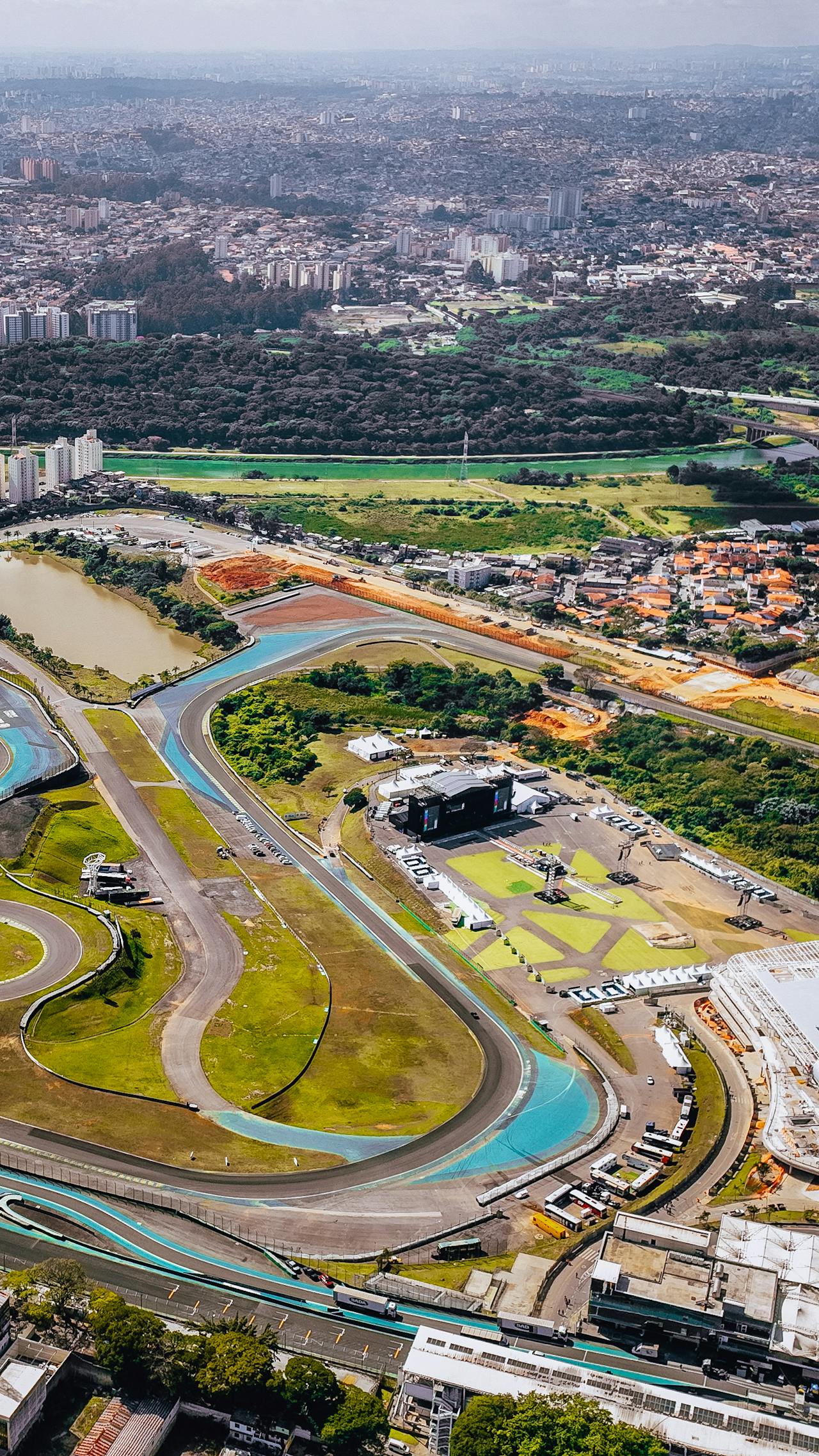
- Suzuka International Racing Course: Iconic figure-eight layout with significant elevation changes. LiDAR captures the complex 3D geometry that makes Suzuka unique among F1 circuits.
- Autodromo Enzo e Dino Ferrari (Imola): Historic circuit with blind corners and elevation changes. The LiDAR data captures the precise relationship between barriers and the racing line at critical points.
These are not the only scanned circuits — the entire F1 calendar is captured — but these are among the most comprehensively documented in public sources.
What Gets Captured
The detail level of F1 circuit scanning goes far beyond what a casual observer might expect. The data resolution and accuracy requirements are driven by two distinct use cases: engineering analysis and entertainment media production.
For Engineering and Safety
The engineering use case demands millimeter-level accuracy in critical areas:
- Surface profile: Longitudinal and lateral profile data at sub-centimeter resolution. This data reveals the micro-geometry that affects tire behavior, drainage, and car balance.
- Drainage grading: Water flow patterns across the track surface. Standing water at racing speeds is a safety hazard, and the scan data helps identify drainage problems before they cause incidents.
- Barrier clearances: Exact distance from the racing line to barriers at every point on the circuit. FIA safety regulations specify minimum clearances, and LiDAR provides the measurement data for compliance verification.
- Run-off area geometry: Surface material transitions (asphalt to gravel to grass), grading, and barrier positions in deceleration zones.
For EA’s F1 25 Game Development
EA’s Codemasters studio receives F1-provided LiDAR data and transforms it into the playable environments in F1 25. The game development use case requires:
- Accurate track geometry: The driving experience depends on the surface profile being correct. Bumps, camber changes, and elevation shifts must match reality for the simulation physics to produce authentic car behavior.
- “Species-correct” environmental detail: Codemasters has described their approach as capturing reality to the point where individual tree species are correct in the digital environment. The LiDAR data provides the spatial framework, and reference photography provides the visual detail.
- Grandstand geometry: Spectator areas, facilities buildings, and circuit infrastructure create the visual environment that makes each track feel unique and real.
- Dynamic elements: While LiDAR captures the static environment, Codemasters adds dynamic elements (marshals, spectators, weather effects) based on the spatial framework the scan data provides.
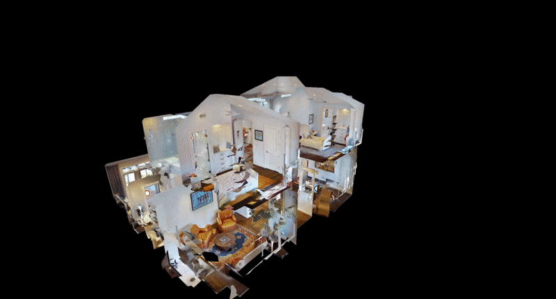
From Point Cloud to Game Engine
The transformation from raw LiDAR point cloud to playable game environment involves several processing stages:
1. Point Cloud Registration and Cleanup
Raw scan data from multiple positions and sensors is registered into a unified coordinate system. Noise, artifacts, and non-permanent objects (vehicles, people, temporary structures) are removed.
2. Mesh Generation
The point cloud is converted into a surface mesh — a continuous 3D surface model that the game engine can render. Track surfaces require extremely high mesh density to preserve the micro-geometry that affects driving physics.
3. Texture Application
High-resolution photography (from photogrammetry and reference cameras) is mapped onto the mesh surfaces to create the visual appearance. Asphalt textures, painted lines, rubber deposits, and surface weathering are all captured photographically and applied to the 3D geometry.
4. Physics Integration
The surface mesh is used to generate the physics model — the invisible surface that the game’s tire model interacts with. Every bump and undulation in the LiDAR data translates into force inputs on the virtual car.
5. Environment Build
Surrounding structures, vegetation, grandstands, and infrastructure are modeled based on the spatial framework from the scan data. This is where the “species-correct” environmental detail is applied.
Beyond Gaming: Why Real-World Applications Matter More
The F1/gaming use case demonstrates LiDAR scanning capabilities at an impressive scale, but the real-world applications of the same technology are the primary value driver.
Circuit Safety and FIA Compliance
Motorsport governing bodies (FIA, IMSA, NASCAR) use 3D scan data for:
- Track homologation (certification that the circuit meets safety standards)
- Annual inspection documentation
- Post-incident analysis (comparing barrier positions before and after contact)
- Drainage certification
Facility Management and Renovation
Circuit operators use scan data for:
- Infrastructure maintenance planning
- Spectator facility upgrades
- Broadcasting infrastructure installation
- Hospitality expansion design
Real Estate and Development
Many circuits are surrounded by commercial or residential development. The scan data provides:
- Precise site surveys for adjacent development planning
- Noise modeling (the 3D geometry affects sound propagation)
- Visual impact assessments
Stadium and Venue Scanning Uses the Same Technology
The terrestrial laser scanners, drone LiDAR platforms, and photogrammetry systems used to capture F1 circuits are the same equipment used for stadium scanning, motorsport circuit documentation, and other venue projects.
If you manage a racing circuit, stadium, arena, or sports venue, the same scanning methodology that produces F1-quality digital environments can produce engineering-grade documentation for your facility. The equipment, workflows, and accuracy levels are identical.
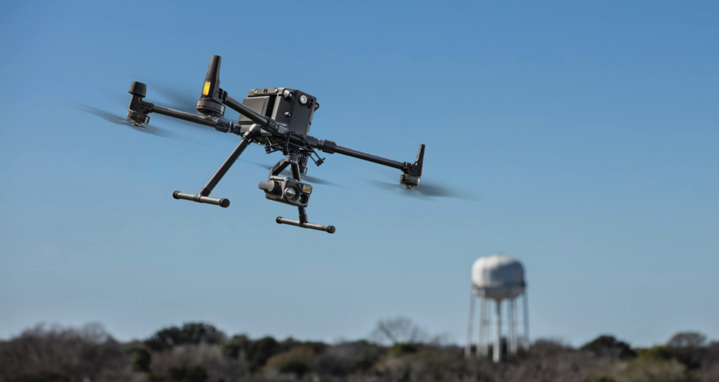
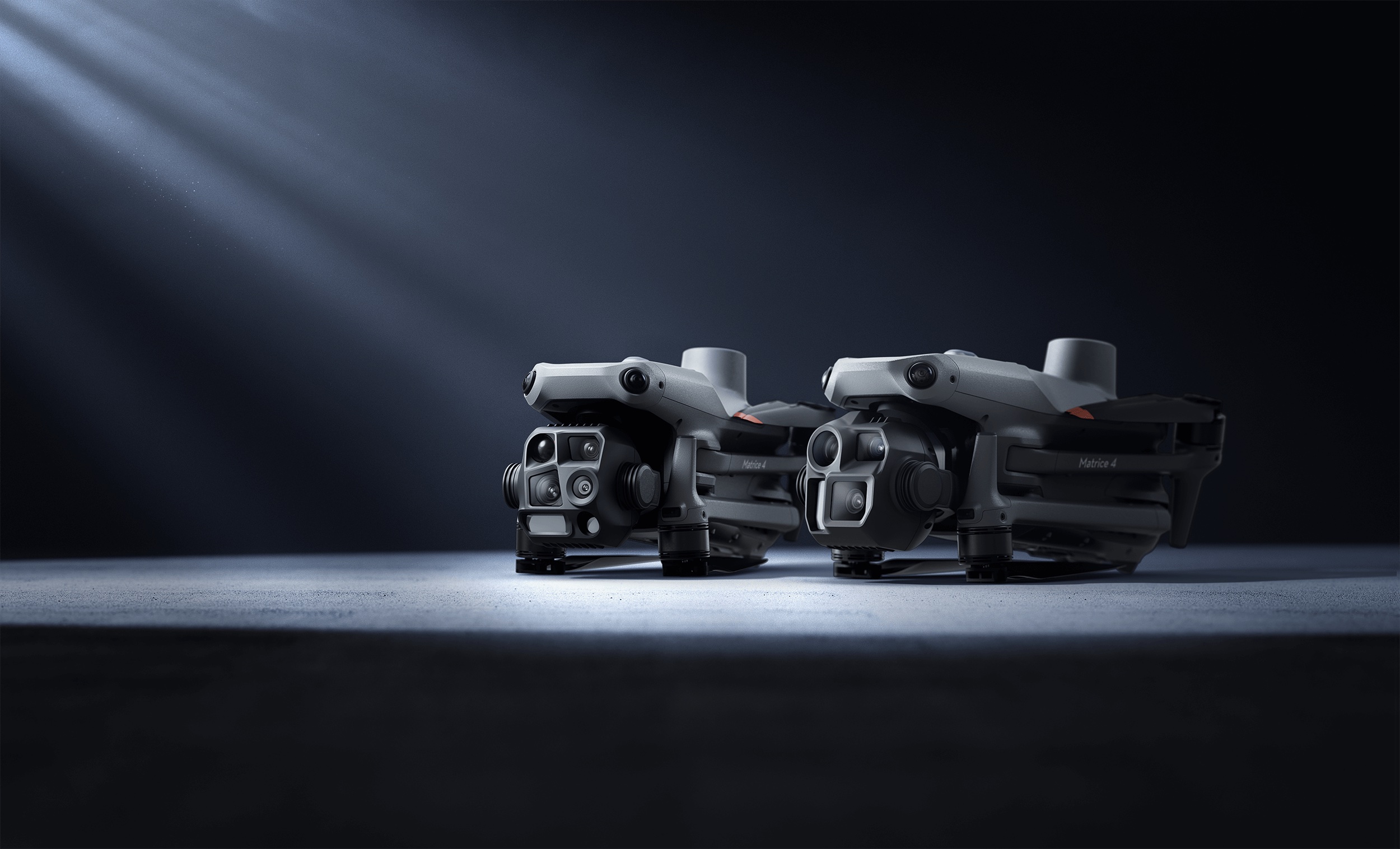
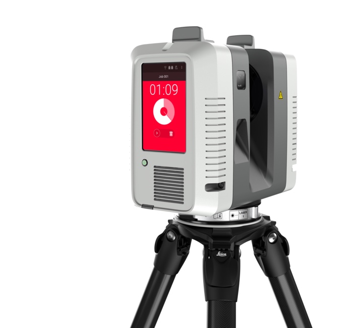
Our scanning fleet includes the Trimble X12, Leica RTC360, FARO Focus Premium, NavVis VLX3, and DJI Matrice 4E with both LiDAR (Zenmuse L3) and photogrammetry (Zenmuse P1) payloads — the same class of multi-sensor technology used for circuit-grade scanning.
Frequently Asked Questions
Does EA use LiDAR data for F1 25? Yes. EA’s Codemasters studio receives F1-provided LiDAR data of every circuit on the calendar. This data forms the foundation for the track geometry, surface profiles, and environmental layout in the game.
Which F1 circuits have been LiDAR scanned? All circuits on the F1 calendar are scanned. Publicly confirmed circuits include Bahrain, Miami, Melbourne, Suzuka, and Imola. The scanning typically happens during Grand Prix weekends when the track is in race configuration.
How accurate is F1 circuit scanning? Terrestrial laser scanning achieves ±2-5mm accuracy for track surfaces and barriers. Drone LiDAR achieves ±20-50mm for surrounding areas. The combined accuracy is sufficient for both engineering safety analysis and game development.
Can any racing circuit be 3D scanned? Yes. The same scanning methodology used for F1 circuits applies to NASCAR ovals, road courses, karting circuits, and drag strips. Our motorsport circuit scanning services cover all circuit types and configurations.
How is circuit scanning different from stadium scanning? Circuit scanning covers more horizontal area but less enclosed space than stadium scanning. Both use the same multi-sensor approach (terrestrial + mobile + aerial). The key difference is the emphasis on surface profile accuracy for track work vs interior spatial accuracy for stadium work.
Explore our motorsport circuit 3D scanning services and racing circuit scanning technology guide. For stadium projects, see our stadium scanning services hub.
Ready to Start Your Project?
Get a free quote and consultation from our 3D scanning experts.
Get Your Free Quote