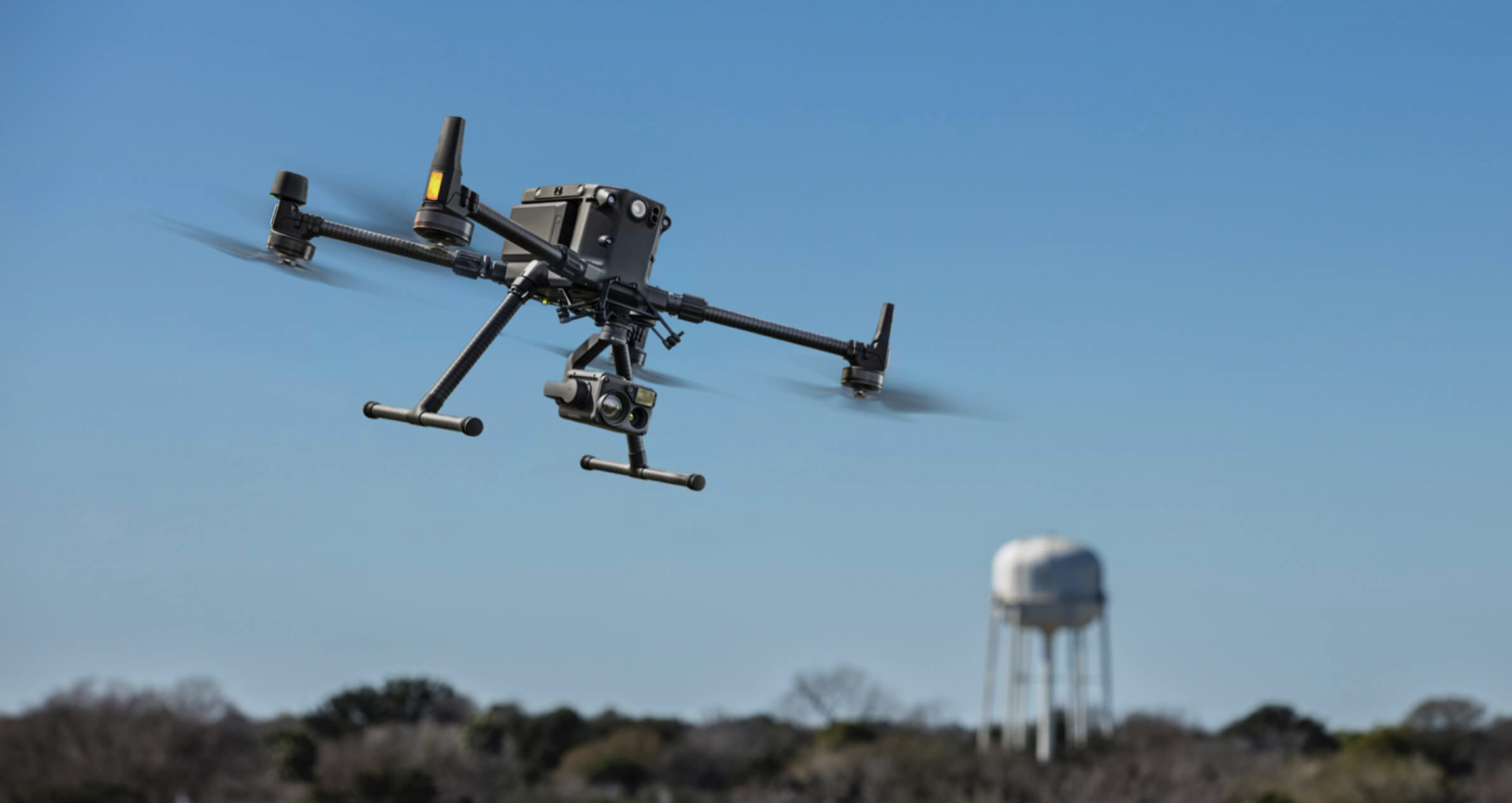
The 2028 Los Angeles Olympics will use dozens of venues across Southern California — from the LA Memorial Coliseum to the Long Beach Marine Stadium rowing course to the Sepulveda Basin archery range. For broadcast production companies, the preparation has already begun, and 3D scanning is central to the planning process.
Broadcast production for the Olympics is the most complex live television operation in the world. Multiple simultaneous events, hundreds of camera positions, thousands of miles of cable, and temporary infrastructure that must integrate seamlessly with permanent venue architecture — all of this planning benefits from accurate 3D venue documentation.
The LA28 Production Challenge
The LA28 Olympics present unique production challenges that distinguish them from a typical sporting event:
Multiple Venue Types
The Games will use indoor arenas, open-air stadiums, purpose-built facilities, and temporary venues. Each venue type presents different scanning and documentation requirements:
- Indoor arenas (basketball, gymnastics, boxing): Complex ceiling structures, lighting rigs, and acoustic considerations that affect camera and microphone placement
- Outdoor stadiums (athletics, ceremonies, football): Large-scale venues where aerial documentation is essential for understanding the complete site
- Water venues (rowing, canoe sprint, sailing): Open-water environments where drone photogrammetry captures conditions that terrestrial scanning cannot access
- Temporary venues (beach volleyball, skateboarding, surfing): Purpose-built infrastructure on sites that must be documented before, during, and after construction
Broadcast Scale
Olympic broadcasting involves:
- 200+ camera positions per major venue
- Dozens of commentary positions with specific sightline requirements
- Broadcast compounds (temporary buildings housing production equipment)
- Cable routing from every camera position to the broadcast compound
- Fiber optic and power infrastructure running through the venue
Planning this infrastructure requires precise dimensional data about every venue — exactly what 3D scanning provides.
Why Broadcast Teams Need 3D Venue Models
Production companies use 3D venue models for pre-production planning months before the first camera is installed:
Camera Position Planning
Every camera position must be evaluated for:
- Sightline to the field of play (can the camera see the entire competition area?)
- Clearance for camera movement (pan, tilt, zoom without obstruction)
- Structural mounting (is the mounting surface strong enough for the camera and operator?)
- Cable routing (how does the signal cable reach the broadcast compound?)
A 3D model allows production designers to evaluate hundreds of potential camera positions virtually, identifying the optimal locations without physical site visits for each iteration.
Virtual Walkthroughs
Production teams conduct virtual walkthroughs of the 3D model to:
- Verify sightlines from each proposed camera position
- Plan commentary booth layouts with views of the competition area
- Design mixed-zone layouts for athlete interviews
- Map spectator-to-camera separation distances
Cable and Infrastructure Routing
The single largest infrastructure challenge in Olympic broadcasting is cable routing. Thousands of meters of fiber optic, power, and signal cable must run from cameras, microphones, and timing systems to the broadcast compound. The 3D model provides:
- Accurate distance measurements for cable quantity estimation
- Clearance verification for cable tray routing
- Conflict detection with existing venue infrastructure
- Access path planning for installation crews
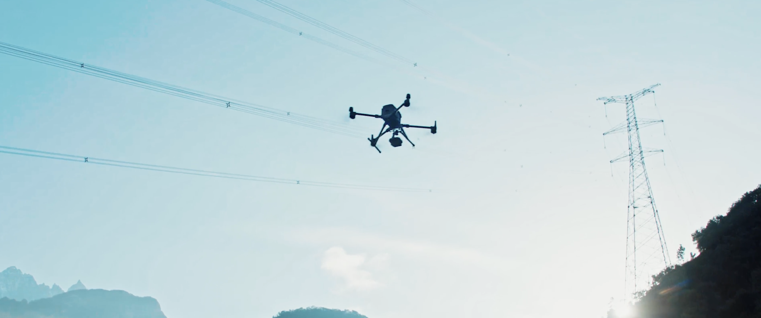
Rowing Course Scanning: Drone Photogrammetry for Water Venues
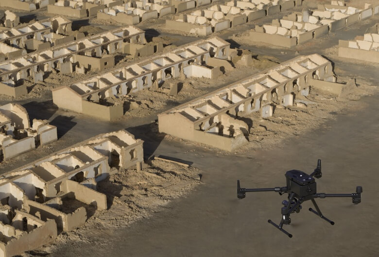
The Long Beach Marine Stadium — a potential LA28 rowing venue — represents a scanning challenge that is fundamentally different from indoor venues. The rowing course is 2,000 meters of open water flanked by shoreline infrastructure.
What Drone Photogrammetry Captures
Drone surveys of rowing courses capture:
- Shoreline geometry: The exact shape of the course boundaries, spectator areas, and infrastructure zones
- Course alignment: The straightness and width of the racing lanes
- Surrounding infrastructure: Boat houses, grandstands, finish towers, and support facilities
- Camera position opportunities: Elevated positions along the course for broadcast coverage
- Access routes: How broadcast vehicles, equipment, and personnel reach each position along the 2km course
Why Photogrammetry Over LiDAR for Water Venues
Water surfaces reflect laser pulses unpredictably, making LiDAR less effective over open water. Photogrammetry captures the visual documentation and surrounding infrastructure without depending on water surface returns. The shoreline, buildings, and spectator infrastructure are all captured accurately.
For the underwater topography of the rowing course, separate bathymetric surveys are used — but the aerial photogrammetry provides the spatial framework that all other data integrates into.
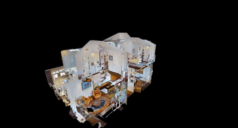
Indoor Arena Scanning for Broadcast Infrastructure
Indoor venues like the Crypto.com Arena (basketball) and Galen Center (fencing) require detailed interior scanning:
Ceiling and Rigging Infrastructure
Broadcast cameras are frequently mounted on ceiling rigging systems. The scan data captures:
- Structural steel positions and load capacities
- Existing lighting and scoreboard mounting points
- Available attachment points for camera rigging
- Clearance from the ceiling to the competition surface
Concourse and Back-of-House
Broadcast compounds and production offices are typically located in concourse areas or loading docks. The scan data provides:
- Room dimensions and ceiling heights for temporary office layouts
- Power distribution panel locations for broadcast equipment connections
- Loading dock access for equipment trucks
- Cable routing paths from the compound to camera positions
Floor-Level Infrastructure
Camera positions at competition level require:
- Floor surface documentation for camera track installation
- Column and obstruction mapping for sightline analysis
- Emergency exit clearance verification (cameras cannot block egress routes)
Cycling Velodrome and Track Venues
Velodrome and track cycling venues have unique geometry that creates specific broadcast challenges:
Banked Track Geometry
A velodrome’s 42-degree banked turns create sightline complications for fixed cameras. A camera mounted on the straight cannot see the far side of the banking without obstruction. The 3D model allows planners to:
- Calculate exact sightline angles from proposed positions
- Identify positions that minimize banking-induced blind spots
- Plan camera movement (tracking cameras that follow riders along the banking)
Infield Positions
Cameras positioned in the velodrome infield have unique access and cable routing requirements. The 3D model documents:
- Infield surface levels relative to the track surface
- Access tunnels and gates for equipment entry
- Power and signal connection points within the infield
Pre-Event Planning vs Day-Of Operations
The 3D venue model serves two distinct phases:
Pre-Event (Months Before)
- Camera position selection and optimization
- Cable routing design and material ordering
- Broadcast compound layout and equipment specification
- Temporary structure engineering (commentary platforms, camera towers)
- Coordination with venue operators on infrastructure modifications
Day-Of Operations
- Real-time spatial reference for technical problems
- Alternative camera position identification if primary positions fail
- Cable replacement routing when damage occurs
- Emergency response coordination using the venue model as common reference
Frequently Asked Questions
When should Olympic venue scanning begin? Venue scanning for broadcast planning should begin 18-24 months before the Games. This allows time for multiple design iterations, infrastructure procurement, and installation planning.
How much does Olympic venue scanning cost? Individual venue scans range from $10,000 to $50,000 depending on venue size and complexity. A complete Olympic venue scanning program across all competition venues represents a significant investment but is a fraction of the total broadcast infrastructure budget.
Can the 3D model be updated as venue modifications are made? Yes. Venues typically undergo multiple modification phases leading up to the Games. Incremental scan updates capture changes and keep the 3D model current for ongoing planning.
What file format do production companies need? Production companies typically work with Autodesk Revit models, SketchUp files, or web-based 3D viewers. Point cloud data can be exported to any of these formats depending on the production team’s software preferences.
Explore our sports broadcast venue scanning services and stadium scanning capabilities. For venue documentation, see our drone photogrammetry services.
Ready to Start Your Project?
Get a free quote and consultation from our 3D scanning experts.
Get Your Free Quote