Stadium scanning projects almost always require both aerial and terrestrial methods. The question is not which to use — it is how to balance the two for your specific venue, budget, and project requirements. Each method excels in different areas of the stadium, and understanding the strengths and limitations of each is essential for project planning.
This guide breaks down when to use aerial scanning, when to use terrestrial scanning, and how combining both delivers the most complete and cost-effective results.
When to Use Aerial Scanning
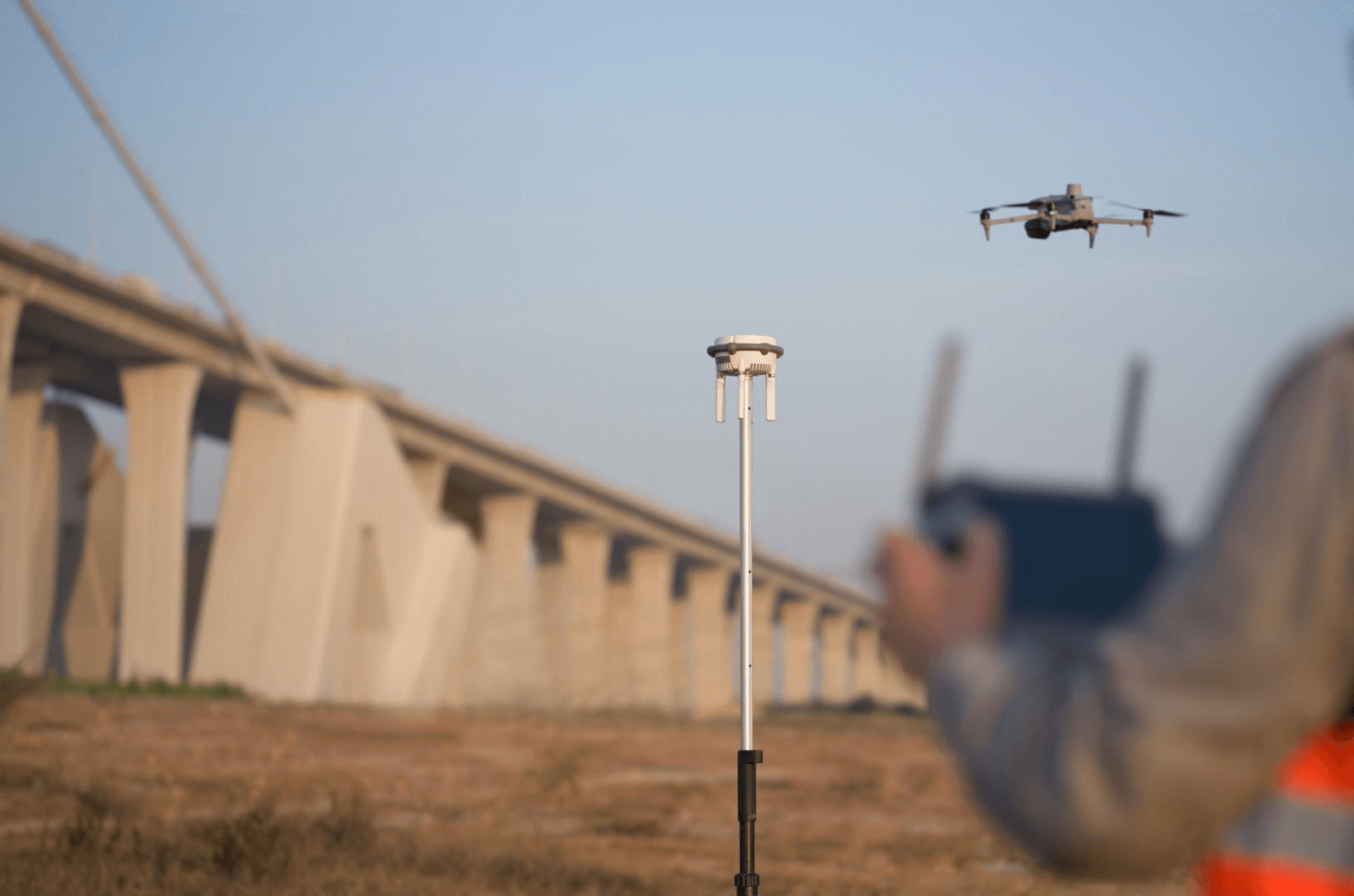
Aerial scanning using drone-mounted LiDAR and photogrammetry payloads is the optimal method for capturing the exterior envelope and surrounding site. Drones access areas that terrestrial scanners cannot reach efficiently — rooftops, upper facades, and expansive campus environments.
Best Applications for Aerial Stadium Scanning
Roof structure documentation: Retractable roofs, cable-stayed structures, membrane systems, and fixed canopies. Drone LiDAR captures the complete roof geometry without scaffolding or rope access. For stadiums with retractable roofs, both open and closed configurations can be captured in a single day.
Exterior facade mapping: The full building envelope from foundation to roofline. Drone photogrammetry produces high-resolution visual documentation, while LiDAR captures the precise geometry for engineering use.
Surrounding site survey: Parking structures, access roads, landscaping, utility infrastructure, and perimeter fencing. Stadium campuses often span 10-30+ acres, which drones cover efficiently in hours rather than days.
Topographic mapping: Site grading, drainage patterns, and elevation data for the stadium campus. This data supports stormwater management, site modification planning, and integration with municipal infrastructure.
Aerial Equipment
| Equipment | Primary Use | Key Specs |
|---|---|---|
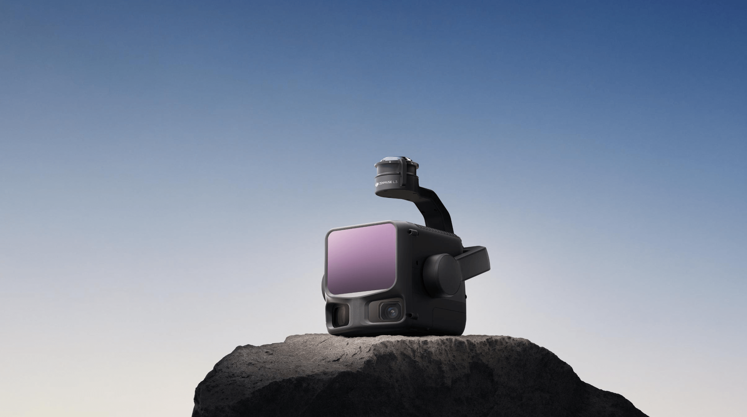
| DJI Matrice 4E + Zenmuse L3 | LiDAR point clouds | 5 returns/pulse, 250m range, ±8mm accuracy |
| DJI Matrice 4E + Zenmuse P1 | Photogrammetry | 45MP full-frame, sub-cm accuracy with RTK |
| RTK/PPK base station | Georeferencing | Centimeter-accurate positioning |
Aerial Limitations for Stadiums
- Interior spaces: Drones cannot scan concourses, locker rooms, or back-of-house areas
- Below-canopy areas: Covered seating sections and cantilevered structures block the aerial line of sight to lower areas
- Airspace restrictions: Stadiums near airports require FAA coordination and may have altitude limitations
- Weather dependency: Wind, rain, and low visibility ground drone operations
When to Use Terrestrial Scanning
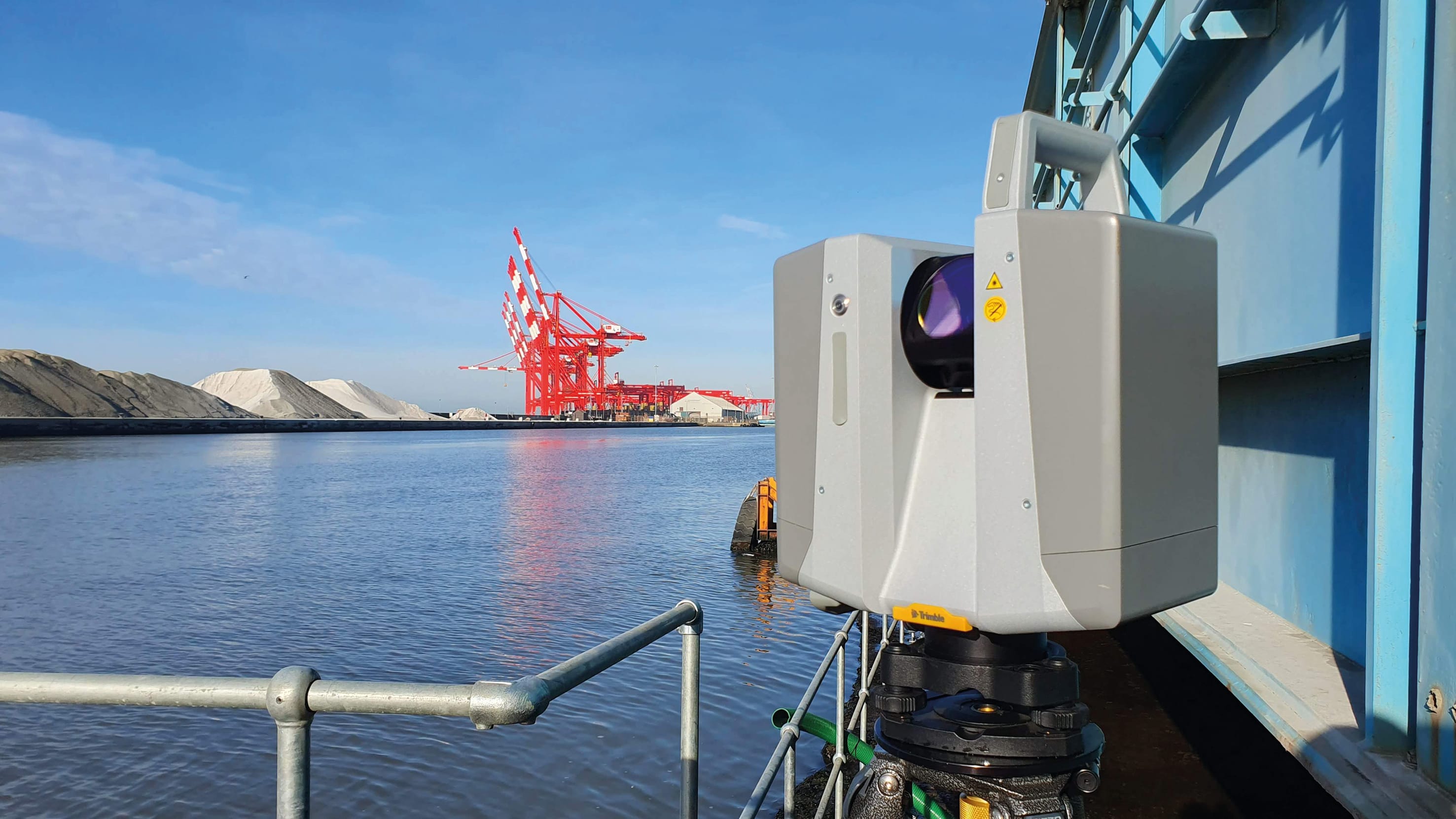
Terrestrial laser scanning captures the interior of the stadium — every concourse, stairwell, mechanical room, and seating section. This is where the majority of scan positions and field time accumulates.
Best Applications for Terrestrial Stadium Scanning
Seating bowl geometry: Precise capture of seat positions, step heights, handrail locations, and sightline geometry. This data supports accessibility verification, seating reconfiguration, and sightline analysis for broadcast camera placements.
Concourse and circulation: Complete dimensional documentation of concourse widths, ceiling heights, column locations, and egress routes. Critical for crowd flow analysis and renovation planning.
Back-of-house spaces: Locker rooms, press facilities, broadcast compounds, storage areas, loading docks, and service corridors. These areas are often the focus of renovation projects.
MEP infrastructure: Mechanical rooms, electrical switchgear, HVAC distribution, fire suppression systems, and utility corridors. Detailed MEP documentation requires high point density and multiple scan positions per room.
Structural elements: Column locations, beam depths, clearances, expansion joints, and load-bearing wall positions. Essential for any structural modification or retrofit design.
Terrestrial Equipment Comparison
| Scanner | Range | Speed | Best For |
|---|---|---|---|
| Trimble X12 | 365m | 2.2M pts/sec | Long-range bowl scans, large volumes |
| Leica RTC360 | 130m | 2M pts/sec | Rapid area coverage, automated registration |
| FARO Focus Premium | 70m | 1M pts/sec | Detailed MEP, complex interiors |
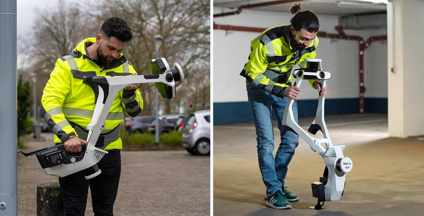
| NavVis VLX3 | 100m | Mobile | Large open concourses, rapid coverage |
Terrestrial Limitations for Stadiums
- Roof access: Cannot efficiently capture roof structures without physical access to the roof level
- Exterior facades: Upper portions of tall facades are inaccessible from ground level
- Large open spaces: Scanning the seating bowl from every necessary angle requires many positions
- Time-intensive: Each static scan position takes 2-5 minutes, and a major stadium requires thousands of positions
Why Most Stadiums Need Both
The Elland Road Stadium project — which required 5,250 scan positions — used terrestrial scanners, mobile mapping, and drone platforms because no single method covers the complete facility.
Coverage Gaps with Only One Method
Aerial only: Captures the roof and exterior accurately but leaves all interior spaces undocumented. For a renovation project, this misses 70-80% of the required data.
Terrestrial only: Captures all interior spaces but struggles with the roof structure, upper facades, and surrounding site. Exterior documentation is incomplete, and site survey data for campus modifications is missing.
The Hybrid Approach
The standard methodology for comprehensive stadium documentation combines all three:
- Terrestrial static scanning for interior spaces requiring high accuracy (seating bowls, mechanical rooms, structural elements)
- Mobile mapping for large interior areas where speed is more important than maximum accuracy (concourses, parking structures, storage areas)
- Drone LiDAR + photogrammetry for the building exterior, roof, and surrounding site
This hybrid approach captures the complete facility with the right tool for each area, optimizing both data quality and field time efficiency.
Cost Comparison
| Scope | Aerial Only | Terrestrial Only | Combined |
|---|---|---|---|
| Equipment mobilization | $2,000–$4,000 | $3,000–$6,000 | $4,000–$8,000 |
| Field work (per day) | $3,000–$5,000 | $4,000–$7,000 | $5,000–$9,000 |
| Typical field days | 1–2 days | 5–15 days | 6–16 days |
| Data processing | $3,000–$8,000 | $10,000–$30,000 | $12,000–$35,000 |
| Total estimate | $8,000–$20,000 | $30,000–$120,000 | $35,000–$150,000 |
The combined approach costs approximately 10-15% more than terrestrial-only, but delivers dramatically more complete coverage. The aerial component adds 1-2 days of field work and moderate processing costs to capture the entire exterior — data that would otherwise be unavailable.
For detailed cost breakdowns by project type, see our stadium 3D scanning cost guide.
Deliverable Differences
From Aerial Scanning
- Georeferenced point cloud of exterior surfaces and site
- Orthomosaic map of the stadium campus (high-resolution top-down photo)
- Digital Terrain Model (DTM) of the surrounding site
- Roof condition assessment imagery
- 3D mesh model of the building exterior
From Terrestrial Scanning
- High-accuracy interior point cloud (±2-5mm)
- Panoramic photo documentation of every scanned space
- Extracted 2D floor plans, sections, and elevations
- BIM-conversion-ready scan data for renovation design
- Virtual walkthrough capability
From the Combined Dataset
- Unified, georeferenced 3D model of the complete facility
- Interior-to-exterior spatial relationships verified
- Full building envelope documentation (no gaps)
- Comprehensive digital twin foundation
Decision Framework
Use this framework to determine the right scanning approach for your stadium project:
Aerial scanning only is appropriate when:
- You need only exterior/roof documentation
- The project scope is limited to site planning or campus modifications
- Budget is limited and interior data is not required
Terrestrial scanning only is appropriate when:
- The project focuses exclusively on interior renovation or space planning
- The roof and exterior are already documented or not relevant
- Airspace restrictions prevent drone operations
Combined approach is appropriate when:
- You are creating a comprehensive digital twin
- The project involves both interior and exterior modifications
- You need a complete facility record for ongoing operations
- The data will serve multiple stakeholders (architects, engineers, security, operations)
For most serious stadium documentation projects, the combined approach is the standard recommendation.
Frequently Asked Questions
Is drone scanning accurate enough for stadium work? Drone LiDAR achieves ±20-50mm accuracy, which is excellent for exterior documentation, site surveys, and roof condition assessment. Interior work requiring ±2-5mm accuracy uses terrestrial scanners. The two datasets complement each other.
Can terrestrial scanners capture the seating bowl? Yes, but it requires many scan positions due to the bowl geometry creating occlusions. Long-range scanners like the Trimble X12 (365m range) can capture the bowl from the pitch level, but additional positions at various heights ensure complete coverage.
How do you combine aerial and terrestrial data? A common survey control network links both datasets. Ground control points — visible to both terrestrial scanners and drone cameras — serve as reference markers for aligning the two datasets into a single coordinate system.
Which method is faster for stadiums? Aerial scanning is dramatically faster for coverage — a drone can scan the entire exterior and site in 1-2 days. Terrestrial scanning is inherently slower due to the number of individual positions required, typically taking 1-3 weeks for a full interior.
Learn more about our aerial LiDAR scanning and interior 3D laser scanning services for stadiums. For a complete overview, visit our stadium scanning services hub or read our stadium scanning educational guide.
Ready to Start Your Project?
Get a free quote and consultation from our 3D scanning experts.
Get Your Free Quote

