Xgrids L2 Pro vs NavVis VLX 3: Native Gaussian Splatting vs Facility SLAM
An expert comparison to help you choose the right equipment for your project.
| Feature | Xgrids Lixel L2 Pro | NavVis VLX 3 |
|---|---|---|
| Form Factor | Handheld | Wearable |
| LiDAR Sensors / Channels | 32 channels (also available in 16-channel model) | 2× 32-layer sensors |
| Point Rate | 640,000 pts/sec (32-ch) / 320,000 pts/sec (16-ch) | 1,280,000 pts/sec (2 × 640,000) |
| Range | 0.5–120m (standard) / up to 300m (select 32-ch model) | Up to 50 m |
| Accuracy | <1–2cm relative; <3cm absolute | 5 mm local, 1 sigma (500 m² test environment) |
| Cameras | 2 × 48MP panoramic (RGB colorization via LixelUpSample) | 4 × 20MP |
| SLAM | Multi-SLAM AI (real-time point clouds) | LiDAR SLAM |
| Processing Software | Lixel CyberColor (LCC) — native Gaussian Splatting output | NavVis IVION |
| Weight | 1.7kg (without battery) | 8.5 kg |
Pricing shown reflects average US rates — indicative ranges, not a quote. Actual costs vary by location based on local market conditions, regulations, and project logistics — both within the US and internationally. Get a custom quote
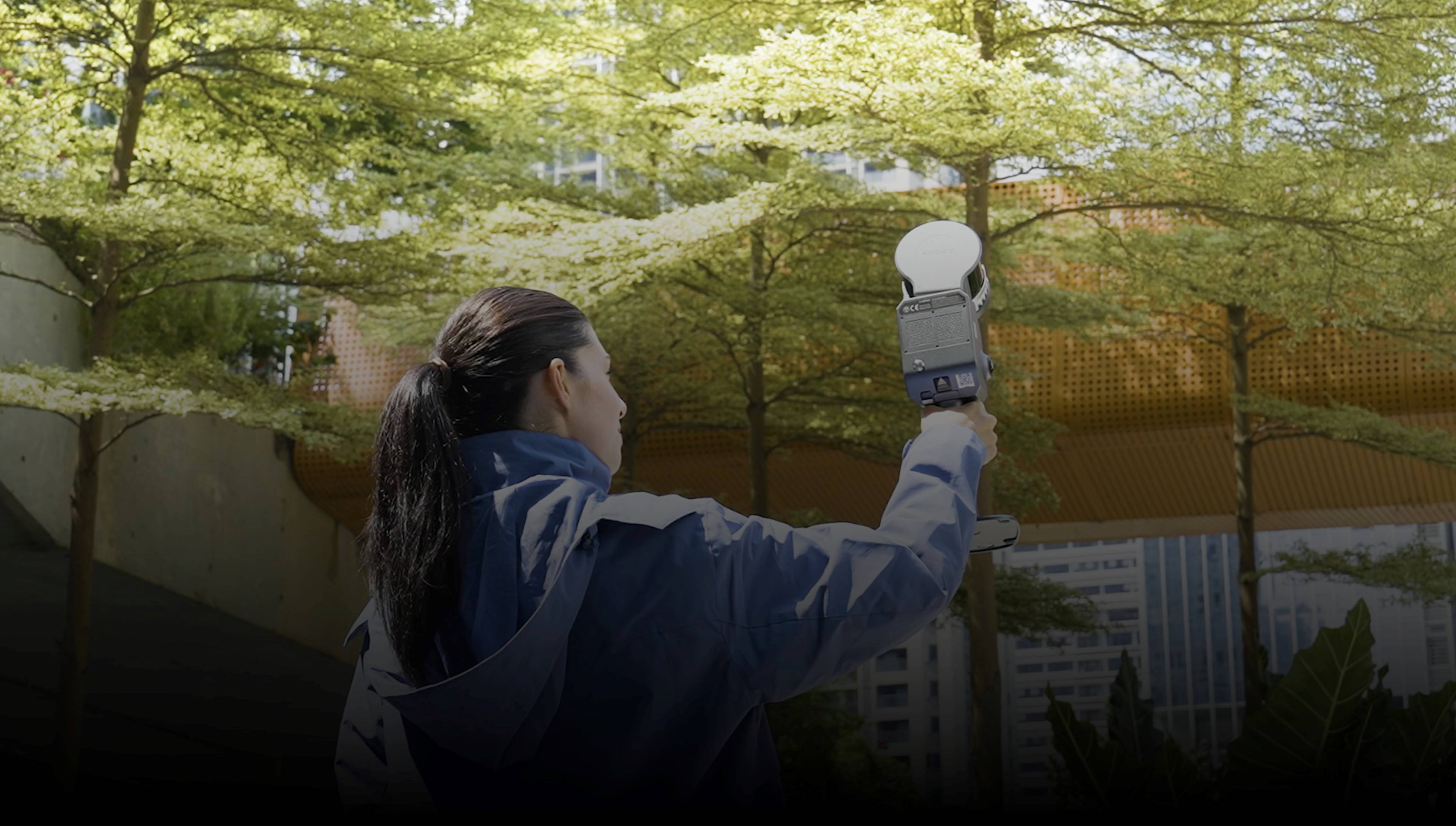
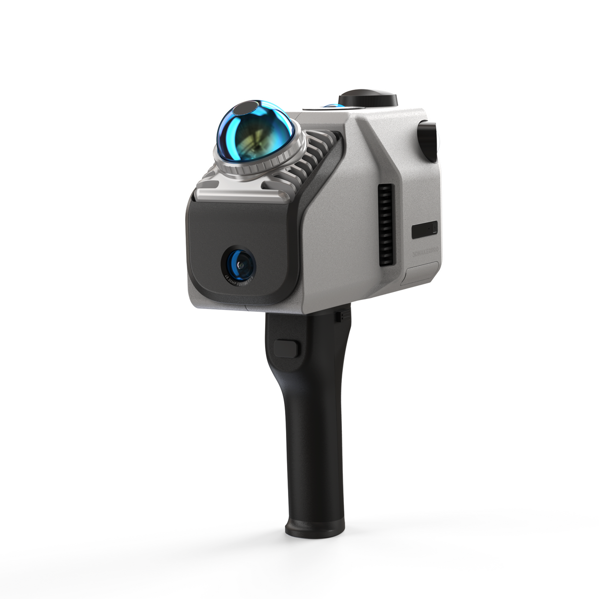
Xgrids Lixel L2 Pro
Handheld SLAM Scanner with Native Gaussian Splatting
The Xgrids Lixel L2 Pro is a 32-channel handheld SLAM scanner capturing 640,000 points/sec with <1-2cm relative accuracy, dual 48MP cameras, and native Gaussian Splatting output via Lixel CyberColor (LCC) software. It carries the only GS-to-BIM Revit plugin on the market plus SDKs for Unity, Unreal Engine, and WebGL, so a single walk-through can produce both an engineering point cloud and a photorealistic splat scene.
Pros
- Native Gaussian Splatting output via Lixel CyberColor (LCC) software
- Only GS-to-BIM Revit plugin on the market (LCC for Revit)
- SDKs for Unity, Unreal Engine, and WebGL — game engine ready
- High point density (up to 1M pts/m² at 1mm spacing) without post-processing
- Long reach for a handheld — 120m standard, up to 300m on select 32-channel models
- Lightweight (1.7kg) with a 1 TB onboard SSD and IP54 sealing
Cons
- Proprietary GS format (LCC) — not standard PLY
- Processing: roughly 1 hour per 3-minute scan in LCC
- Higher price point (~$15,000-$25,000 system)
- Requires the LCC software ecosystem for GS features
- Centimeter-class accuracy — well short of the VLX 3 millimeter specification
Best For
NavVis VLX 3
Flagship Wearable SLAM Scanner for Large Facilities
The NavVis VLX 3 is the flagship wearable scanner, combining dual 32-layer LiDAR sensors for 1,280,000 points/sec (2 × 640,000, datasheet v2409) with LiDAR SLAM and four 20MP cameras. NavVis publishes 5mm local accuracy, 1 sigma, in a dedicated 500 m² test environment, with physical control-point support to constrain absolute accuracy. It is built for rapid documentation of large, multi-floor facilities, with output processed in NavVis IVION for digital twin delivery.
Pros
- Continuous walk-through capture with no tripod setups
- Handles stairs and elevators
- Real-time visual feedback on data coverage
- IVION cloud processing included
- Millimeter-class local accuracy — 5 mm, 1 sigma, in NavVis' 500 m² test environment
- Digital twin ready output
Cons
- Requires training
- IP42 only — limited protection against water
- 8.5 kg worn on the body versus 1.7 kg handheld
- 50 m range ceiling limits long-shot capture of tall or distant surfaces
Best For
Our Expert Verdict
This is an accuracy-and-throughput system versus a visualization-and-BIM system. The NavVis VLX 3 is the stronger measurement instrument by a wide margin — 5mm local accuracy (1 sigma, NavVis' 500 m² test environment) and 1,280,000 pts/sec across its dual 32-layer sensors, captured continuously on foot. The Xgrids Lixel L2 Pro trades that precision for centimeter-class accuracy in a 1.7kg handheld with far longer reach (up to 300m on select 32-channel models) and, uniquely, native Gaussian Splatting through LCC plus the only GS-to-BIM Revit plugin available. If the deliverable is a measurable digital twin of a large facility, the VLX 3 leads. If the deliverable includes photorealistic splat scenes or game-engine assets, the L2 Pro does something the VLX 3 does not.
Choose Xgrids Lixel L2 Pro if...
Choose the Xgrids Lixel L2 Pro when the deliverable includes Gaussian Splatting — photorealistic walkthroughs, Unity/Unreal/WebGL assets, or GS data that has to land inside Revit through the LCC plugin — and centimeter-class geometry is acceptable.
Choose NavVis VLX 3 if...
Choose the NavVis VLX 3 when accuracy and coverage rate drive the project: large multi-floor facilities, deadline-driven as-built documentation, and digital twins where 5mm-class local accuracy is the requirement.
Download the Spec Sheets
Original manufacturer documents, free with no email required — verified against each manufacturer's live copy.
Browse the full library: Equipment Spec Sheets & Downloads →
Frequently Asked Questions
Which scanner is more accurate?
The NavVis VLX 3. It is specified at 5mm local accuracy (1 sigma, 500 m² test environment) with physical control-point support to constrain absolute accuracy — NavVis publishes no figure for the result with control points. The Xgrids Lixel L2 Pro is specified at <1-2cm relative and <3cm absolute — a 2-4× difference that is decisive for measurement-critical as-built work.
Which captures more area per day?
The VLX 3. Its dual 32-layer sensors capture 1,280,000 points per second continuously while walking, and it handles stairs and elevators. The L2 Pro captures 640,000 pts/sec in its 32-channel configuration (320,000 in the 16-channel model). Neither manufacturer publishes an area-per-day figure.
Which one produces Gaussian Splatting?
Only the Xgrids Lixel L2 Pro. Its Lixel CyberColor (LCC) software outputs Gaussian Splatting natively, and Xgrids ships the only GS-to-BIM Revit plugin on the market along with SDKs for Unity, Unreal Engine, and WebGL. NavVis VLX 3 data is processed in NavVis IVION for point cloud and digital twin delivery.
How different are they to carry?
Substantially. The L2 Pro is a 1.7kg handheld unit (without battery). The VLX 3 is an 8.5 kg wearable system. Over a long capture day that difference shapes operator fatigue and how tight a space you can work in.
Which has the longer range?
The L2 Pro. It covers 0.5-120m as standard, with select 32-channel models reaching up to 300m. The VLX 3 is rated at up to 50m operational range, which is ample for interiors but limits capture of tall bays, distant facades, or open exterior areas.
Are either of these suited to outdoor work?
Both are primarily indoor and building-scale tools. NavVis rates the VLX 3 IP42 for indoor and outdoor use, which offers little protection against rain; the L2 Pro is described as indoor and building-scale focused rather than a solution for large outdoor areas, though it carries an IP54 rating and the longer range of the two. Large exterior sites are better served by drone-based capture.
Professional Equipment In This Comparison
The professional equipment in this comparison, compared spec by spec. Specifications shown are the manufacturers' published figures. Models THE FUTURE 3D operates are identified on their own pages.
Similar Equipment You Might Compare
Professional Services Using This Equipment
The Future 3D delivers these professional services with its own equipment fleet — each service page names the instruments we deploy.
3D Virtual Tours
Immersive Matterport virtual tours for properties and spaces
3D Laser Scanning
Millimeter-accurate point cloud capture with Trimble and NavVis
Scan-to-BIM
BIM-conversion-ready 3D laser scan data in E57, RCP, LAS, and OBJ
Digital Twins
Living 3D models with real-time IoT integration
As-Built Documentation
Registered point clouds, 360° panoramas, and PDF reports from 3D scanning
Google Street View
Google Trusted Photographer services for business interiors
Industries That Benefit From This Technology
Xgrids Lixel L2 Pro and NavVis VLX 3 technology drives innovation across these key industries.
Schools & Education
Virtual campus tours, facility documentation, and safety planning
Real Estate
Immersive property tours and marketing assets
Retail
Store planning and virtual store tours
Hospitality
Hotel virtual tours and event space showcases
Insurance
Property documentation and claims support
Property Management
Portfolio documentation and move-in/out inspections
Available Nationwide
The Future 3D provides professional 3D scanning services across the United States.
Florida (Headquarters)
Northeast
West Coast
South & Midwest
Need Help Choosing?
Our experts can recommend the right equipment for your specific project requirements.