If you are evaluating 3D laser scanners for AEC (Architecture, Engineering, Construction) projects in 2026, three names dominate the conversation: FARO Focus Premium, Leica RTC360, and Trimble X12. Each has distinct strengths, and the right choice depends on your specific project requirements, workflow, and downstream software ecosystem.
This guide provides an independent, specification-based comparison of all three scanners. We use all of them professionally and can speak to real-world performance, not just marketing specifications.
Important note: We do not publish equipment prices in this guide. Scanner pricing changes frequently, varies by region and dealer, and often includes bundled software or service contracts that make list prices misleading. Contact the manufacturer or an authorized dealer for current pricing. The price tier indicators ($$$-$$$$) provide relative positioning only.
Scanner Specifications at a Glance
| Specification | FARO Focus Premium | Leica RTC360 | Trimble X12 |
|---|---|---|---|
| Range | 0.5m to 200m (90% reflectivity); 150m at 10%; 50m at 2% | 0.5m to 130m | 250m effective working range (365m ambiguity interval) |
| Point accuracy | 2mm at 10m / 3.5mm at 25m | 1.9mm at 10m / 2.9mm at 20m | 2.2mm at 20m (3D point accuracy); Trimble publishes no 10m figure |
| Scan speed | Up to 2M pts/sec | Up to 2M pts/sec | Up to 2.187M pts/sec |
| Scan time | Gray scale under 1 min; HDR colour under 1:15; Colour Flash Scan under 30 sec | Under 2 min for a complete full dome scan and spherical HDR image at 6mm at 10m resolution | 3:07 full dome (High quality) |
| Weight | 4.4 kg including battery | 5.35 kg nominal, without batteries | 6.7 kg (7.7 kg with batteries) |
| Field of view | 360 x 300 degrees | 360 x 300 degrees | 360 x 320 degrees |
| IP rating | IP54 | IP54 | IP54 |
| Integrated camera | 13 MPx HDR camera; up to 266 MPx colour (FARO brochure 11/2024) or 166 MP (FARO user manual 08/2025) | 3-camera 36 MP system, 432 MPx raw for the 360 x 300 degree spherical image; 1 min imaging speed for the full spherical HDR image | ~80 MP panorama (HDR, up to 11 exposures) |
| Levelling | Tilt compensation | IMU-based tilt, 18 arcsec accuracy for setups within plus or minus 10 degrees inclination | Dynamic dual-axis tilt compensation, range plus or minus 0.5 degrees (no self-levelling system) |
| On-board registration | Yes | Yes (automatic) | Yes (Trimble Perspective) |
| Battery life | ~4 hours | Up to ~4 hours on two internal batteries | ~2.5 hours per battery, ~5 hours with two fitted |
| Price tier | $$$$ | $$$$ | $$$$ |
All three scanners are survey-grade instruments that exceed the accuracy requirements of virtually all commercial AEC scanning projects. The differences between them are meaningful for specific use cases but marginal for general building documentation.
FARO Focus Premium
Overview
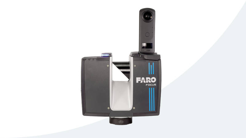
The FARO Focus Premium is the latest generation of FARO’s long-established Focus line. FARO has been the market share leader in terrestrial laser scanning for AEC applications for over a decade, and the Focus Premium continues that position with competitive specifications and a mature software ecosystem.
Strengths
Long range (200m at 90% reflectivity): The Focus Premium has the second-longest range of the three scanners, making it suitable for large outdoor environments, industrial plants, and open structures where scan subjects may be far from the scanner position. FARO’s longer-range sibling, the Focus Premium Max, reaches 400m.
Fast scanning: FARO publishes a Colour Flash Scan in under 30 seconds and a grey-scale scan in under a minute, measured from start until the scanner can be moved. For projects with hundreds of scan positions, this speed advantage adds up significantly over the course of a multi-day project.
Mature software ecosystem: FARO SCENE is the processing software for Focus scanners. It is well-established, widely known in the industry, and integrates cleanly with Autodesk products, particularly ReCap and Revit. Most BIM teams have experience working with FARO data.
Lightweight (4.4 kg including battery): The Focus Premium is the lightest of the three scanners, which matters when carrying equipment through multi-floor buildings, climbing ladders, or working in confined spaces.
HDR imaging: A 13 MPx HDR camera with 2x, 3x and 5x exposure bracketing produces high-quality colorized point clouds with good dynamic range — useful for projects where visual documentation is important alongside measurement data. FARO’s own documents differ on the resulting colour resolution: the 11/2024 brochure states up to 266 MPx, while the 08/2025 user manual states 166 MP.
Considerations
- Battery life is the longest of the three at approximately 4 hours, reducing the need for field battery swaps
- The FARO ecosystem is somewhat closed — SCENE is the primary processing path, though data can be exported to open formats
- On-board registration works well but is not as automated as the Leica VIS system for field verification
Best For
- High-volume commercial scanning where speed per scan matters
- Projects requiring long-range capture (industrial plants, outdoor structures)
- Teams already invested in the FARO/SCENE/ReCap workflow
- Field teams that prioritize lightweight equipment for portability
Leica RTC360
Overview
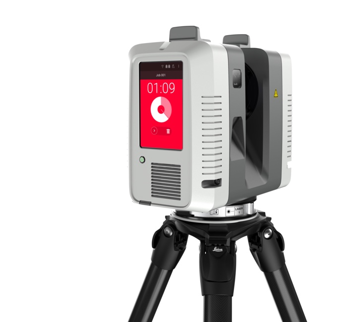
The Leica RTC360 introduced a significant workflow innovation with its Visual Inertial System (VIS), which automatically pre-registers scans in the field using on-board motion tracking. This reduces post-processing time and provides field teams with real-time quality feedback. It has become popular for projects where field efficiency and immediate QA are priorities.
Strengths
Automatic field registration (VIS): The RTC360’s Visual Inertial System tracks the scanner’s movement between positions and automatically pre-aligns scans as they are captured. Field technicians can see registration quality in real-time on the Cyclone FIELD 360 app, catching coverage gaps or registration issues before leaving the site.
Excellent color capture (36 MP): The RTC360’s three-camera 36 MP system captures 432 MPx of raw data for the calibrated 360 x 300 degree spherical image, producing rich, detailed colorization. For projects where visual documentation is as important as measurement (facility walkthroughs, heritage documentation), the Leica color quality is exceptional.
Streamlined field-to-office workflow: The RTC360 + Cyclone FIELD 360 + Cyclone REGISTER 360 pipeline is designed as an end-to-end workflow. Data captured in the field is pre-registered and can be brought into the office processing software with minimal additional work.
Compact and robust (IP54): The RTC360 is well-built and handles typical field conditions — dust, humidity, vibration during transport — reliably.
Considerations
- Shorter range (130m) compared to the FARO Focus Premium (200m) and Trimble X12 (250m effective working range) — this matters for large outdoor or industrial environments
- Leica rates the two internal batteries at typically up to 4 hours combined, so long scanning days still need spares
- Heavier than the FARO Focus Premium at 5.35 kg nominal, quoted without batteries
- The Leica/Cyclone ecosystem is powerful but has a steeper learning curve for teams new to Leica products
Best For
- Teams that prioritize field efficiency and real-time QA
- Projects with tight field schedules where on-site registration saves critical time
- Heritage and architectural documentation where color quality matters
- Organizations already invested in the Leica/Cyclone ecosystem
Trimble X12
Overview
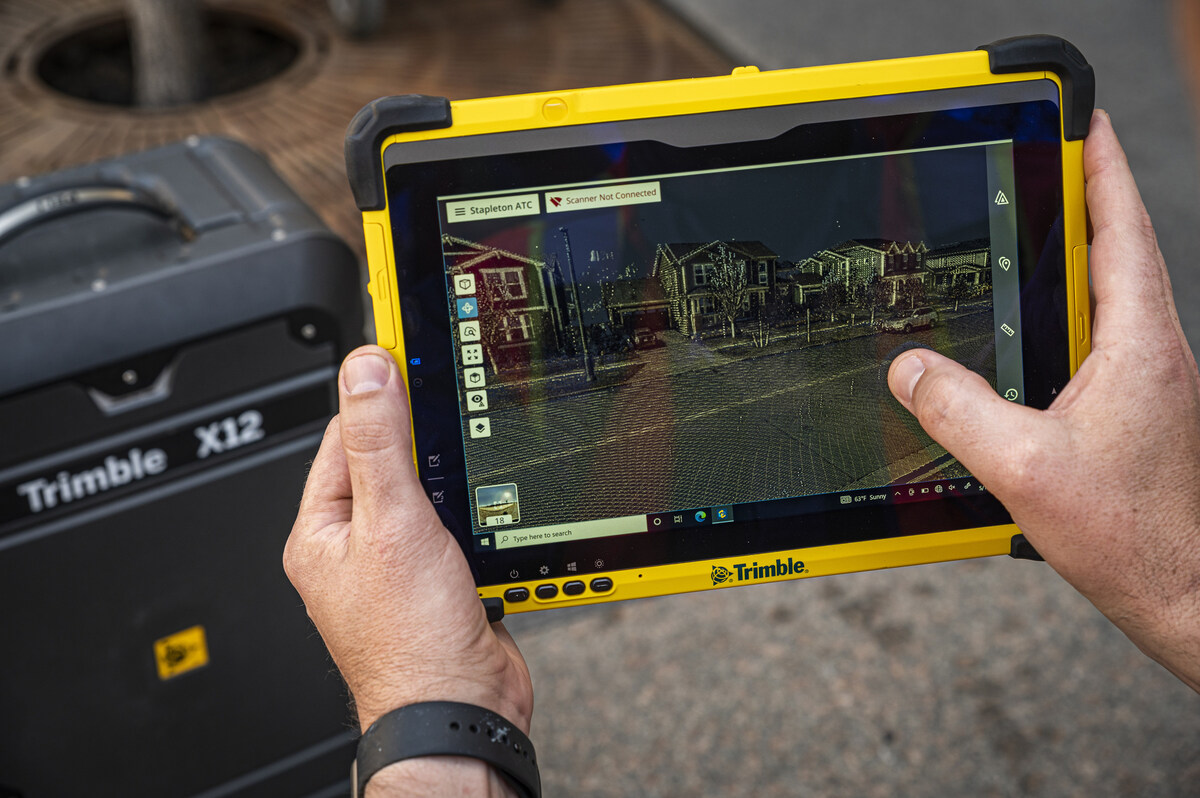
The Trimble X12 is Trimble’s flagship terrestrial laser scanner, designed for survey-grade accuracy with a focus on integration with Trimble’s broader survey and geospatial ecosystem. It is the scanner THE FUTURE 3D deploys as our primary instrument for commercial scanning projects.
Strengths
Longest range of the three (250m effective working range): Trimble publishes a 250m effective working range and a 365m ambiguity interval, giving the X12 the longest reach of these three scanners and making it a strong choice for large industrial environments, outdoor scanning, and projects where scan positions may be far from the subject.
Survey-grade integration: The Trimble X12 integrates natively with Trimble survey controllers, GNSS receivers, and total stations. For projects that require georeferenced data tied to survey control networks, the Trimble ecosystem provides the most seamless workflow from field to coordinate system.
Trimble Perspective: The X12’s processing software, Trimble Perspective, provides point cloud registration, visualization, and export capabilities. It produces clean, well-registered datasets in standard formats.
IP54 rating: The X12 is rated IP54 for dust and water-spray protection — the same class as the other two scanners here — which covers scanning on active construction sites, in outdoor environments, and in industrial facilities.
High scan speed (2.187M pts/sec): The X12 captures the most points per second of the three scanners, though real-world scan time also depends on resolution settings and field-of-view configuration.
Considerations
- A full-dome scan at High quality takes 3:07, which is longer than the FARO Focus Premium’s fastest mode (though at different resolution settings, times can vary)
- The Trimble ecosystem is most valuable when you also use Trimble GNSS, total stations, and survey workflows — teams without Trimble survey equipment lose some of the integration advantage
- At 6.7 kg bare (7.7 kg with batteries fitted), it is the heaviest of the three scanners
Best For
- Survey firms and teams that need integration with Trimble survey equipment and coordinate systems
- Long-range scanning applications (large industrial, outdoor, infrastructure)
- Projects requiring georeferenced data tied to survey control networks
- Harsh field conditions (IP54 protection)
Head-to-Head Comparison by Use Case
Commercial Office Building Renovation
Recommended: Any of the three — all are excellent choices for standard commercial scanning. The FARO Focus Premium’s speed advantage makes it slightly more efficient for high scan-count projects. The Leica RTC360’s automatic registration reduces post-processing time. The Trimble X12’s range is not a significant advantage in interior commercial spaces.
Industrial Plant or Refinery
Recommended: Trimble X12 or FARO Focus Premium. Long range is essential in open industrial environments where equipment may be 100+ meters from the scanner position. The Leica RTC360’s 130m range can be limiting in large outdoor/industrial settings.
Heritage and Historic Buildings
Recommended: Leica RTC360 for its superior color capture and imaging quality. Heritage documentation often requires high-quality visual records alongside measurement data. The 432 MPx spherical capture produces the richest colorized point clouds.
Multi-Site Portfolio Scanning
Recommended: FARO Focus Premium for speed and portability. When scanning multiple buildings per day (common in portfolio-wide facility documentation), the FARO’s lighter weight and faster scan times add up to measurably more coverage per day.
Survey-Controlled Projects
Recommended: Trimble X12 for its native integration with Trimble survey controllers and GNSS receivers. If the project requires state plane coordinates or survey-grade georeferencing, the Trimble workflow from scan to coordinated dataset is the most streamlined.
Data Center Documentation
Recommended: Any of the three work well in data center environments. All produce the accuracy needed for retrofit planning. The FARO Focus Premium’s speed is advantageous in high scan-count environments like dense server halls. The Leica RTC360’s field registration is valuable for real-time QA in security-restricted environments where return visits are difficult to arrange.
Software Ecosystems Compared
The scanner choice often drives (or is driven by) the software ecosystem. Here is how the three platforms compare:
| Feature | FARO SCENE | Leica Cyclone | Trimble Perspective |
|---|---|---|---|
| Registration method | Target + cloud-to-cloud | VIS + target + cloud-to-cloud | Target + cloud-to-cloud |
| Processing speed | Fast (optimized for FARO data) | Moderate to fast | Moderate |
| E57 export | Yes | Yes | Yes |
| RCP/RCS export | Yes (direct) | Yes (direct) | Yes (via export) |
| LAS export | Yes | Yes | Yes |
| Revit integration | Strong (via ReCap) | Strong (via ReCap or CloudWorx) | Strong (via ReCap or Trimble Connect) |
| Cloud processing | FARO Sphere | Leica Cyclone REGISTER 360 (PLUS) | Trimble Connect |
| Mobile field app | FARO Connect | Cyclone FIELD 360 | Trimble Perspective (field) |
All three ecosystems can produce deliverables in the formats your downstream teams need. The choice often comes down to what your organization already uses and what your team is trained on.
For a broader view of software options beyond the scanner manufacturers’ platforms, see our point cloud software comparison tool.
What About Mobile/SLAM Scanners?
This comparison focuses on tripod-mounted terrestrial scanners — the survey-grade instruments used for precision measurement. Mobile/SLAM scanners (NavVis VLX3, Leica BLK2GO, GeoSLAM ZEB series) serve a different purpose:
- Faster capture: Walk through a building instead of setting up tripod positions
- Lower accuracy: Typically plus or minus 5-15mm vs plus or minus 1-4mm for terrestrial
- Best for: Facility management, space planning, large-area coverage where speed matters more than precision
Mobile scanners are not replacements for terrestrial scanners on projects requiring engineering-grade accuracy. They are complementary tools for different use cases. Learn more about how 3D scanning works and the role of different scanner types.
What About Newer Entrants?
Several other manufacturers produce scanners that compete in the AEC space:
- Leica BLK360 G2: Compact, affordable entry point — excellent for small projects but with reduced range and accuracy vs. the RTC360
- Z+F IMAGER 5016: Strong performer in the European market with excellent accuracy specifications
- Riegl VZ-400i: Premium long-range scanner popular in mining, surveying, and infrastructure
For most AEC clients in the U.S. market, the FARO/Leica/Trimble trio covers the vast majority of project requirements.
How THE FUTURE 3D Chooses Scanners
We deploy the Trimble X12 as our primary scanner because of its survey-grade accuracy, long range, and integration with survey control workflows. For projects requiring georeferenced data, the Trimble ecosystem provides the most efficient path from field scanning to coordinated deliverables.
We also deploy supplemental equipment (NavVis VLX3, Trimble X9) for projects where mobile scanning or different capture workflows better serve the client’s needs. Equipment selection is driven by project requirements, not by what we happen to own.
The scanner is a tool. What matters more than the scanner brand is the team operating it, the methodology they follow, and the quality of the delivered data. A skilled team with any of the three scanners in this comparison will produce excellent results. An inexperienced team with the most expensive scanner on the market will not.
Frequently Asked Questions
Which scanner is the most accurate?
On published 3D point accuracy the Leica RTC360 leads at 1.9mm at 10m, with the FARO Focus Premium at 2mm at 10m. However, real-world project accuracy depends on many factors beyond single-point accuracy: registration quality, survey control, environmental conditions, and scan overlap. All three scanners deliver accuracy that exceeds the requirements of virtually all commercial AEC projects. The practical accuracy difference between them in a real building environment is negligible.
Which scanner is best for beginners?
The Leica RTC360 has the most automated field workflow thanks to the VIS automatic registration system. Field technicians receive immediate feedback on scan quality and coverage, reducing the learning curve for new operators. The FARO Focus Premium and Trimble X12 require more manual attention to scan planning and post-processing registration.
Do I need to know what scanner my scanning provider uses?
Yes. Knowing the scanner model tells you the accuracy class, range capability, and software ecosystem of the data you will receive. A provider using a Matterport Pro3 (consumer-grade) is not delivering the same quality as one using a Trimble X12 or FARO Focus Premium. Always ask, and be wary of providers who cannot or will not tell you. Our guide on hiring a scanning company covers this in detail.
Can data from different scanner brands be combined in one project?
Yes. Point cloud data from any scanner can be exported to E57 (the universal exchange format) and combined in processing software like CloudCompare, Autodesk ReCap, or Leica Cyclone. This is common on large projects where multiple scanning teams or multiple scanner types are deployed.
Which scanner is cheapest?
We do not publish equipment prices as they change frequently and vary by region, dealer, and bundled services. All three scanners are in the same general price tier ($$$$) — these are professional instruments representing significant capital investments. Contact the manufacturers or authorized dealers for current pricing. For project budgeting, what matters is the service cost per square foot, not the equipment cost.
Does THE FUTURE 3D use only Trimble scanners?
The Trimble X12 is our primary scanner for most commercial projects. We also deploy the Trimble X9 and NavVis VLX3 for projects where their specific capabilities (faster mobile capture, different scan densities) better serve the client’s needs. Scanner selection is project-driven.
Need a scanning provider who matches the right equipment to your project? Request a quote or explore our 3D laser scanning services.
Ready to Start Your Project?
Get a free quote and consultation from our 3D scanning experts.
Get Your Free Quote