The North Sea is the world’s most concentrated offshore wind energy zone. With over 30 GW of installed capacity across the United Kingdom, Germany, Denmark, the Netherlands, Belgium, and Norway, and with ambitions to reach 120+ GW by 2030, the region presents the single largest opportunity for dock-based drone inspection operations in the European energy sector.
Inspecting offshore wind turbines is expensive, dangerous, and logistically complex. Each turbine requires regular blade inspection, tower assessment, foundation monitoring, and substation checks. Traditional methods involve rope access teams, crewed vessels, and occasionally manned helicopters. Dock-based drones deployed from vessels operating near the wind farm can dramatically reduce the cost and risk of these inspections while improving coverage and data quality.
Why Offshore Wind Needs Dock-Based Drones
Scale of the Inspection Challenge
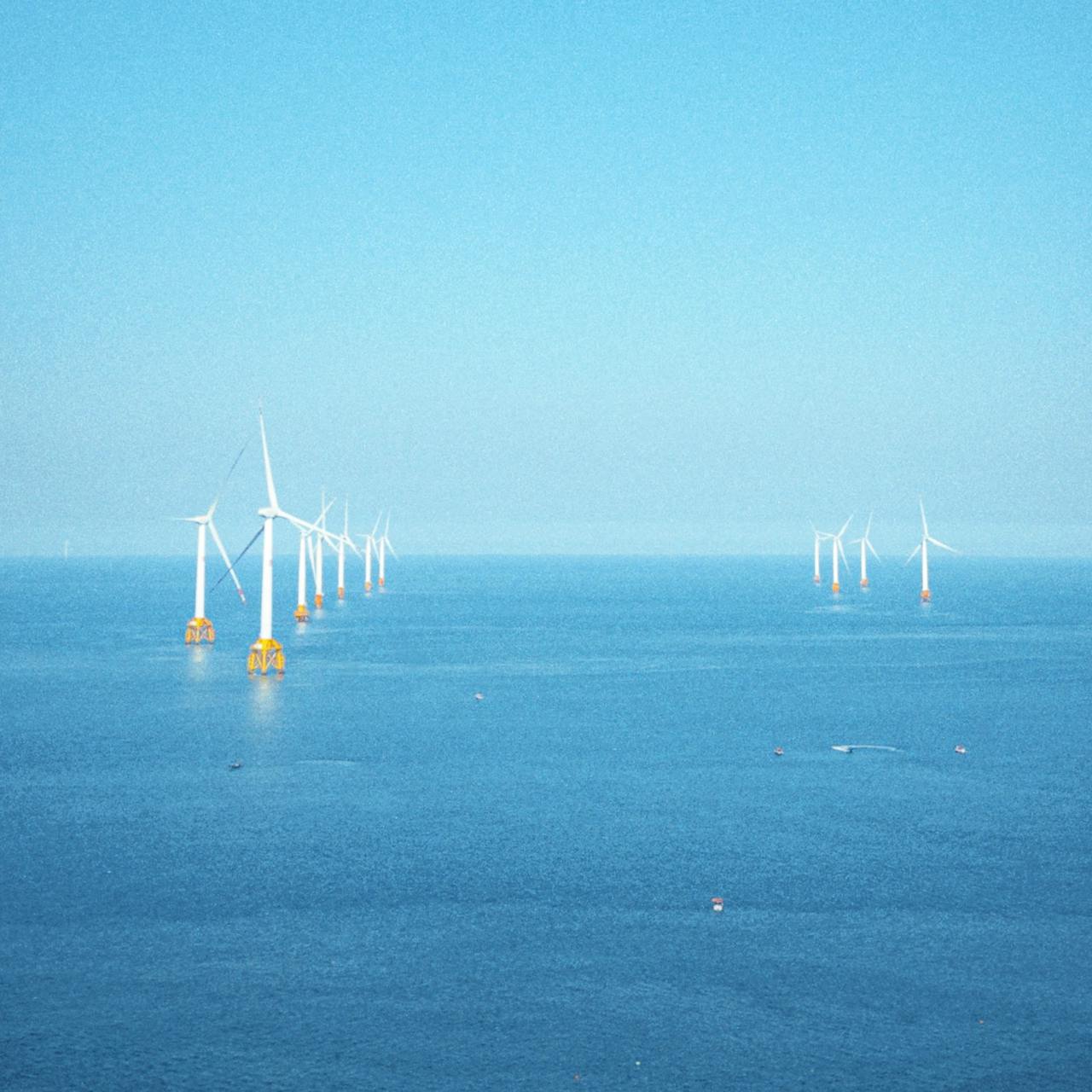
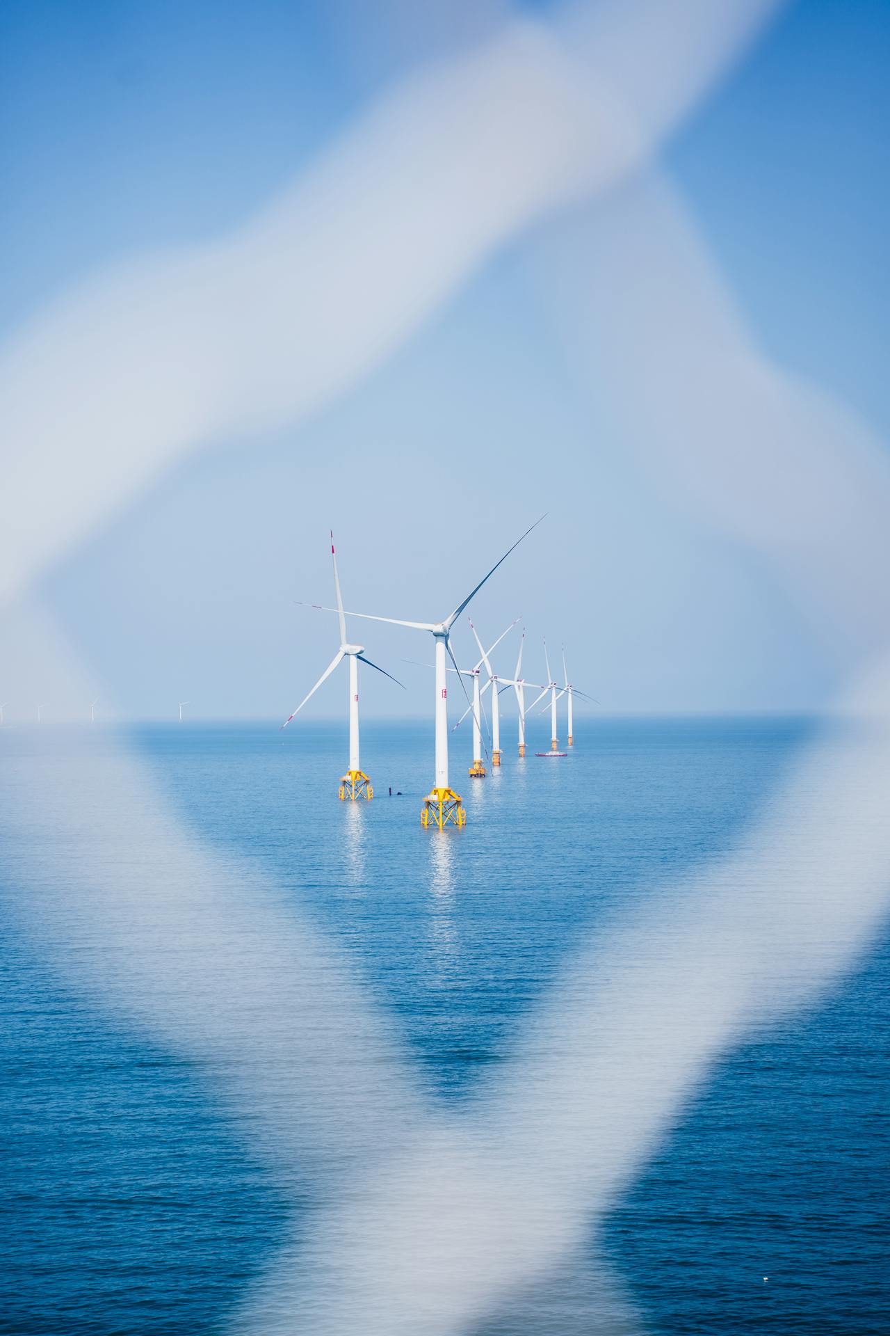
A typical North Sea wind farm contains 50-100+ turbines, each standing 150-250 metres above sea level with blade lengths of 80-115 metres. Inspecting a single turbine using rope access takes a qualified team an entire day. A wind farm of 80 turbines requires months of inspection time using traditional methods.
A dock-based drone can inspect multiple turbines per day, covering blade surfaces, tower sections, and transition pieces with high-resolution imagery and thermal data. Where a rope access team inspects one turbine per day, a vessel-mounted dock system can survey 4-8 turbines per day depending on conditions.
Safety
Offshore rope access is among the most hazardous industrial activities. Technicians work at height, over water, in variable weather conditions, with helicopter or vessel transfer to the turbine. Every minute of human exposure offshore carries risk.
Dock-based drone inspection eliminates the need for personnel to climb turbines for routine visual inspection. The drone launches from the vessel deck, flies to the turbine, captures imagery, and returns. The human operator remains safely on the vessel.
Weather Window Utilisation
North Sea weather limits offshore operations to specific windows. Human activities require minimum sea states, visibility, and wind conditions for safe transfer and work at height. Drone operations have less restrictive weather requirements and can be launched rapidly when conditions are marginal for human work but safe for flight.
The dock’s integrated weather station and automatic flight management system maximises the utilisation of available weather windows by launching automatically when conditions are suitable and aborting when they deteriorate.
Vessel-Mounted Dock Deployment
Offshore wind farms require vessel-mounted rather than fixed dock installations. The dock is mounted on the deck of a Service Operation Vessel (SOV), Crew Transfer Vessel (CTV), or dedicated survey vessel.
How It Works
- The inspection vessel positions itself near the wind farm
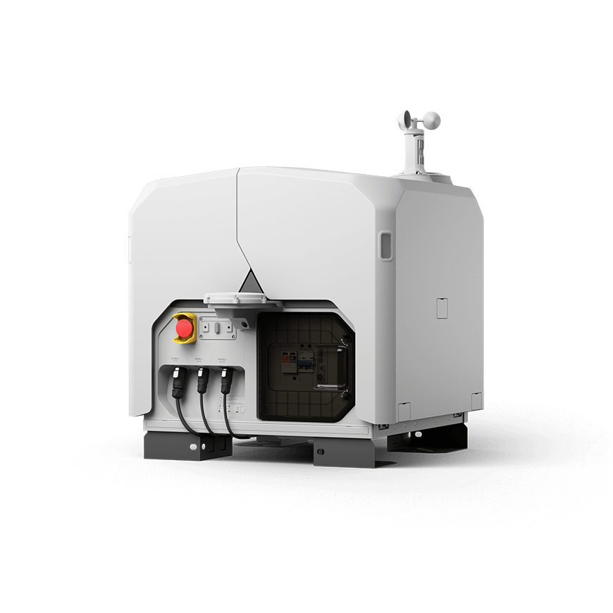
- The DJI Dock 3 (or equivalent vessel-rated dock) is secured to the vessel deck
- The dock launches the drone (Matrice 4D for RGB/LiDAR or Matrice 4TD for thermal)
- The drone flies to the target turbine and executes the inspection flight plan
- The drone returns to the vessel deck for battery change and data upload
- The process repeats for the next turbine
The vessel can reposition between turbines while the drone is flying, or the drone can transit between turbines within battery range. Flight planning accounts for vessel movement, wind conditions, and turbine spacing.
Why the DJI Dock 3 Is Mandatory for Offshore
The Dock 3’s specifications make it the only current DJI dock suitable for offshore deployment:
IP56 rating. The North Sea delivers persistent salt spray, horizontal rain, and storm-driven water. The Dock 2’s IP55 rating is insufficient for prolonged maritime exposure. IP56 provides protection against powerful water jets, which is the minimum requirement for offshore operations.
-30°C operating temperature. North Sea winter temperatures, combined with wind chill on an exposed vessel deck, can drop well below the Dock 2’s -25°C limit. The Dock 3’s -30°C rating provides operational margin for year-round deployment.
12 m/s operational wind limit. Average North Sea wind speeds are 8-10 m/s. The Dock 2’s 8 m/s operational limit would ground the drone on the majority of North Sea operating days. The Dock 3’s 12 m/s limit allows flight on most days when the vessel itself can safely operate.
Vehicle/vessel mounting. The Dock 3 is purpose-designed for mobile mounting, including marine applications. The Dock 2 is a fixed installation product not designed for the dynamic loads of vessel-mounted deployment.
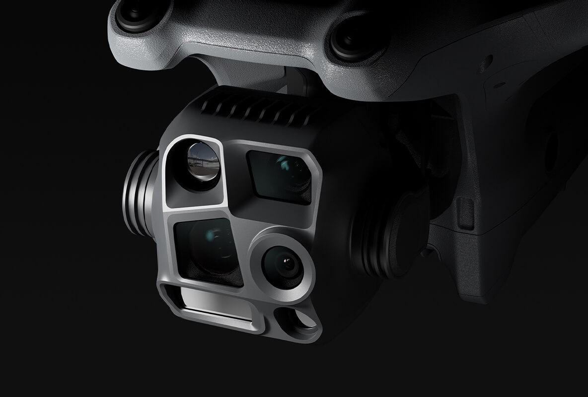
What Drone Inspection Captures
Blade Surface Inspection
Blade inspection is the primary value driver for offshore wind drone operations. The drone flies a programmed path along each blade, capturing:
- Leading edge erosion — The most common blade defect, caused by rain, salt, sand, and particle impact at tip speeds exceeding 300 km/h. High-resolution imagery reveals erosion patterns, coating loss, and surface roughness changes.
- Lightning strike damage — Lightning receptors and down-conductor damage visible in close-range imagery. Thermal imaging reveals internal heating that indicates conductor failure.
- Cracks and delamination — Surface cracks, trailing edge splits, and bonding line failures visible in RGB imagery. Thermal imaging can detect subsurface delamination through differential heating patterns.
- Ice damage — Relevant for turbines in the northern North Sea (Norwegian, Danish sectors). Post-icing inspections document blade condition after ice events.
Tower and Transition Piece
The drone captures the full tower surface from nacelle to foundation:
- Coating condition and corrosion progression
- Weld integrity on transition pieces (J-tube welds, grouted connections)
- Marine growth extent above and below splash zone (above-water only for drones)
- Access ladder and platform structural condition
Substation and Balance of Plant
Offshore substations, meteorological masts, and accommodation platforms are also inspected during dock-based operations:
- External structural condition
- Cable entry point integrity
- Fire detection equipment positioning
- Signage and marking compliance
Country-Specific Context
United Kingdom
The UK has the world’s largest installed offshore wind capacity (approximately 15 GW as of 2026), concentrated in the North Sea (Dogger Bank, Hornsea, East Anglia) and Irish Sea (Walney, Burbo Bank). The Crown Estate manages seabed leasing. UK CAA regulates drone operations independently from EASA since Brexit, using CAP 722 for BVLOS authorization.
Germany
Germany’s North Sea and Baltic Sea wind farms total approximately 8.5 GW, with a national target of 30 GW by 2030. Key clusters include Borkum Riffgrund, Nordsee One, and DanTysk. The BSH (Federal Maritime and Hydrographic Agency) manages offshore site allocation. LBA handles BVLOS authorization through EASA SORA.
Denmark
Denmark pioneered offshore wind with the world’s first offshore wind farm (Vindeby, 1991, now decommissioned). Current capacity exceeds 2 GW with major expansion planned (energy islands, Hesseloe, North Sea clusters). Trafikstyrelsen processes BVLOS applications.
Netherlands
Dutch North Sea wind farms include Borssele, Hollandse Kust, and IJmuiden Ver. Total capacity is approximately 4.7 GW. The Netherlands has been a U-space pioneer, with the Port of Rotterdam corridor providing experience directly transferable to offshore drone operations. ILT handles BVLOS authorization.
Norway
Norway’s first large-scale floating offshore wind farms are under development (Hywind Tampen operational, Sorno-Norwegian projects planned). The floating foundation technology creates unique inspection requirements compared to fixed-bottom turbines. Luftfartstilsynet processes BVLOS applications through EASA.

EASA Compliance for Offshore Operations
Maritime BVLOS operations require SORA authorization with specific considerations:
Operational volume. Defined over water, which typically has zero ground population density. This results in low GRC values, simplifying one dimension of the risk assessment.
Air risk. Offshore wind farms are typically in restricted airspace zones or maritime safety areas with minimal manned aviation traffic. ARC values are generally low, though proximity to helicopter routes serving the wind farm must be assessed.
Emergency procedures. Over-water operations require specific emergency protocols: drone ditching procedures, flotation or recovery provisions, and coordination with the vessel bridge team.
Maritime coordination. The dock operator must coordinate with vessel operations, wind farm control rooms, and maritime traffic management. Communication protocols between the drone remote pilot and the vessel master must be documented in the ConOps.
Check your country’s regulatory readiness with our BVLOS Compliance Checker.
Getting Started with Offshore Wind Drone Operations
THE FUTURE 3D deploys vessel-mounted dock systems for offshore wind farm inspection across North Sea markets. We provide vessel integration assessment, EASA/CAA BVLOS compliance, DJI Dock 3 procurement and installation, flight path programming for turbine inspection, and ongoing managed inspection services.
Our proprietary dock system, at 25% lower cost than standard DJI pricing, is also available for offshore deployment in configurations designed for marine environments.
Learn more at our Dock Operations Hub, plan your offshore deployment with the Dock Deployment Planner, or request a quote for a wind farm inspection programme.
Ready to Start Your Project?
Get a free quote and consultation from our 3D scanning experts.
Get Your Free Quote