Mobile SLAM Scanning Service for Large Facilities
Mobile SLAM scanning captures entire buildings by walking through them — no tripods, no shutdowns, no disruption. Using NavVis VLX 3 and NavVis MLX mobile mapping systems, THE FUTURE 3D scans 200,000-300,000 sqft per day at ±5mm accuracy. That is roughly 10 times faster than traditional tripod-based 3D laser scanning, making it the clear choice for warehouses, factories, hospitals, and any large indoor environment.
THE FUTURE 3D deploys NavVis mobile mapping technology across all 50 US states and internationally. With offices in Miami and New York, a 5.0/5.0 Google rating, and 7+ years of field experience, our team delivers registered point clouds, panoramic imagery, and digital twin access — typically within days of scanning. We respond to every inquiry within 1 hour.
How Mobile SLAM Scanning Works
Mobile SLAM scanning replaces the stop-and-go workflow of traditional tripod scanning with a continuous, walk-through capture process. The operator walks naturally through a building while the scanner builds a complete 3D model in real time. The entire workflow — from arrival to deliverable data — is designed for speed without sacrificing the accuracy your project demands.
Walk
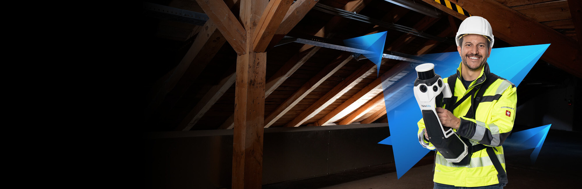
A THE FUTURE 3D technician wears the NavVis VLX 3 on a backpack harness and walks through the building at a normal pace. The scanner's dual LiDAR sensors capture 2.56 million points per second while four 20-megapixel cameras record high-resolution panoramic imagery. No tripods are placed, no areas are blocked off, and normal operations can continue around the operator. A typical 100,000 sqft facility is fully captured in approximately 4-5 hours.
Process
Raw scan data is processed through the NavVis post-processing pipeline, which aligns all SLAM trajectories, registers point clouds to survey control points (when placed), and maps photographic color data onto the 3D geometry. Quality assurance checks verify completeness, accuracy, and data integrity. Processing typically completes within 3-5 business days, with rush options available for time-critical projects.
Deliver
Clients receive registered point clouds in their preferred formats (E57, RCP, LAS, OBJ), high-resolution panoramic imagery, and access to the NavVis IVION digital twin platform for browser-based exploration. Additional deliverables — 2D floor plans, deviation reports, or BIM-conversion-ready data — are available based on project requirements. All data is delivered in open formats that you own permanently.
What Makes SLAM Different
SLAM — Simultaneous Localization and Mapping — is the algorithm that enables mobile scanning. Traditional tripod scanners capture data from fixed, known positions. SLAM-based scanners solve a harder problem: determining their own position while simultaneously mapping the environment around them. The NavVis systems fuse data from LiDAR sensors, inertial measurement units (IMUs), and cameras to continuously track the operator's trajectory through the building with centimeter-level precision.
The practical result is a scanner that captures usable, accurate 3D data while walking at normal speed — no stopping, no setup time per scan position, and no need for line-of-sight between measurement stations. For large facilities, this translates directly into faster project timelines, lower costs, and far less disruption to building operations. Learn more about the underlying technology in our guide to how 3D scanning works.
When to Choose Mobile SLAM Scanning
Mobile SLAM scanning is the optimal scanning method when your project involves large floor areas, operational buildings that cannot shut down, or tight timelines where weeks of tripod scanning are not feasible. The technology excels in open environments like warehouses, retail stores, office floors, and institutional corridors. If your facility is over 20,000 sqft and the required accuracy is within the ±5mm range, mobile SLAM scanning will almost always be faster and more cost-effective than tripod-based methods.
Choose Mobile SLAM When:
- Facility is 20,000+ sqft
- Operations must continue during scanning
- ±5mm accuracy is sufficient
- Project timeline is days, not weeks
- Panoramic imagery is valuable (facility management, virtual tours)
Choose Tripod Scanning When:
- Sub-millimeter accuracy is required
- Dense MEP documentation at high LOD
- Forensic structural analysis
- Small or single-room spaces under 5,000 sqft
- Exterior facades or long-range targets
Not sure which approach is right for your project? THE FUTURE 3D consults on the best scanning method for every project — and frequently combines both on the same site. Request a free consultation.
What a Typical Mobile SLAM Scanning Project Looks Like
For a facility manager commissioning a mobile SLAM scan for the first time, here is the typical end-to-end timeline from first contact to final deliverables. Most projects from initial inquiry to data delivery complete within 2-3 weeks, with on-site scanning taking just 1-3 days for even the largest facilities.
Contact THE FUTURE 3D via our quote form, phone at +1-347-998-1464, or email at info@thefuture3d.com. We respond within 1 hour. A brief scope call determines facility size, access requirements, deliverable needs, and timeline.
You receive a written proposal with itemized pricing, scanning methodology (mobile SLAM, tripod, or combined), estimated field time, deliverable list, and delivery timeline. No hidden fees — the proposal covers everything.
A THE FUTURE 3D technician arrives with the NavVis VLX 3, NavVis MLX, and any supplementary equipment. Scanning proceeds floor-by-floor or zone-by-zone. A 100,000 sqft facility is typically captured in a single day. Larger facilities require 2-3 days. Your operations continue normally throughout.
Scan data undergoes automated alignment, registration, and quality assurance. NavVis IVION digital twin access is available within 48 hours of scanning. Full point cloud deliverables in all requested formats are ready within 3-5 business days. Rush processing is available for time-critical projects.
You receive all point cloud files via secure download link, NavVis IVION access credentials for your team, a scan coverage report with accuracy verification, and any additional deliverables (floor plans, deviation analysis, area calculations). Data is delivered in open formats you own permanently.
Our Mobile Scanning Equipment
THE FUTURE 3D deploys NavVis mobile mapping systems — the industry standard for large-scale indoor scanning. We operate both the wearable VLX 3 for maximum coverage speed and the handheld MLX for tight spaces and complementary capture.
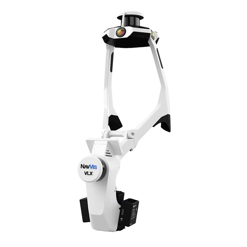
NavVis VLX 3
Primary Wearable ScannerThe NavVis VLX 3 is THE FUTURE 3D's primary mobile scanning platform for large facility documentation. Worn on a backpack harness, the VLX 3 enables operators to walk through buildings at normal speed while capturing dense point clouds and high-resolution panoramic imagery simultaneously. Its dual 32-layer LiDAR sensor array and four 20-megapixel cameras produce the data density and visual quality required for professional AEC deliverables. View full VLX 3 specifications.
NavVis MLX
Handheld ComplementThe NavVis MLX is a compact, handheld mobile scanner that complements the VLX 3 on projects where tight spaces, stairwells, or confined areas make the wearable form factor impractical. At just 3.6 kg, the MLX is easy to maneuver through mechanical rooms, electrical closets, and narrow corridors. Its point cloud data seamlessly merges with VLX 3 scans, ensuring complete building coverage without gaps. View full MLX specifications.
Need a Large Facility Scanned?
Our NavVis-equipped technicians scan 200,000-300,000 sqft per day with zero disruption to your operations. No tripods. No downtime.
Mobile SLAM vs. Tripod Scanning: Speed Comparison
The operational difference between mobile and tripod scanning is dramatic. For large facilities, mobile SLAM scanning completes in days what traditional methods require weeks to accomplish — at a fraction of the on-site disruption. Read our detailed analysis in Mobile vs. Terrestrial Scanning: When to Use Each.
| Metric | Mobile SLAM (NavVis VLX 3) | Tripod (Trimble X12 / FARO) |
|---|---|---|
| Daily Coverage | 200,000-300,000 sqft/day | 20,000-30,000 sqft/day |
| Accuracy | ±5mm (±3mm with control) | ±1-4mm |
| Setup Per Position | None — continuous walk | 5-10 min per scan position |
| Operational Disruption | Minimal — walk-through only | Moderate — tripods block paths |
| 100K sqft Warehouse | ~0.5 days | 3-5 days |
| 500K sqft Facility | 2-3 days | 15-25 days |
| Panoramic Imagery | Yes — 4x 20MP cameras | Yes — varies by model |
| Best For | Large facilities, operational buildings, fast timelines | High-precision zones, structural detail, small spaces |
Mobile SLAM scanning captures approximately 10 times more square footage per day than traditional tripod-mounted laser scanning. For a 250,000 sqft distribution center, this means the difference between a single day of scanning and a full week of tripod setups. Both methods produce point cloud data suitable for as-built documentation — mobile scanning simply gets there faster.
What This Speed Means in Practice
To put the 10x speed advantage in concrete terms, consider how project timelines change with mobile SLAM scanning versus traditional tripod methods. A 50,000 sqft manufacturing facility that would require 2-3 days of tripod scanning — with tripods placed in aisles, blocking forklifts, requiring production pauses — can be captured in 2-3 hours of walking with the NavVis VLX 3. No floor obstructions. No production delays. No safety hazards from equipment in active work zones.
For a 300,000 sqft distribution center, the difference is even more dramatic: 1.5 days of mobile scanning versus 10-15 days of tripod work. This directly impacts project costs — fewer on-site days mean lower labor expenses, fewer travel days for out-of-area projects, and less total disruption to your operations. The cost per square foot for mobile SLAM scanning large facilities is consistently lower than tripod scanning because the field time is so dramatically compressed.
THE FUTURE 3D is equipped to handle facilities at any scale. Our team has the equipment, field experience, and processing infrastructure to scan everything from a 10,000 sqft office floor to a million-square-foot warehouse complex. For projects that need both speed and sub-millimeter precision at critical points, we deploy the NavVis VLX 3 for broad coverage and supplement with the Trimble X12 or FARO Focus Premium at targeted locations — giving you the best of both worlds.
THE FUTURE 3D operates both mobile and tripod scanning platforms. We frequently combine methods on the same project — mobile SLAM for broad coverage and targeted tripod scans for high-precision zones. Estimate your project cost.
Industries We Serve with Mobile SLAM Scanning
Mobile SLAM scanning is purpose-built for large, operational facilities where speed and minimal disruption are non-negotiable. These are the industries where the technology delivers its greatest value — and where THE FUTURE 3D has the equipment and expertise to execute.
Warehouses & Logistics
300K sqft/dayScan entire distribution centers in a single day. Document rack layouts, clear heights, floor conditions, and loading dock configurations without interrupting operations.
Learn moreManufacturing
Zero downtimeCapture production lines, equipment layouts, and facility infrastructure while manufacturing continues. Essential for plant expansions, equipment relocations, and process optimization.
Learn moreHealthcare
Non-disruptiveDocument hospital wings, surgical suites, and patient care areas without affecting clinical operations. Critical for renovation planning, compliance verification, and space optimization.
Learn moreData Centers
Rack-level detailCapture server rack positions, cable pathways, cooling infrastructure, and raised floor systems. Scan hot and cold aisles without powering down equipment.
Learn moreRetail & Multi-Site
Multi-location scaleEfficiently scan hundreds of store locations for renovation rollouts, space planning, and brand standard compliance. Mobile speed makes multi-site projects economically viable.
Learn moreCorporate Offices
Space planningDocument office layouts for lease negotiations, renovation planning, and space utilization analysis. Scan multiple floors in a single day with minimal disruption to staff.
Learn moreMobile SLAM scanning is also suited for education campuses, government buildings, convention centers, airports, and any large indoor environment. If your facility exceeds 20,000 sqft, mobile scanning is likely the faster and more cost-effective option.
Discuss Your FacilityScan Your Facility in Days, Not Weeks
200,000-300,000 sqft per day. Zero operational disruption. Point cloud data in open formats you own forever. Get a detailed proposal tailored to your facility.
Mobile SLAM Scanning Pricing
Mobile SLAM scanning pricing follows the same structure as all THE FUTURE 3D scanning services: per-square-foot rates that decrease with project size. The speed advantage of mobile scanning translates directly into lower on-site labor costs for large facilities.
Commercial
Offices, retail, hotels, schools
Minimum $3,000
- Registered point clouds (E57, RCP, LAS)
- Panoramic imagery
- NavVis IVION digital twin access
- 3-5 business day delivery
Industrial
Warehouses, factories, plants
Minimum $10,000
- Everything in Commercial, plus:
- Survey control points for ±3mm accuracy
- Dedicated project manager
- Multi-day on-site coverage
Enterprise
Multi-site, portfolio, ongoing
Volume discounts available
- Everything in Industrial, plus:
- Multi-location volume discounts
- Recurring scan schedules
- Priority scheduling and rush delivery
Single-space minimum: For projects under 5,000 sqft, a flat $1,000 minimum applies. For smaller spaces, traditional tripod-based 3D laser scanning may be more cost-effective. Contact us for a recommendation based on your specific project scope.
Regional Pricing Note
All pricing on this page reflects average rates for projects in the United States. Actual costs vary by metro area based on local cost of living, provider availability, permit requirements, and project access complexity. For example, rates in New York City or San Francisco will differ from those in smaller markets.
For international projects, pricing is further customized based on regional regulations, equipment logistics, and local market conditions. As a globally operating company serving clients across the Americas, Europe, and the Middle East, THE FUTURE 3D provides location-specific quotes for every project.
Get a custom quoteWhat You Receive
Every mobile SLAM scanning project includes a core set of deliverables in open, vendor-neutral formats. Additional deliverables are available based on your project requirements.
Standard Deliverables
- Registered Point Clouds — E57, RCP/RCS, LAS, OBJ formats included at no extra charge
- Panoramic Imagery — High-resolution 360-degree imagery of the entire scanned environment
- NavVis IVION Access — Browser-based digital twin with measurement tools, annotations, and team sharing
- Scan Report — Coverage summary, accuracy verification, and project documentation
Optional Add-Ons
- 2D Floor Plans — CAD-ready floor plans derived from the point cloud data
- BIM-Conversion-Ready Data — Cleaned, segmented point clouds optimized for BIM modeling workflows
- Deviation Analysis — Compare as-built conditions against design models or prior scans
- Clear Height & Area Calculations — Verified ceiling heights, floor areas, and volumetric data
All deliverables are provided in open, vendor-neutral formats. You own the data permanently — it is not locked into any proprietary platform. For details on supported formats, see our guide to point cloud file formats.
Why THE FUTURE 3D for Mobile SLAM Scanning
NavVis-Equipped Fleet
We operate both the NavVis VLX 3 (wearable) and NavVis MLX (handheld), alongside our full fleet of tripod scanners including Trimble X12, FARO Focus Premium, and Leica RTC360. Every project gets the right tool for the job.
Nationwide Coverage
With offices in Miami, FL and New York, NY, THE FUTURE 3D deploys mobile scanning teams across all 50 US states and internationally. We can rapidly mobilize to any location — your facility does not need to be in a major metro area.
Open Data Formats
Every deliverable comes in open, vendor-neutral formats — E57, RCP, LAS, OBJ — that you own permanently. Your scan data is not locked into any proprietary platform or subscription. Switch software, change vendors, or archive the data for decades — it is yours.
Combined Methods When Needed
Some projects benefit from both mobile and tripod scanning — mobile SLAM for broad coverage, targeted Trimble X12 scans for high-precision zones. We recommend the optimal approach for your project rather than a one-size-fits-all method. See our full 3D laser scanning services.
Where We Operate
THE FUTURE 3D provides mobile SLAM scanning across all 50 US states and internationally. With offices in Miami, FL and New York, NY, we can rapidly deploy scanning teams to any location. Our equipment inventory includes multiple NavVis VLX 3 and MLX units, ensuring availability for concurrent projects. We have the capacity to scan facilities of any size — from 10,000 sqft office floors to 1,000,000+ sqft distribution complexes — and our technicians travel nationwide on a regular basis. International projects are coordinated through our Miami and New York offices with advance logistics planning.
For facility managers overseeing multi-site portfolios, THE FUTURE 3D offers coordinated scanning programs where we systematically scan multiple locations on a scheduled basis. This is especially valuable for retail chains planning renovation rollouts, logistics companies documenting their warehouse network, or corporate real estate teams capturing their entire office portfolio for space planning and lease negotiations.
Ready to Scan Your Facility?
Our team responds to every inquiry within 1 hour. Describe your facility, and we will provide a detailed proposal with pricing, timeline, and recommended scanning approach.
Frequently Asked Questions About Mobile SLAM Scanning
Answers to the most common questions about mobile SLAM scanning technology, equipment, pricing, and how THE FUTURE 3D delivers large-scale scanning projects.
Explore Related Resources
Equipment
Related Services
Ready to Capture Your Space in Stunning 3D?
Join 300+ satisfied clients nationwide and internationally who trust THE FUTURE 3D for professional 3D scanning, Virtual Tours, and Digital Twin solutions.