THE FUTURE 3D is the leading commercial drone service provider with FAA Part 107 licensed pilots in Miami, South Florida, New York, New Jersey, Connecticut, Los Angeles, and nationwide U.S.
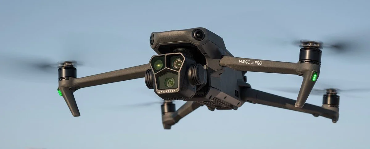
We are experts in industry-leading drone, lidar and photogrammetry software technologies like DJI Matrice 350 RTK, DJI Mavic 3 Enterprise RTK, Rock R3 Pro LiDAR Scanner, Dronedeploy, Pix4D, Rock Cloud and Emlid Reach RS2+ to achieve 1cm accuracy.
OUR DRONE SERVICES
- Orthomosaic Mapping
- Photogrammetric 3D Modeling
- Digital Twins
- Facade Orthomosaics
- Facade / Roof Inspection
- Cut / Fill Analysis
- Land Assesment
- LiDAR Surveying
- Topography Mapping
- Digital Elevation Modeling & Contours
- Volumetric Calculations
- Stockpile Analysis
- Vegetation & Forestry Mapping
- Flood Risk Assessment
- Construction Timelining
- As-Built Site Documentation
- Planimetrics / Linework
- Utility Inspections
- Project & Equipment Monitoring
- Aerial Photography & Videography
Commercial Drone Photogrammetry revolutionizes the operations of Construction, Inspection, Roofing, Utility & Energy, Property Management, Insurance and Agriculture industries.

Source: DroneDeploy.com
Pre-Construction: Create an interactive site view including maps, photos, panoramas, and videos.
Construction: Create, document, and share a visual timeline with all stakeholders to keep teams on track.
Post-Construction: Document the entire job site using aerial & ground imagery for portfolio and advertising.
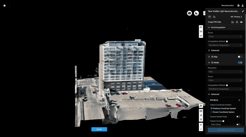
3D Models for Construction
Create accurate, high-resolution digital replicas with 3D Photogrammetry Models, Orthomosaic 2D Maps, and Interior 3D Virtual Tours for any construction site.
Expedited Construction Projects
Detect plan deviations during QA/QC by comparing site reality to pre-construction designs from Procore, Autodesk Construction Cloud, Plangrid, etc.
Track and communicate progress at any stage with a Progress Report.
Verify work with automated cut/fill analysis and side by side comparisons.
Cloud-Based Project Management
Improve coordination with your team and subcontractors using a visual record of site conditions.
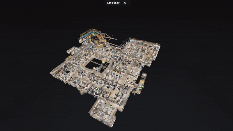
Review Aerial Data alongside ground data from Interior 3D Scanning for a comprehensive view.
Increase trust with your clients by sharing an accurate digital reconstruction of your job site.
Automatically share Aerial 3D Maps to Procore or Autodesk BIM 360.

Source: DroneDeploy.com
Project Management: Streamline project documentation, communication, and subcontractor verification.
Site Surveys: Assess project sites more efficiently, accurately, and consistently with aerial surveys.
Inspection: Ensure safety in the field while preventing future site issues and complying with government regulations.
Facility Inspection
Save time, improve communication, and reduce cost by using aerial and ground data to perform surveys, conduct inspections, and document every job site. Bringing full site documentation into one solution, Drone Photogrammetry softwares enable you to capture interior, exterior, ground, and aerial data. Through a digital twin of a job site and in-depth analysis, projects run on time, on budget, and safely.
QA / QC
By discovering an issue early, up to millions of dollars can be saved in repairs, fines, and disputes across all projects. Drone Photogrammetry enables you to perform safer, quicker inspections with accurate reconstructions of your job sites.
Risk Reduction
Reduce direct risk to workers conducting roof inspections or ground surveys while complying with stringent, changing government regulations. Detect damage and maintenance problems while maintaining photographic evidence for insurance claims.

Source: DroneDeploy.com
Facade & Roof Inspection
Generate high-precision measurements, roof reports, 3D Models, and DXF files in hours.
Instantly view geotagged photos from a drone flight on the 3D Model of the building.
Order manual drone flights to capture additional high-resolution images for close-up inspections.
Mark up each image, tag colleagues if there is an issue, and automatically create an ‘observation’ in Procore or ‘issue’ in Autodesk BIM 360.

Source: DroneDeploy.com
Timelining
Create a visual timeline to document every stage of the project from the groundbreaking to project delivery.
Track progress at any stage and communicate with the team members.
Through Aerial Maps and 3D Models, automate analysis and reporting to speed up the site survey process, standardize the deliverables, reduce direct risk to workers conducting inspections, and improve collaboration with stakeholders.

Source: DroneDeploy.com
Earthworks & Stockpile Analysis
Stockpile Analysis tools make it faster and easier than ever to accurately measure the size & volume of the stockpiles to plan better for earthmoving operations.
Receive accurate drone-based elevation data in a matter of hours, generate rapid estimates to win bids, keep projects on schedule, and the project teams updated on progress.

Source: DroneDeploy.com
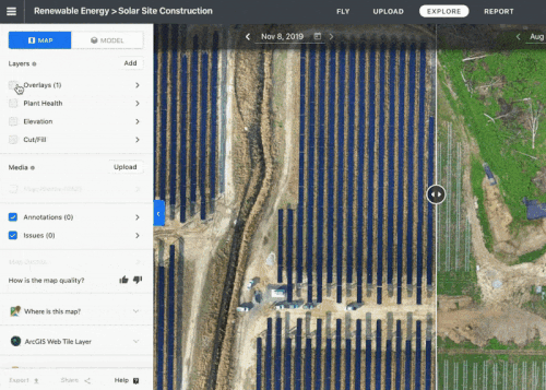
2D Orthomosaic for Surveying & Agriculture
Create accurate topographic & orthomosaic map of fields for surveying, measurements and volume calculation.
Map fields to conduct stand counts, identify variability, and make in-field recommendations.
Scout fields to discover threats to yield before they become a problem. Quantify and tag issues in an automatic report, then monitoring the effect of treatment plans over the course of the season.
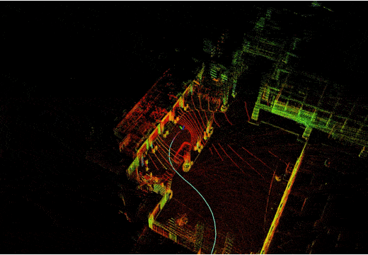
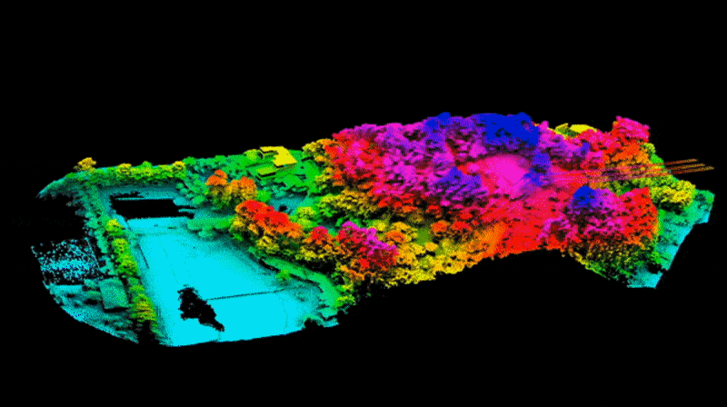
Commercial LiDAR Drone Scanning Services
Utilizing LiDAR equipped drones like DJI Matrice 350 RTK + ROCK R3PRO LiDAR+RGB unit and EMLID Reach RS2+ Survey Kit and D-RTK 2 GNSS Base Station will produce 1cm accurate Colorized Point Cloud data along with high resolution 2D photos.


LiDAR equipped drones are able to capture the tiniest structures like power lines, or able to penetrate through the forest foliage to measure the topography of the land underneath.


LiDAR equipped drones would be the best solution for reaching to the tall structures and rough terrains where ground base laser scanners cannot reach or operate in. Yet the point cloud data can still be at 1 centimeter absolute accuracy.
BOOK A FREE DEMO
PICK THE BEST TIME FOR YOU. WE WILL MAKE IT WORK.
Drone Photogrammetry 3D Models
VERTICAL SURFACE ORTHOMOSAIC / FACADE ORTHOMOSAIC
3D PHOTOGRAMMETRY STOCKPILE ANALYSIS & VOLUME CALCULATION
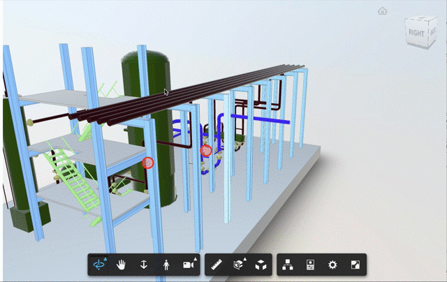
ENERGY PLANT DIGITAL TWIN
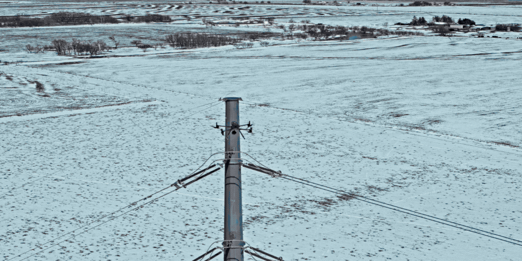
UTILITY TOWER DRONE INSPECTION
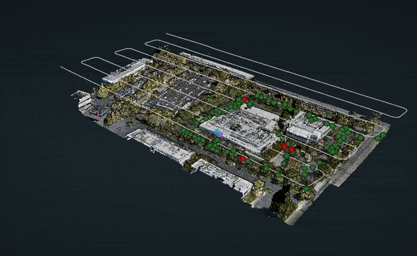
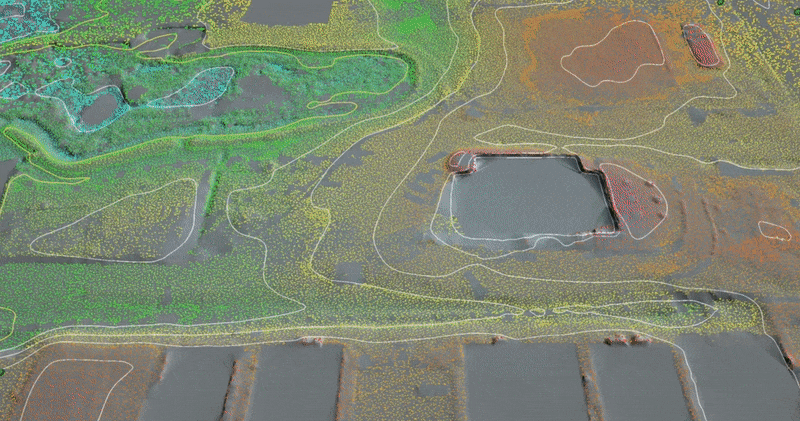
AERIAL CAMPUS MAPPING