3D SCAN TO BIM FILE
3D LASER & SLAM SCANNING, AS-BUILT DOCUMENTATION, DIGITAL TWIN & BIM FILE CREATION
3D LASER & SLAM SCANNING, AS-BUILT DOCUMENTATION, DIGITAL TWIN & BIM FILE CREATION
3D Scanning service with FARO & Trimble 3D Laser Scanners and Matterport Pro 3 & Leica LiDAR Scanners in Miami, New York and nationwide U.S.
AS-BUILT BIM FILE (.RVT)
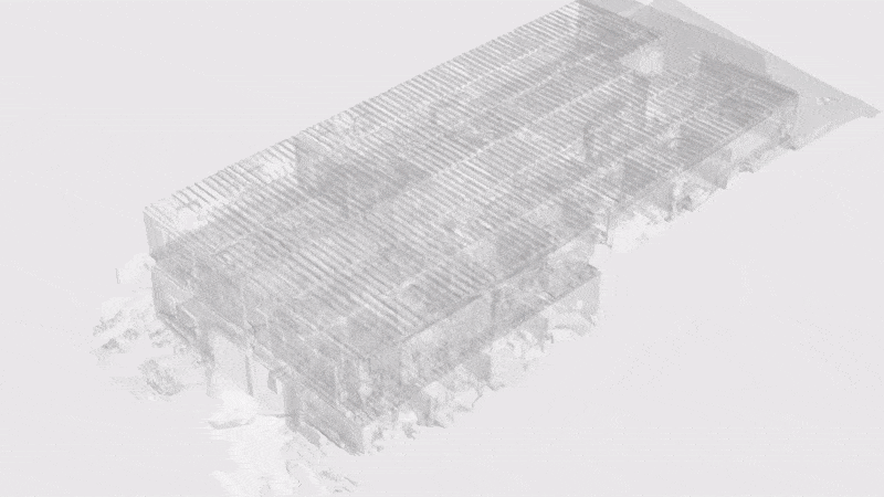
As-Built BIM File is an additional deliverable from a 3D Scan of a space. The files can be easily imported into Autodesk’s® Revit software. Included in the BIM (Building Information Modeling) package are:
.RVT BIM file (compatible with Revit 2020 or newer)
.DWG CAD file (Floor Plan)
.DWG CAD file (Reflected Ceiling Plan)
With this all-in-one service, the entire project surveying phase can be streamlined, and shorten it to days, from weeks. We will do everything from 3D scanning to post-processing, therefore you simply import the BIM file to Revit and immediately start working on your project.
Order Options
Architecture: Existing conditions of base building architecture, dimensions, and quantities based on black and white point cloud. (LOD 200)
Architecture + Furniture: Architecture plus existing conditions of tables, seating, cabinets, appliances, and some wall fixtures, etc, based on black and white point cloud.
Architecture + MEP: Architecture plus existing conditions of visible MEP systems including but not limited to mechanical equipment, piping, plumbing, and electrical outlets based on black and white point cloud.
Architecture + Furniture + MEP: Existing conditions of interior architecture, furniture, equipment, and visible MEP systems including but not limited to mechanical equipment, piping, plumbing, and electrical outlets based on black and white point cloud.
Processing Times
Standard Processing Times (Hours)
48-96
72-120
96-144
120-168
144-264
Floor Area of Space (SQFT)
0-1K
1-5K
5-10K
10-25K
25-50K
THE MATTERPAK™ BUNDLE
The MatterPak™ Bundle is for architects, engineers, construction professionals and BIM & VDC managers who want to import the 3D data into third-party programs (3ds Max, ReCap, Revit, or AutoCAD) to perform additional work and offer as part of a commercial package to their clients. For example:
Architects and engineers can use the point cloud (.XYZ) to jump-start their designs.
Construction professionals can use the ceiling plan and floor plan images for documentation/verification and building turnover packages, or use the point cloud as a part of the QA/QC process.
BIM & VDC managers can use for creating digital twins to build Feedback Driven Responsive Buildings / Dynamic Building Amenities.
3D data is accurate to within 1% of reality. Ceiling plan and floor plan images contain a scale legend.
MatterPak™ combines 3D depth data with 2D visual data to create a textured 3D mesh file (.OBJ). We sample the .OBJ file to create the Dollhouse View in 3D Showcase.
An .OBJ file lets 3D developers and VR enthusiasts to kickstart their projects with a 3D model of a real-world place.
It works on Maya, 3D Studio Max or MeshLab platforms. For Maya, you may need to convert the .OBJ into an .FBX file. If SketchUp is preferred, a plug-in will be needed to import .OBJ objects.
The .OBJ files have a scale of 1 unit = 1 meter. The scale can be updated in the 3D software to choose a different scale or scaling the model after loading.
For architecture, engineering, and construction purposes.
Open in Recap, Revit or AutoCAD and jump-start your as-built designs.
Fully automatic point cloud registration of all sweeps (setups).
Colorized based on the 360º panorama imagery and accurate to within 1% of reality.
For architecture, engineering, and construction purposes.
Get a quick top-down view of the job site and everything inside it.
Use in AutoCAD as a tracing element.
Open in 3ds Max, Maya, or other 3D software.
The floor plan is just a unique, orthogonal view of the 3D mesh. Make your own views/slices of the 3D mesh by manipulating the .OBJ file yourself.
For architecture, engineering, and construction purposes.
Same as the high resolution floor plans, but a quick vertical view of everything on the ceiling.
See ventilation shafts, wiring, plumbing, insulation and more.

For architecture, engineering, and construction purposes.
High-density point cloud for all scan locations in the Matterport space.
Approximately 20x the detail derived from a Matterpak™.
Vendor-neutral point cloud format that's widely adopted by most 3D design applications.
MATTERPORT E57 POINT CLOUDS
The Matterport E57 file contains a high-density point cloud for all scan locations in the Matterport space. It contains point cloud, pano images, and metadata from each scan location. The file format, .E57, is a compact, vendor-neutral point cloud format that’s defined by the ASTM E2807 standard. This format is widely adopted by most 3D design applications, including but not limited to:
Autodesk Recap Pro, Autodesk Revit, Autodesk Navisworks, Autodesk, AutoCAD, Leica Register 360, Leica Cyclone, Faro Scene, Trimble Sketchup, Trimble Business Center, TopCon Magnet
For a comprehensive list of supported applications, refer to this website.
E57 vs. Matterpak™
E57 is a single file containing a colorized point cloud, as opposed to the Matterpak bundle which has several components (colorized point cloud, reflected ceiling plan, high-resolution floor plan, and 2D mesh file). The Matterpak is designed to provide decimated point cloud information from the capture device to create a light-weight solution that can be accessible from anywhere, including a phone or tablet.
E57 is a higher-density point cloud that processes a much larger dataset coming from the capture device which results in approximately 20x the detail derived from a Matterpak, to complete complex workflows. With the E57 file:
Architects and designers can conceptualize designs with a detailed understanding of the space.
Project stakeholders and construction teams can collaborate more efficiently.
Building operators can maintain inventories of equipment and assets across a portfolio.


Matterport Pro 3 offers +/- 20mm accuracy at 10m range and 1.5m points per scan with its LiDAR scanner.
Measurements via Matterport Pro 2 are generally accurate to within 1% of reality. For example, in a 10 ft (3 m) long room, measurements can vary within 1.2 in (3 cm) from actual.
Objects smaller than 1 in (2.5 cm) in any dimension may not appear. This also applies to very shiny or very dark objects since not enough light is reflected back to form a 3D mesh.
PICK THE BEST TIME FOR YOU. WE WILL MAKE IT WORK.