In recent years, commercial drone services have grown exponentially, finding applications in diverse industries. One such game-changing application is the innovative lidar drone topography mapping technique. At THE FUTURE 3D, we are at the forefront of this revolution, delivering unparalleled drone services to industries across the globe.
What is Lidar Drone Topography Mapping?
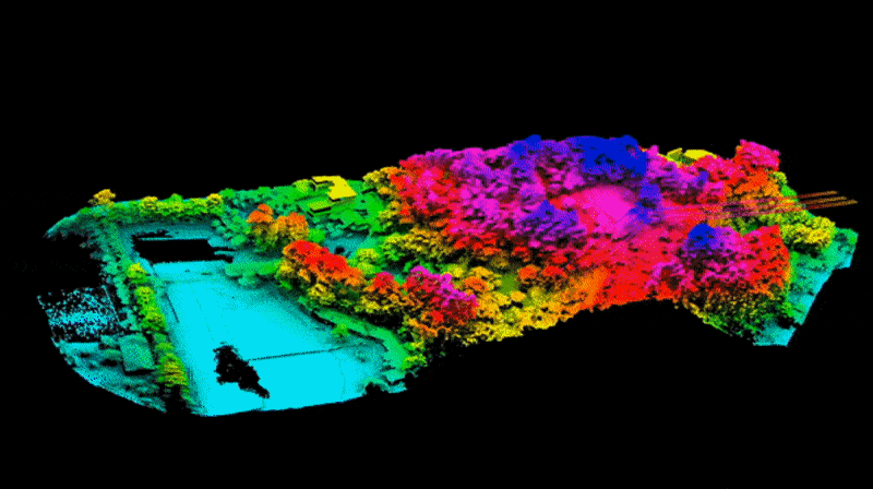
LiDAR (Light Detection and Ranging) is an active remote sensing method that uses laser light to measure distances and create precise, 3D representations of the natural world. When coupled with the mobility and flexibility of drones, it becomes an exceptional tool for detailed topography mapping.
Our commercial drone services equip drones with high-tech LiDAR sensors. The drone then flies over a specified area, sending out laser pulses towards the ground. When these pulses hit an object, they bounce back to the drone, and the travel time is recorded. The data is then processed to generate an accurate, 3D topographical map of the landscape.
Who Might Need Lidar Drone Topography Mapping?
From construction companies and surveyors to environmental researchers and urban planners, a wide array of industries can benefit from lidar drone photogrammetry.
Construction and Engineering: Lidar drone topography mapping can help these industries by providing detailed surveys for site planning and monitoring progress.
Agriculture: Precision agriculture can leverage LiDAR data to optimize field use, monitor crop health, and manage resources more efficiently.
Environmental Research: Scientists and researchers can gain valuable insights about the terrain, biodiversity, and changes in the environment.
Urban Planning: City planners can use LiDAR mapping to design and manage urban landscapes more effectively.

Why Use Lidar Drone Topography Mapping?
Lidar drone topography mapping brings numerous advantages, making it an indispensable tool for industries requiring high-accuracy, detailed terrain data.
Efficiency: Lidar-equipped drones can cover large areas quickly, saving valuable time compared to traditional methods.
Accuracy: Lidar drones, such as Rock Robotic's R3 PRO, provide high-resolution, 3D data, delivering unparalleled accuracy.
Safety: By utilizing drones, hazardous or difficult-to-reach areas can be surveyed safely and easily.
Cost-Effective: Drone-based Lidar is significantly more cost-effective than manned aircraft surveys.
Industry-Leading Tools
At THE FUTURE 3D, we work with industry-leading tools and brands to deliver top-notch drone services. We use advanced platforms like DJI, renowned for their highly reliable drones, and DroneDeploy for efficient data processing and visualization. We also use Pix4D, an industry standard in photogrammetry software, and Emlid Reach RS2+ , an incredibly precise GNSS receiver.
In conclusion, lidar drone topography mapping is reshaping industries, making operations more efficient, accurate, and safe. Partner with THE FUTURE 3D today, and experience the future of commercial drone services. The sky is not the limit; it's just the beginning.
BOOK A FREE DEMO
PICK THE BEST TIME FOR YOU. WE WILL MAKE IT WORK.
